We were so relieved to be off of the heavily commercial northern rivers (Illinois, Mississippi & Ohio) and onto the scenic and familiar waters of the Tennessee. After leaving Paducah, we motored up the Tennessee (since it flows north into the Ohio) to the Kentucky Dam lock, which was a short 23 miles from the mouth of the Tennessee.
This part of the Tennessee River is familiar to us since we bought our first boat, a 34 foot sailboat, Adventuress, at Lighthouse Landing Marina at the northern end of Kentucky Lake (which this part of the Tennessee River is called) in Grand Rivers, KY in 1999 and sailed it on Kentucky Lake near Paris Landing, TN for two years before moving it to Houston.
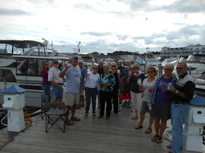
After waiting for less than an hour just downstream from the Kentucky Dam Lock, along with Paddy Wagon & The Last Resort, we were called into the lock by the lockmaster, looped our docklines over the floating bollards in the lock walls, and were raised up 57 feet to the upper pool. Upon exiting the lock, we passed by Lighthouse Landing, and then cut across the channel that connects the Tennessee River to the Cumberland River, and then onto one of the better marinas on the loop, Green Turtle Bay (aka GTB), just one mile downstream (north) from the channel.
GTB is a major stopping off point for many of the loopers since it is the first marina following the harrowing trip down the Mississippi and up the Ohio, allowing the loopers to relax and unwind for a few days before heading south. During the two days we were at GTB, we saw about a dozen other loopers come & go, which gave us a chance to catch up with friends we hadn't seen for quite a while. Nearby to GTB is the famous Patti's Restaurant, a local landmark which features 2 inch pork chops and their delicious homemade pies, which we feasted on with several of the fellow loopers. From GTB, loopers have a choice of either going up the Cumberland to visit Nashville, or continue along the Great Loop up the Tennessee (south) to Pickwick Lake, at the Tennessee-Mississippi-Alabama border.
After two nights at GTB, we said goodbye to our looper buddies, and departed the
marina and headed back through the cut over to the Tennessee River. Although we really enjoyed the voyage from Chicago with the other boats, we were really looking forward to finally being alone for a while. We had 200 miles to go to get through the rest of Kentucky and down across the state of Tennessee to Pickwick Lake. This part of the Tennessee River is absolutely gorgeous with many coves and inlets to pick from for anchoring overnight in complete solitude and in the middle of nature and wilderness. (At risk of sounding slightly prejudiced toward our home region, we think that it is just as pretty as parts of the North Channel in Canada).
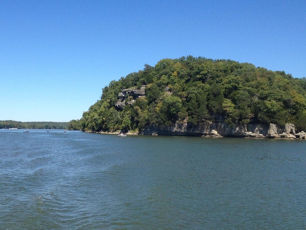
Motoring up the northern part of the river, we passed many tall cliffs in the protected wildlife refuge area of the Land Between the Lakes and very few other boats, except for a bass boat every now & then.
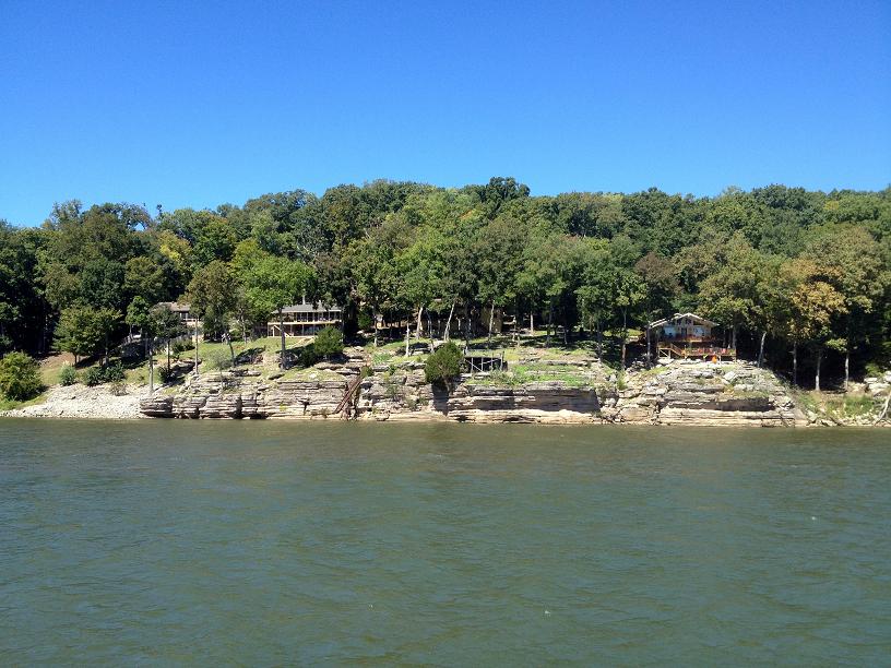
During the 200 miles to get to Pickwick, there was little reason to seek out marinas due to the availability of scenic anchorages, so we opted to drop the anchor at the end of each of the three days that it took us to go up river. After passing the Land Between the Lakes area, we dropped down into our home state of Tennessee, passing more high bluffs and cliffs with many interesting weekend and permanent homes overlooking this scenic river.
At about 2pm, on the 4th day on the river and our 139th day on the loop, we approached our very last lock (for a while, anyway), the Pickwick Dam lock, which is just prior to our final stop for this year, Aqua Yacht Harbor, which is at the beginning of the Tenn-Tom Waterway. At this point, loopers can elect to continue eastward on the Tennessee to Chattanooga & Knoxville, or head south down the Tombigbee (aka Tenn-Tom) Waterway to Mobile & the gulf.
Shortly after arriving in Pickwick, Jim finalized the details of his next work opportunity, which means that he is going to go back to work in Williamsburg, VA for 6 months, which will give us a chance to replenish our cruising kitty a bit and to visit family and non-looper friends. So Rickshaw will be resting for the winter, either in Pickwick or possibly a little further south, while Jim & Belinda live in a furnished apartment in Virginia.
After this contract winds up next March, our hope is to take Rickshaw further up the Tennessee to Knoxville next spring, and then down to the gulf next fall. So we will suspend posting of the blog until we resume our cruising adventure next year.
We REALLY appreciate all of our friends & family keeping up with our blog, and all of the comments that we've received, which has helped keep us motivated to keep it up to date, so that we will have a record of our adventure to remind us of the good friends, good times and great memories that we've made along the way.
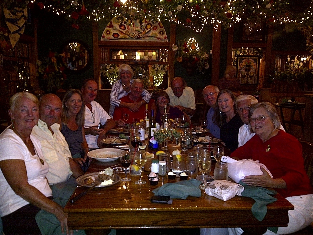
We enjoyed a much needed dinner out at Patti's with just a few of the Looper friends we made along the way. Two couples are from Canada and one couple is from New Zealand & Austrailia.
Another view of our anchorage. It was 360 degrees of wooded shoreline and not another boat in sight!
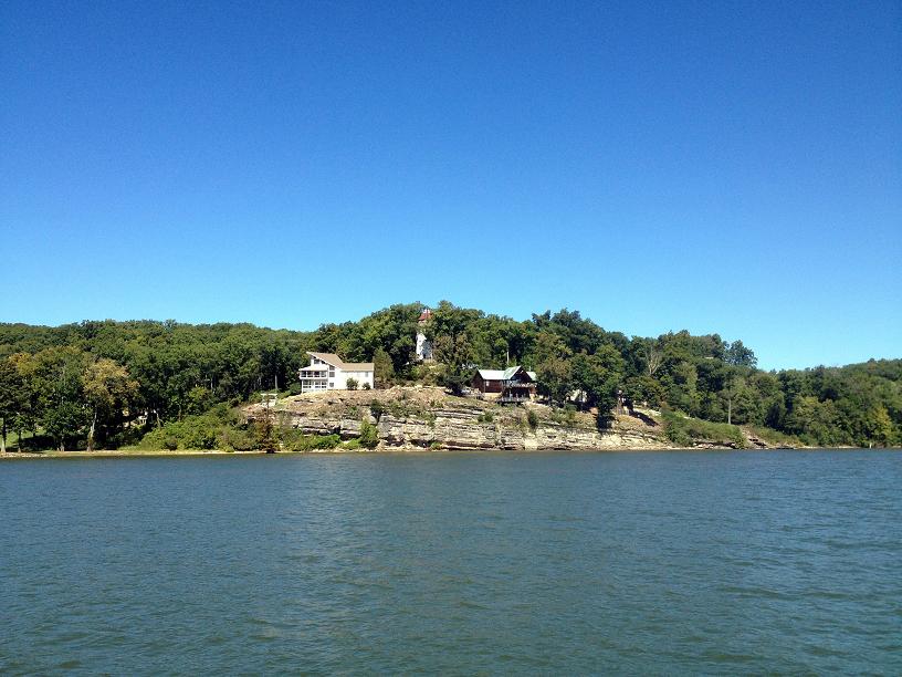
A few of the homes we saw perched upon interesting rock formations. The house in the middle of the picture is built to look like a light house.
Four bass boats fishing the cliff face.
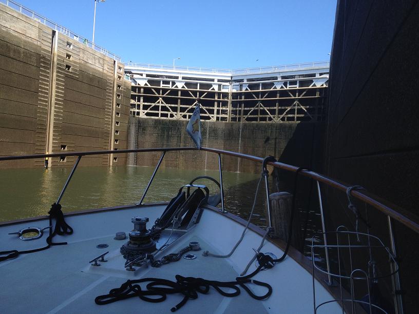
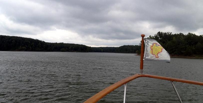
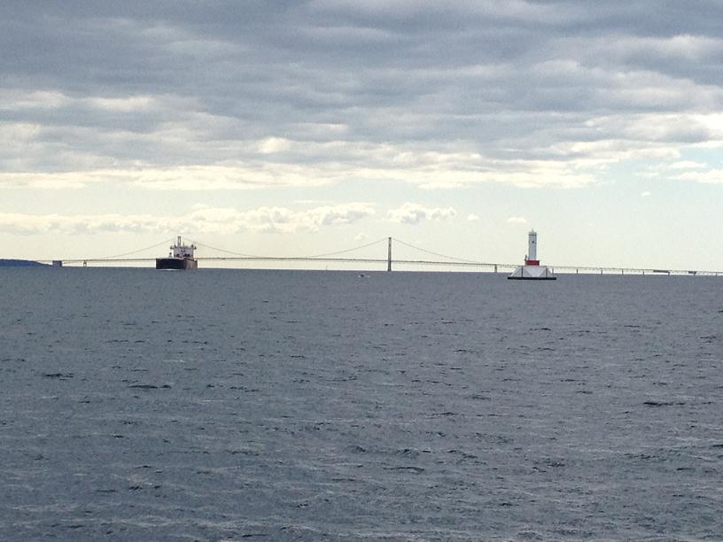
We just entered our last lock for this year - the Pickwick Lock.
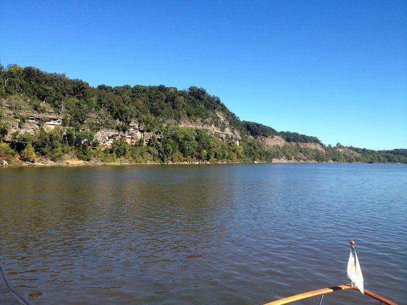
After the industrial atmosphere of the Illinois, Mississippi and Ohio Rivers, the Tennessee River was a welcomed scenic treat!
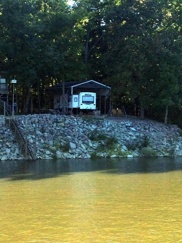
This gave me an idea: An RV pad with a boat dock for Rickshaw. Who needs a house? The view never changes.
|
One view of our first anchorage on the Tennessee River.
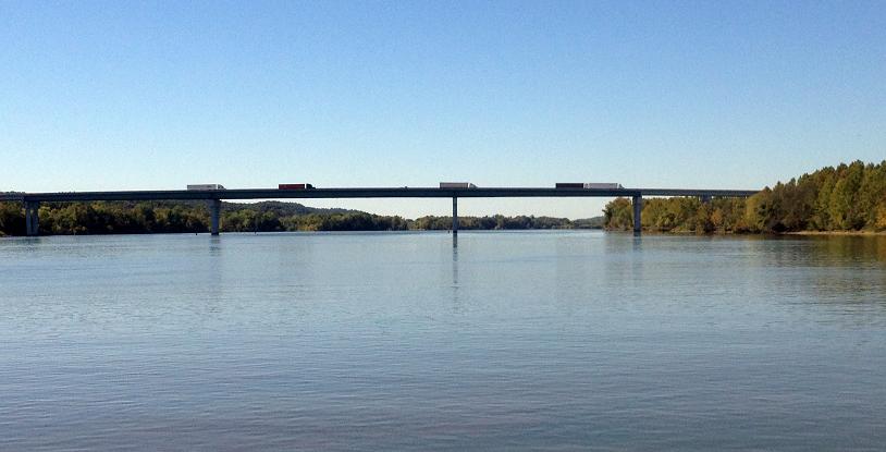
It was a bit of a thrill for us to cruise under the I-40 bridge just east of Memphis. Over the 40 plus years we lived in Memphis we crossed this bridge many times by car. Note all the semi-tractor trucks on the bridge - this is a main artery to Memphis - which is a huge distribution hub.
More houses along the Tennessee River.
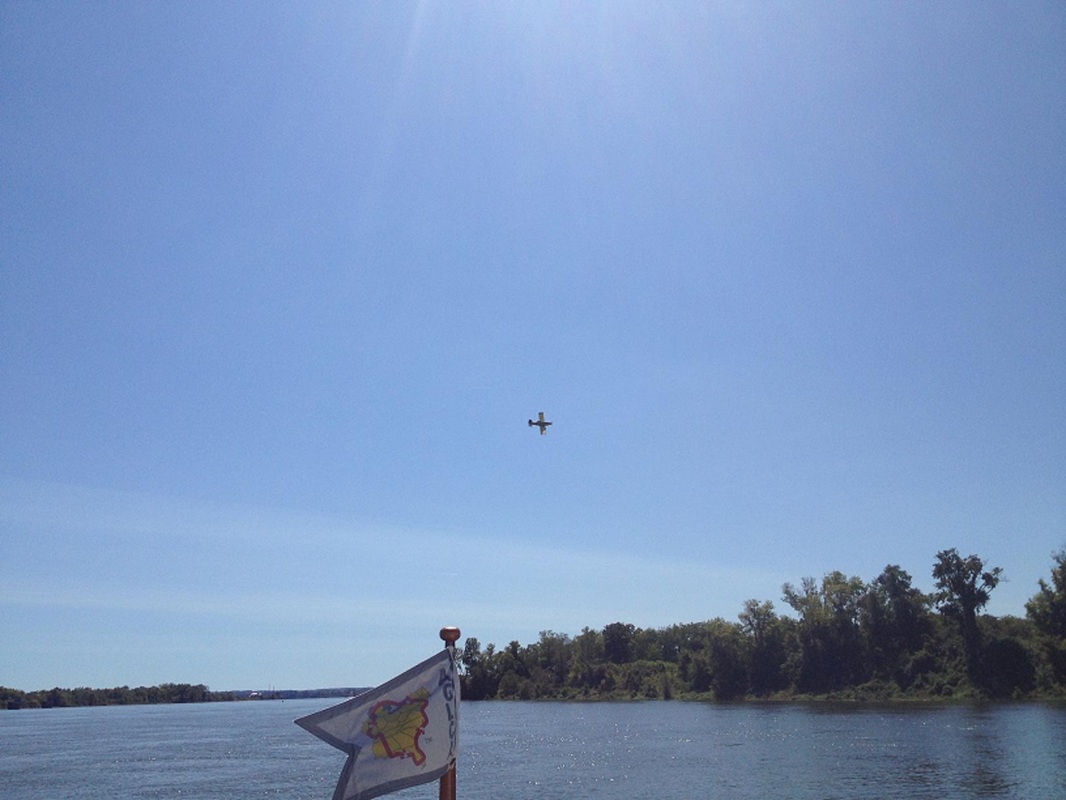
This crop duster seemed to be swooping Rickshaw as she cruised south, up the river.
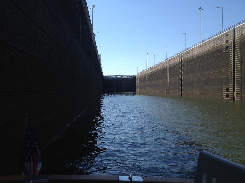
Unlike the Erie, Oswego and Canadian locks - the river locks are wide and long to accomodate the barges.
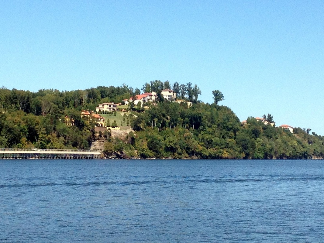
Huge homes on a bluff on Pickwick Lake.
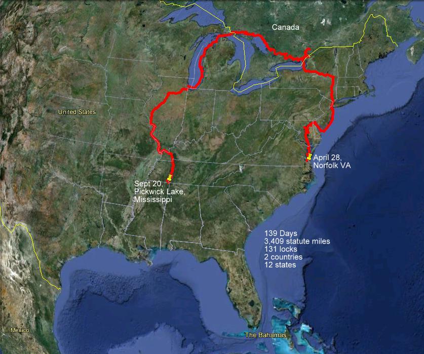
We traveled the Tennessee River from Sept. 15 - Sept 20. After leaving Paducah we stopped at two marinas and three anchorages. We passed thru two locks and traveled 223 miles.
|
The last stop on the Illinois River, where the Illinois flows into the mighty Mississippi River, is Grafton, IL. We arrived in Grafton on Sunday, 9/9, at the end of another long day on the river. Grafton is apparently a very popular weekend boating destination for nearby St. Louis residents, because the marina was overflowing with ski boats, house boats and cruisers, all trying to squeeze one more day of summer fun in before the fall weather arrived. Before we could step off of Rickshaw after backing her into her slip in the Grafton harbor, we were met at the dock by inquisitive weekend boaters and other loopers, all inquiring about where we'd been. We estimated that around 15 people at one time were standing behind our boat. Some of the questions were kind of strange, e.g. one man wanted to know if I thought it was possible to put a small amphibious airplane on the dinghy deck, and another person wanted to know if I knew if any of the boats that were around us were for sale. After getting Rickshaw settled into her slip, we met up with a few other loopers, including Queen Kathleen, that we hadn't seen for a while, followed by a dinner get-together at the local biker bar - a BBQ shack/restaurant.
The next day, Monday, we took a road trip, via a rental car, along with Rick & Diane on Toucan and Bruce & Bev on The Last Resort, to visit the sights of St. Louis and St. Charles, including a brief stop at the home Belinda was born in, in St. Charles. The St. Louis trip included a tour of the Anheuser-Busch brewery, where we learned, among other things, that AB gets its water for brewing the beer from the Mississippi. After the AB tour, we quickly sped over to the St. Louis arch for a quick trip to the top, before returning back to Grafton.
Tuesday was the day when we would start the fast push down the Mississippi River 220 miles to the confluence of the Mississippi & Ohio Rivers at Cairo. With the current flowing at 3-4 mph we were able to speed along, at times going 14 mph, as compared to our normal 10 mph cruising speed. We were constantly on the VHF radio calling tows pushing large rafts of barges up & down the river, to make sure that we knew which side to pass each of them on and to make sure we wouldn't be run down. As one might expect, there are not very many coves, inlets or other places to stop along the river, so each day on the river had to be carefully planned out to ensure that we knew where we were going to stop, especially if space was limited. One such place that had limited space was our destination for Tuesday, Hoppie's Marina 60 miles down the river from Grafton. Hoppie's Marina is famous, if not infamous, among loopers as an obligatory stop along the Great Loop route. It is basically several barges that are tied together along the Mississippi river bank, that has been providing a stopover spot for boaters for 80 years. It is run by an elderly couple, Fern & Hoppie, who are a repository of knowledge for the river conditions from here south to Mobile. Each afternoon, Fern gathers all of the boaters that arrived that day together in a circle on one of the barges to share her wisdom on where it's safe to go and stop along the way. She described how the drought this year has really compromised the ability of commercial & pleasure boaters to make safe passage down river. A lot of the trusted & true anchorages are too shallow to enter this year, making it necessary to be slightly more creative in finding a good spot to stopover each night. Between Hoppies and the Ohio River, which is 180 miles further south, there was only one possible stop, 60 miles down river, at a lock & dam on a Mississippi River tributary, the Kaskaskia River.
We left Hoppie's at 9:00 Wednesday morning, catching the fast moving southbound current as we pulled away from the barges and into the main channel. At 12-14 mph, our 60 mile trip was very fast. We arrived at the Kaskaskia lock around 1:00pm, tying our docklines to whatever security we could find on the work barge alongside the lock. Since there was only room for two of the three boats on the barge, The Last Resort had to raft up to Rickshaw and Paddy Wagon. The early arrival gave us some time to get caught up on a few boat projects.
Thursday was going to be the longest day so far of the entire trip, 119 statute miles, to enable us to get to the next/only anchorage stop remaining on the river. The stop suggested by Fern was, at first glance, very much less than ideal. We pulled in behind a 100 ft long sandbar that jutted out into the river, and the 3 boats in our little looper group (Rickshaw, Last Resort & Paddy Wagon) dropped their anchors in 12-15 feet of sticky, Mississippi gumbo mud. Even though we were very much out of the channel, it was still a bit unsettling to be brought into several million candlepower illumination by the searchlights from tows rounding the bend coming up the Mississippi and out of the Ohio, just 100 yards further south throughout the night.
Thursday happened to be Bev's birthday, so our (Rickshaw & Last Resort) present to her was to host a surprise dinner for her on Rickshaw, which meant we had to get everybody onto Rickshaw's aft deck via dinghy, which Don on Last Resort was willing to do by dropping his dinghy into the water, and picking up Bev & Bruce along the way.
On Friday, at first light, we pulled up our anchors and made the turn into the Ohio River, this time fighting current since we were going upstream on the Ohio. As was our experience on the Mississippi, there were very few dependable anchorages, and no marinas, on the 60 miles we needed to go to get to the mouth of the Cumberland River. Normally, 60 miles in a single day, even against the current, is not beyond our daily limit, but we had to transit 2 locks that day, which were known for having very significant delays. A week or so earlier, we had heard reports of some boaters being held up for up to 24 hours waiting for their turn to enter the second of the two locks. As we approached the first lock, which was usually pretty quick for most loopers, we were informed that our expected wait time was to be 2 hours or more. So we all three dropped our anchors out of the channel, turned off our engines, and waited, as patiently as we could, for the lockmaster's voice over the VHF radio telling us to proceed up to the lock. Over 3 1/2 hours later, we got the call and rushed into the lock, not even bothering to tie up. We just free-floated in the lock, counteracting the rushing of the water being let into the chamber with our engines. After such a long delay, and with the prospect of a long delay at the second lock, we weren't sure where we would be able to stop that night, because the recommended anchorage, at the mouth of the Cumberland River, now seemed to be out of reach during the daylight hours, and travelling at night along the river was definitely not a good idea. When we got to the 2nd lock, we were told that our wait would be about an hour, which made the Cumberland anchorage reachable but just after sunset. We decided to try to find a good spot at the mouth of the Tennessee River, 15 miles closer, near Paducah, KY. We had read, on a boaters' website, that some people had reported, in earlier years, that they were able to anchor next to a small island called Cuba Towhead. But when we arrived there, we didn't see any way that this spot could be useable, since the spot where we would anchor would be in the middle of an active channel used by the local towboats. We spotted a old, rusty, apparently abandoned, 130 foot barge tied to the bank, so we made the group decision to tie up there for the night, with the hope that we would not be kicked off by the owner before the next morning. Fortunately, we weren't and spent a quiet night tied to the rustly old barge, rocked by the wakes of passing tows moving barges up and down the narrow channel throughout the night.
 We traveled 220 miles on the Mississippi and 50 miles on the Ohio River before we turn south into the Tennessee River.  The group that went on the road trip to St. Louis and St. Charles - Left to right: Jim & Belinda, Rick & Diane (Toucan) and Bruce & Bev (Paddy Wagon). 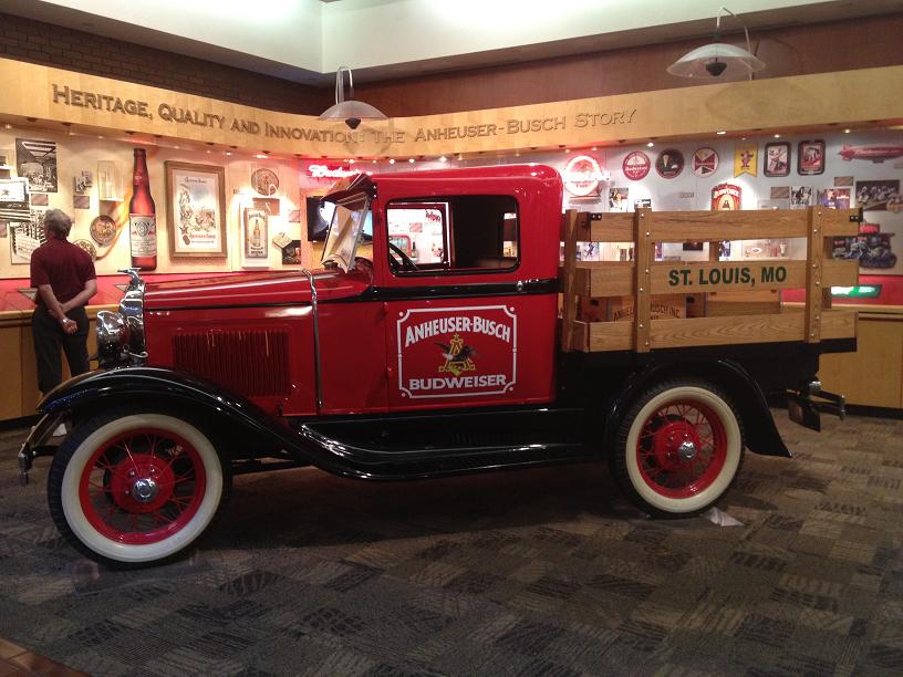 An antique beer truck at the Anheuser-Busch brewery. 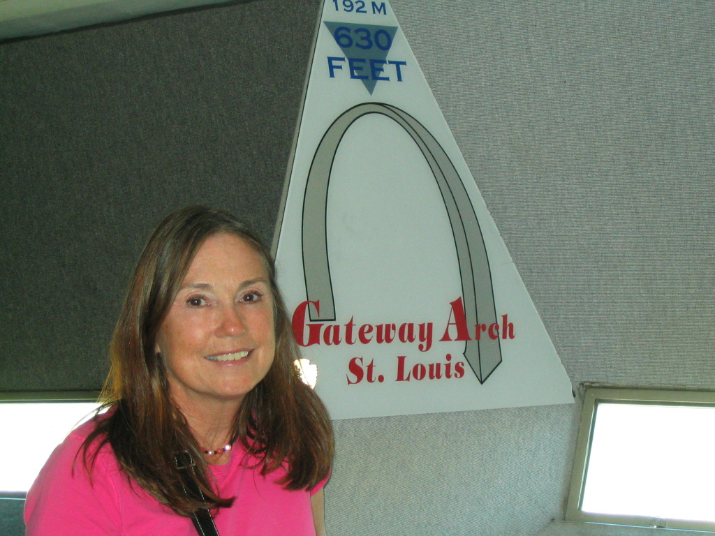 Belinda at the top of the Gateway Arch in St. Louis. 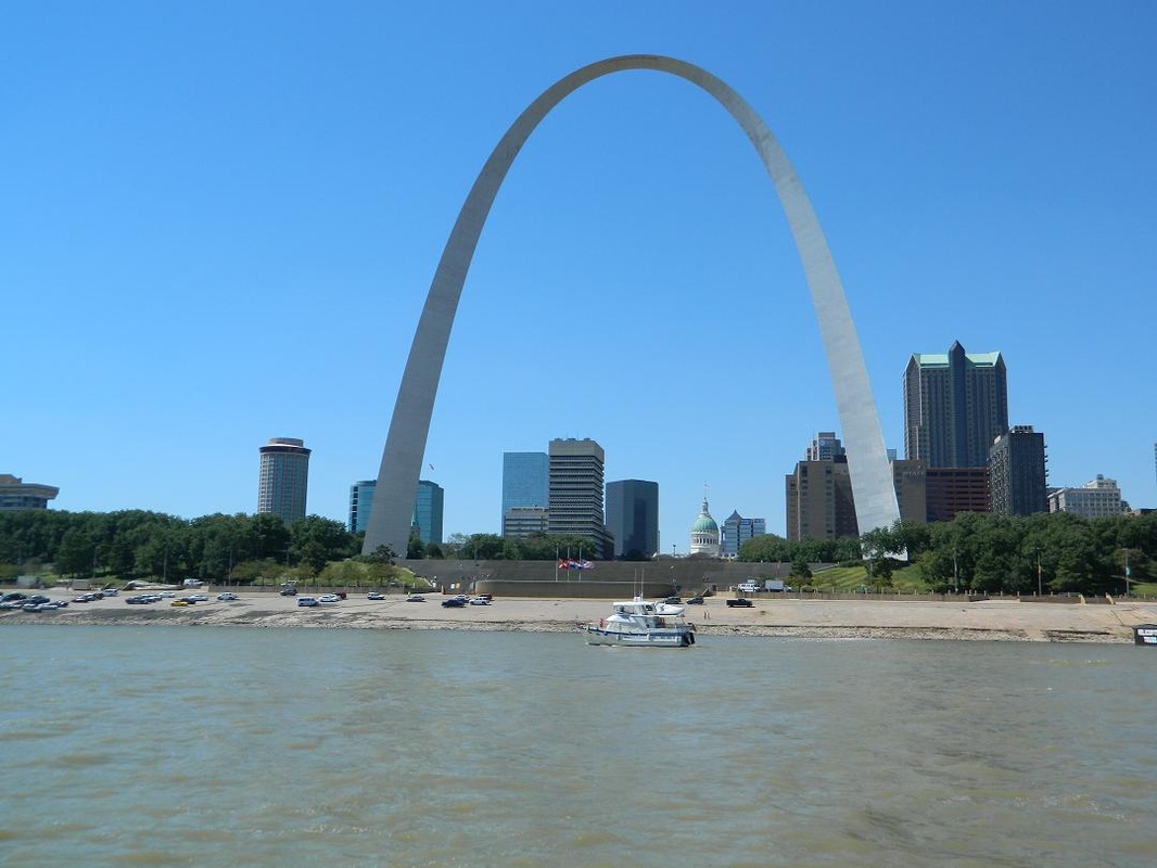 Rickshaw in front of the Gateway Arch on the Mississippi. Thanks Freya! 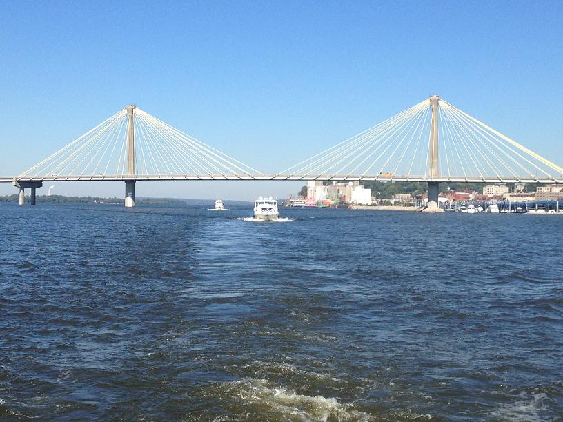 The Mississippi River bridge at Alton, Illinois. 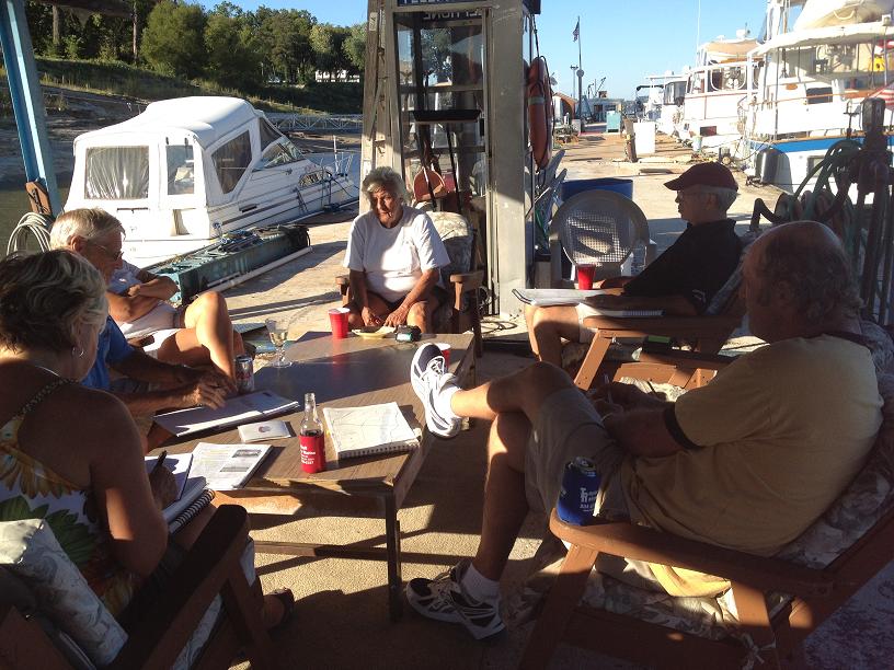 Fern holding river class for the three Looper boats. 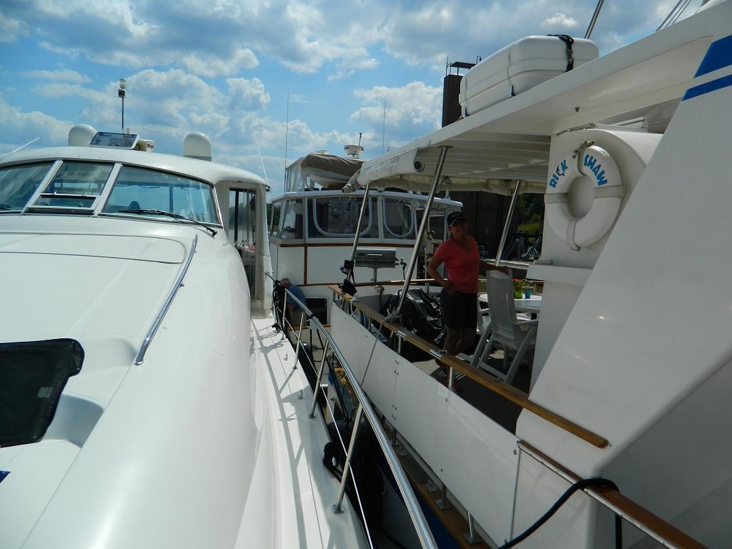 Belinda standing on the aft deck of Rickshaw with Paddy Wagon tied up behind and The Last Resort rafted up to us both. With limited mooring and anchoring options we have to cooperate and work together to keep everyone safe.  Don and Freya coming to celebrate Bev's birthday on their dinghy. 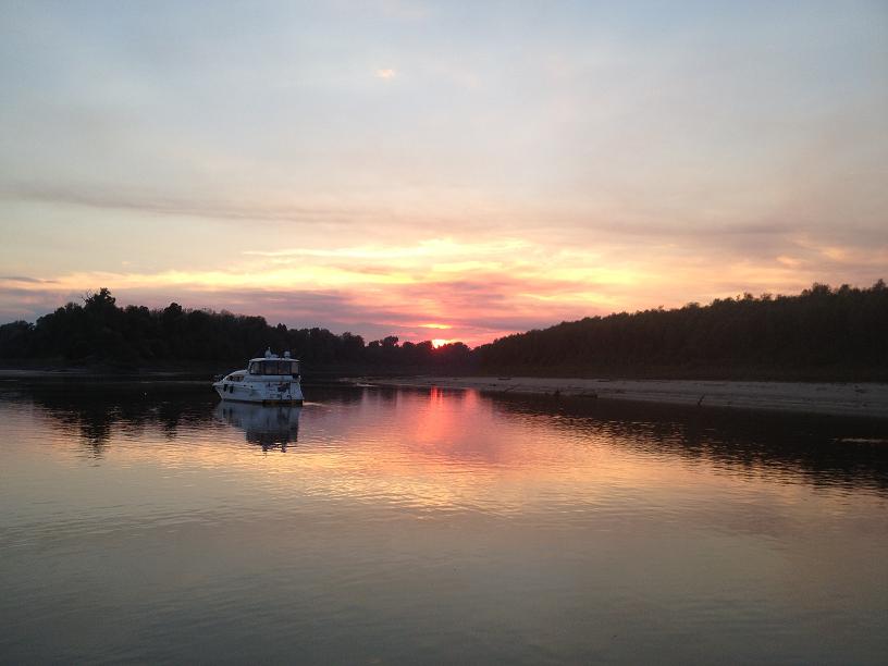 The Last Resort at anchor at sunset. Don and Freya owned a Resort for 25 years and sold it to go cruising. 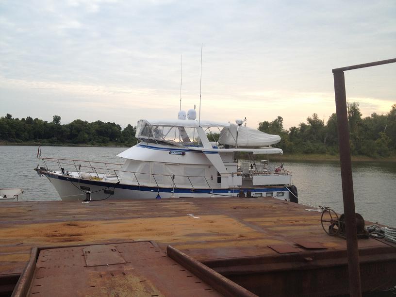 Rickshaw tied to the rusty barge we found just before dark after a very long day of waiting on locks. | 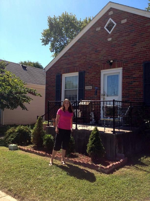 Belinda standing in front of the house her family lived when she was born. 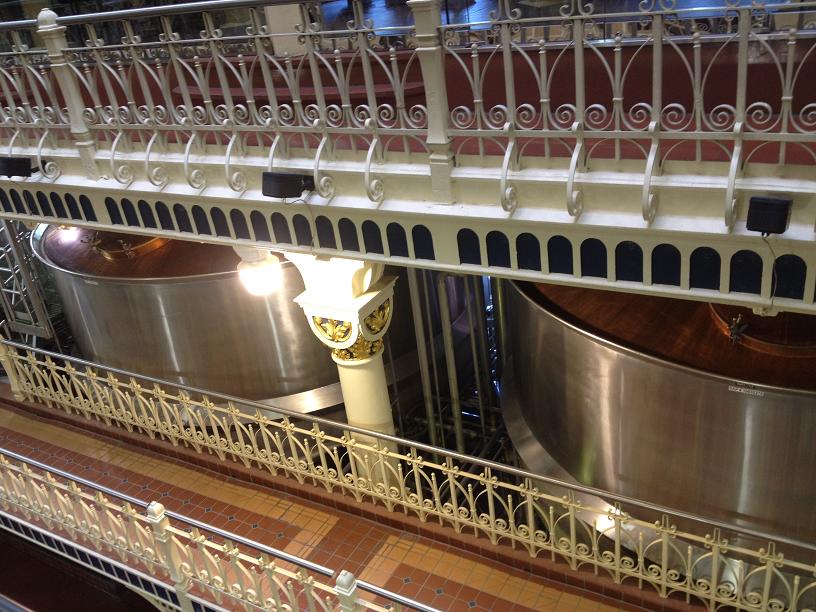 Just two of the many tanks at the very ornate brewery that was built in the 1800s. 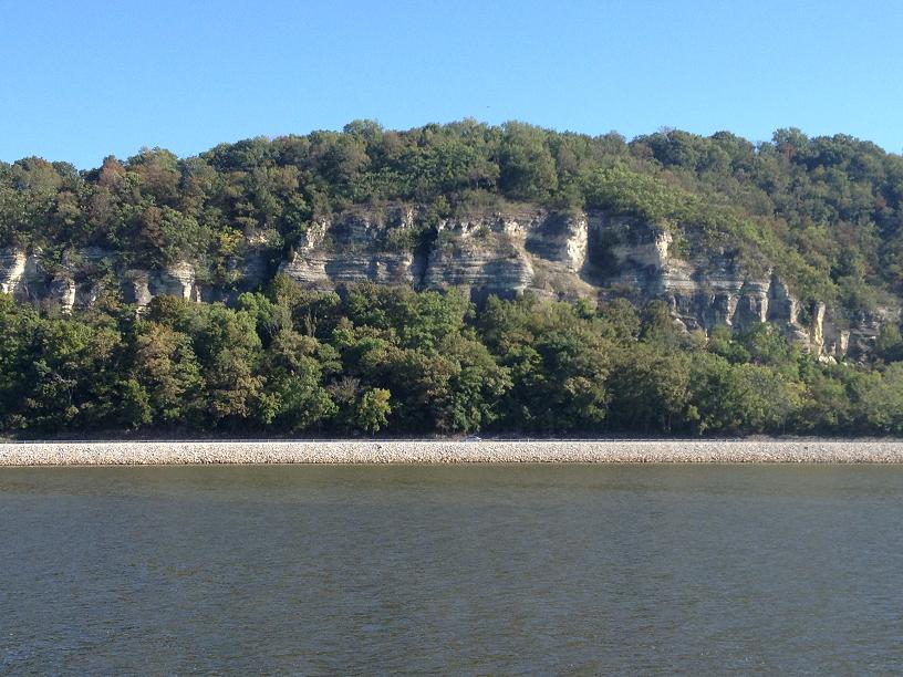 Some interesting cliffs along the Mississippi River.  Rickshaw tried up at Hoppies on the west bank of the Mississippi River.  Rickshaw tying up to the work barge at the KasKaskia Lock off the east side of the Mississippi River.  This is the chartplotter view of the Mississippi River and all the towboat traffic around all the curves. It is very dangerous to pass the big barges in a curve so it necessary to call the tow captains to alert them to our location and to get passing instructions.  Belinda made Bev a birthday hat for the occasion. 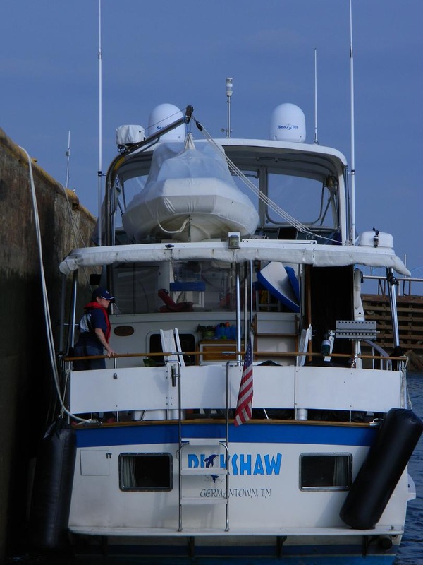 Belinda on the aft deck handling the stern line while locking through. | 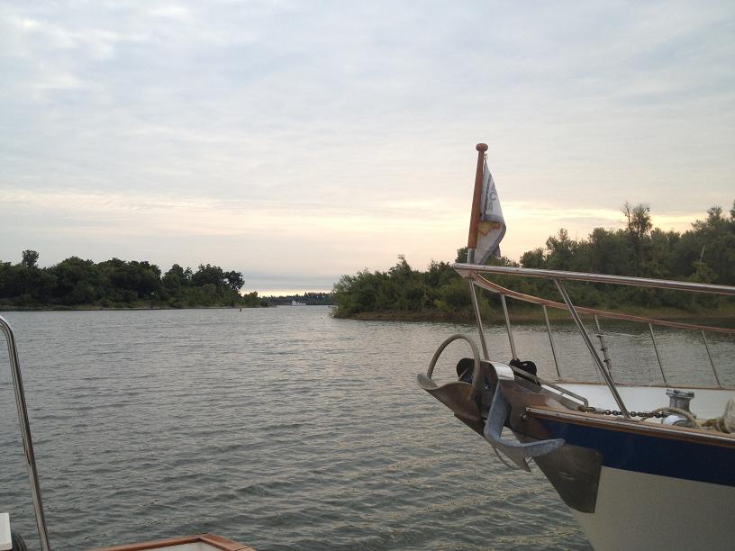 Tomorrow we will take the cut and go south on the Tennessee River - we will be on the home stretch!
We left the safe harbor in Chicago on Monday morning, pulling out of the 31st Street Marina early to get a jump on the long day ahead of us. To get to the Illinois River, which leads to the Mississippi, from Chicago, boaters have 2 choices: boats with a vertical clearance of less than 17'2" can take the scenic route through downtown Chicago. If greater than 17'2" (which Rickshaw is), the only other choice is the Calumet River, which meanders through the industrial (and not so attractive) South Chicago. So after leaving the breakwater of the marina, we turned the boat south towards the Calumet River, and started passing under the many bridges and through the several locks. Over the next few days, we continued motoring 333 miles in a generally southwest direction toward the confluence of the Illinois River with the Mississippi.
On the Illinois, we were back to having to deal with locks, but, this time, instead of small, quaint, pleasure boat locks, we were transitting large (100 ft wide X 600 ft long) commercial locks along with tows pushing barges down& up the river. Although we had only 8 locks on the Illinois between Lake Michigan and Grafton, Illinois, a good part of our time was spent hovering in place in front of the locks, waiting for the tows & their barges to clear the locks. Being commercial, the tows usually take a higher priority than the pleasure boaters. At some locks, we had to wait 2 hours in order to be called up by the lockmaster and being given permission to lock through. Some of the tows were pushing more barges than one lock chamber would hold at a time, so, in those cases, the tow would push the first group of barges into the lock, disconnect the front half from the back half of the barges, and pull the back half out of the lock chamber. Then after the water level in the lock chamber was adjusted (up or down) to equal the river level on the far side of the lock, a giant winch and cable would pull the barges out of the lock, the far gates would close allowing the water level to be adjusted back, so that the tow and the remaining barges could enter the lock and rejoin with the front half of the barge raft and continue on their delivery trip. Which kind of explains why it can take so long for a tow with several barges to transit a lock.
The Illinois River also introduced us to another new "adventure", Asian carp. This invasive species, which can grow to up to 100 lbs, is slowly taking over the river, eating everything in the river, and slowly destroying the ecosystem of the river. To
combat this threat and to prevent its migration into the Great Lakes, the Corps of Engineers has electrified a a 300 yard section of the river that all boats must pass through. Although there are no effects to the boats themselves, there are several signs along this stretch of the river issuing severe warnings about touching the water as we went through this particular section. As boats move down the river, especially in shallow water, these fish can get excited and leap out of the water several feet. If the sides of the boat are low enough, they can actually leap into the boat, leaving a slimy, bloody mess. At one point in the river, we saw a bass boat with the name "Peoria Carp Hunters" on the side. The sides of the boat had netting (like on the sides of trampolines), to protect the occupants from getting hit by the flying fish. As we passed by the boat, we noticed that 2 of the people were putting on football helmets and getting into a small dinghy being towed by the bass boat. Each of the helmetted "customers" had fishing nets so that when the bass boat accelerated its motor, the customers in the towed dinghy could attempt to snatch the jumping carp out of the air with the nets. What fun! Had we not been in a hurry, we might have tried it out.
The drought of 2012 has lowered the water level in the rivers by a foot or so making some of the normal anchorages and marinas too shallow for Rickshaw. This means that we have fewer choices for parking the boat at night, and sometimes we have to go more miles that we would normally want to in a single day.
During the trip between Lake Michigan and the Mississippi River, we stopped at the free downtown wall at Joliet, a great marina, Heritage Harbor, in Ottawa, IL, then onto Peoria. With the oncoming change of the seasons from summer to fall, we've had to stop every other day when a new weather front moves through, making our trip south much longer than we had hoped.
After staying in Peoria for 2 nights due to a strong weather front that moved through the state, we left the Peoria city docks on Saturday morning, heading to the next possible stop in Beardstown. Several years ago, the city docks in Beardstown were wiped out, and an enterprising tug boat captain started allowing boaters to tie up to his very rough work barge, which was covered with a wide variety of iron cranes, pulleys, ropes, cables, welders, boat parts, etc.
The final day was one of the longest days of the trip (88 miles) due to the lack of stopover stops on the river. So we departed from the barge at first light and motored down the final leg of the river to the very lively town of Grafton, IL, at the point where the Illinois River flows into the Mississippi.
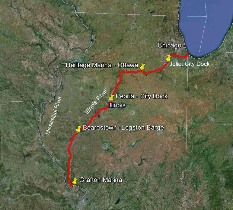 We traveled 333 miles on the Illinois River. We made four stops over 7 days before arriving in Grafton Illinois at mile 0. 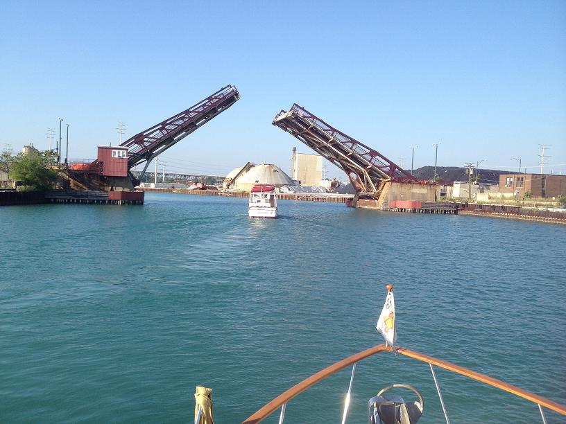 We had to ask many bridges to open for us as we started down the Calumet River. Beyond the bridge is one of the many industrial sites that line the river. 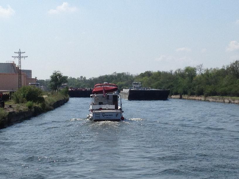 We are following Toucan. We both had to squeeze between the parked barge on the left and the approaching barge on the right.  Rickshaw rafted up with The Last Resort with Toucan and Paddy Wagon behind us in the lock. 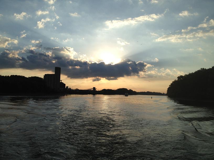 With the long distances we had to cover we were up early on travel days. But we got to see beautiful sunrises like this one. 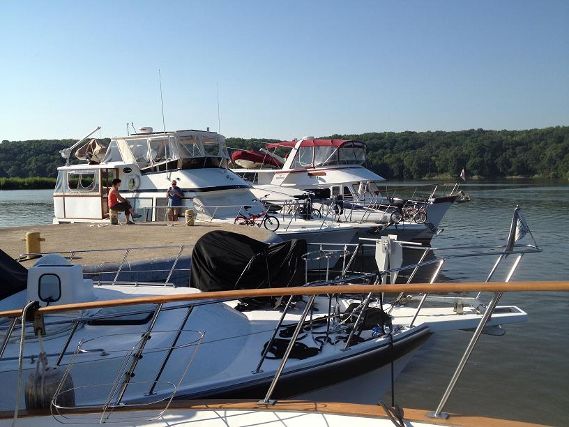 There are 5 boats rafted up to this cell. three on one side and two on the other. After this picture was taken another one joined us.  The city dock in Peoria from the other side of the river. Rickshaw is docked next to The Sprit of Peoria.  Through the crane you can see Rickshaw. The Last Resort is on the right. It is owned by a couple who sold their resort to cruising. 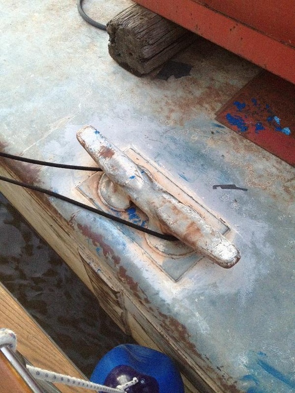 The cleats on the barge are HUGE compared to what we use on a marina dock. | 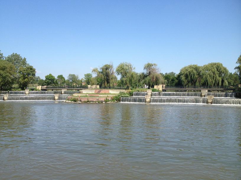 We did see this pretty fountain along the banks. It could be from the water treatment plant since this is the river Chicago dumps its waste water. 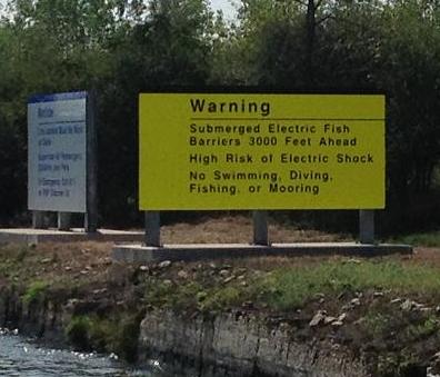 Sign posted upon entering the electric shock barrier, 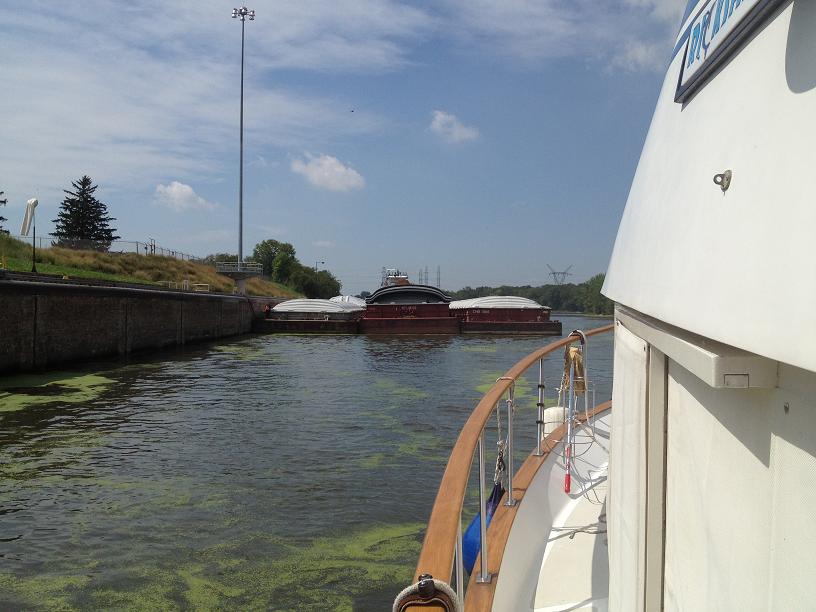 As we were leaving this lock there was a 3 wide barge waiting to come in. 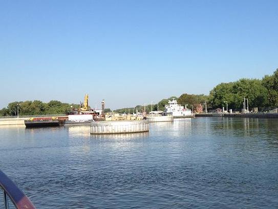 Outside of the locks are cells (large concrete cylinders) for the barges to tie up when they have to wait to lock through. Sometimes recreational vessels use them too.  We finally got to lock through with a barge. Instead of tying to the lock wall as we normally do, we were told to tie up to the barge. It was actually easier as we just floated down with it.  This was the weather radar on the morning we decided to stay another day in Peoria. 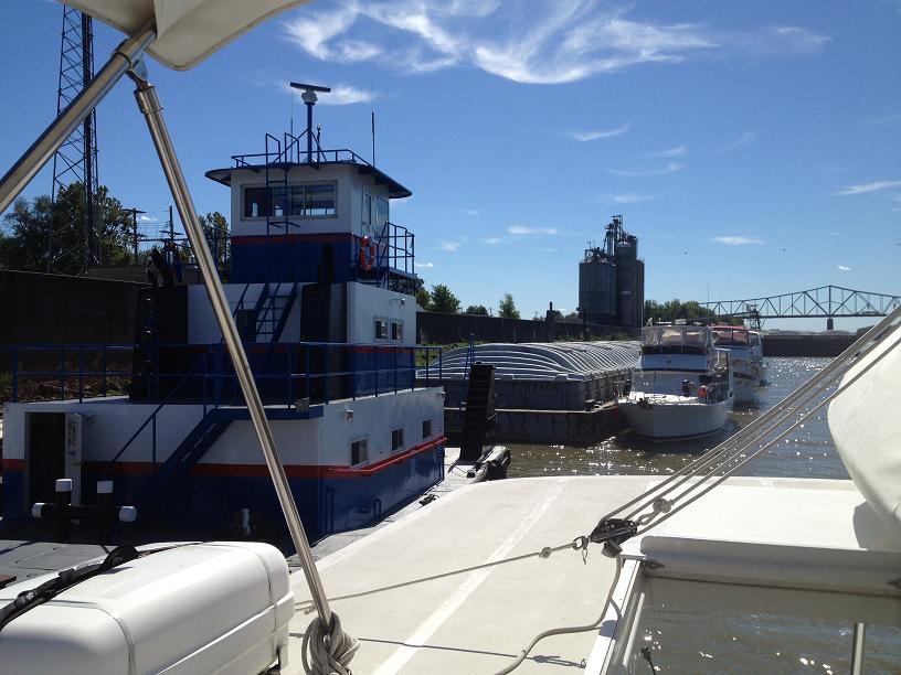 In Beardstown our only option for docking was to tie up to a working barge service. |
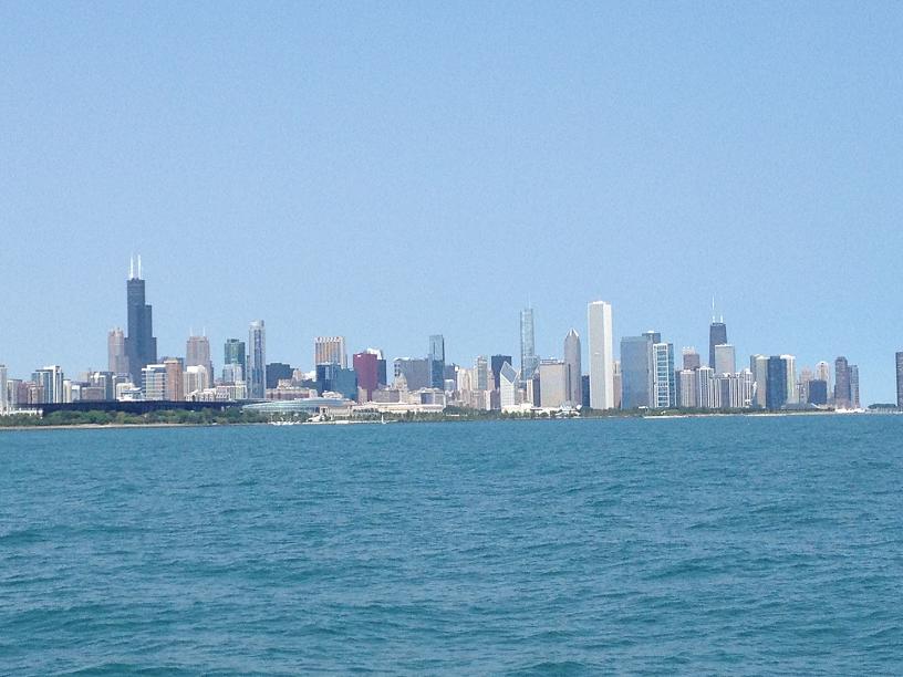
 From the bow - coming into Chicago. From the bow - coming into Chicago. We made it into the 31st Street Harbor in Chicago, 3 miles south of downtown, just after noon on Wednesday, 8/29, just ahead of the 5-9 ft. seas predicted on Thursday. We were amazed that the brand-new marina was less than 50% full, so we had our pick of a slip, selecting one in the middle of the marina, close to the office and the laundry room. Our plan was to stay in Chicago until Sunday, which would allow us the opportunity to visit the city, and to attend a Great Loop get-together on Saturday.
A couple of the other loopers, Quest & Queen Kathleen, had arrived in Chicago
a few days earlier, and were scheduled to leave the next day (Thursday). At this point in the trip, we will start saying good-bye to other loopers that we've come to know during the past 4 months on the loop. From this point forward, the route for everyone is the same (down the Illinois, Mississippi & Ohio rivers), so, unless someone stops for several days on the rivers, once someone gets ahead, there's probably not much chance that we would be able to catch up. Carl & Ricki on Quest live in West Virginia, so their route will be to continue up the Ohio after we turn south down the Tennessee River, so, once they leave Chicago, there's probably not much chance that we would see them again.
So, we called Carl & Ricki to arrange a final get-together dinner Wednesday night at Navy Pier, and then followed up dinner by watching the fireworks of off Navy Pier from the aft deck of Quest. We said our sad good-byes to Ricki & Carl, whom we had known since last fall in Yorktown, wished them well on their voyage back home, and then returned to Rickshaw via taxi at the end of the evening.
The next day we rode our bikes into the downtown area and took the hop on/hop off tour through downtown Chicago, taking in the sights of this fabulous city. In between our trips between the marina and downtown, the 18 mile bike path that went by our marina and runs alongside Lakeshore Drive gave us a good opportunity to get our bikes out and get some exercise, riding along beautiful, teal-green Lake Michigan.
On Friday, we went back into downtown to take the architectural boat tour of the Chicago River, which is lined with famous and beautiful towering buildings designed to take maximum advantage of the views of the lake.
On Saturday, we met up with the son & daughter-in-law of our good friends, Woody & Carolyn (who had stayed with us on Rickshaw for a week), for breakfast. It was great to finally meet Brandon & Rachel, who live in Chicago & whom we had heard so much about from Woody & Carolyn. Later that day, we were picked up by Skip & Barb, from Moor $tuff, who also live in Chicago, who took us on a tour of the University of Chicago before going to the looper get-together in a downtown high-rise. At the get-together, we met several other loopers, one couple from Brazil, who were doing the loop, with their 3 year old daughter on their 50 ft. trawler, Jade, after bringing the boat up from South America. After they finish the loop, they're going to take their boat across the Atlantic and do the canals of Europe! We also met a couple from New Zealand, on Loopy Kiwi, and another couple from Canada, on The Last Resort. So, it was quite an experience to meet up with such an international group.
We had planned to leave Chicago on Sunday, but due to the rains from Hurricane Isaac that had made their way into the midwest, we decided to stay in Chicago for another day, which gave us a chance to catch up on a few boat chores (including fixing the generators that had been giving us some problems), and getting ready for the next phase of our journey. Starting from here, we will be going down through the rivers and back to going through locks again, but this time, we will be sharing the rivers & the locks with tows and barges.
 The view from our slip in 31st Street Marina. 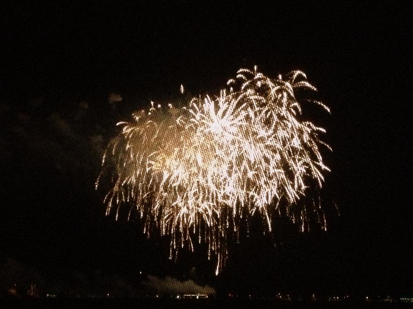 We enjoyed the fireworks from the aft deck of Quest after a farewell dinner with Carl and Ricki. 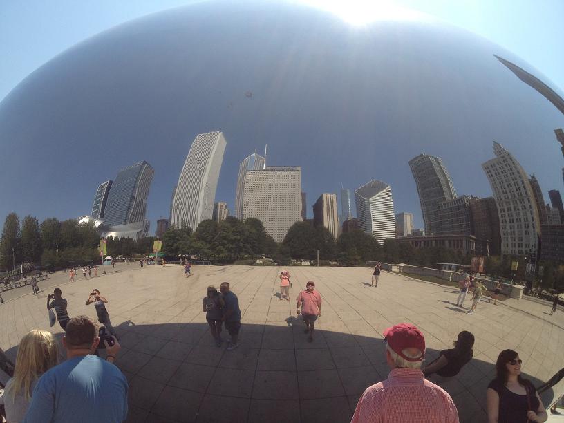 The relection of downtown Chicago in The Bean. Also, Jim, Jim's back and Belinda taking the picture.  Since Rickshaw is too tall to go thru downtown to connect with the Illinois River we decided to take a boat tour thru downtown that features the outstanding architecture. |  We stopped on the bike trail that runs 18 miles along Lake Michigan by Navy Pier and into downtown. 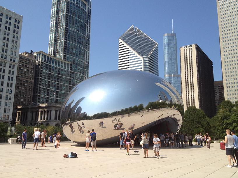 The chrome sculpture known as The Bean in Millennium Park. 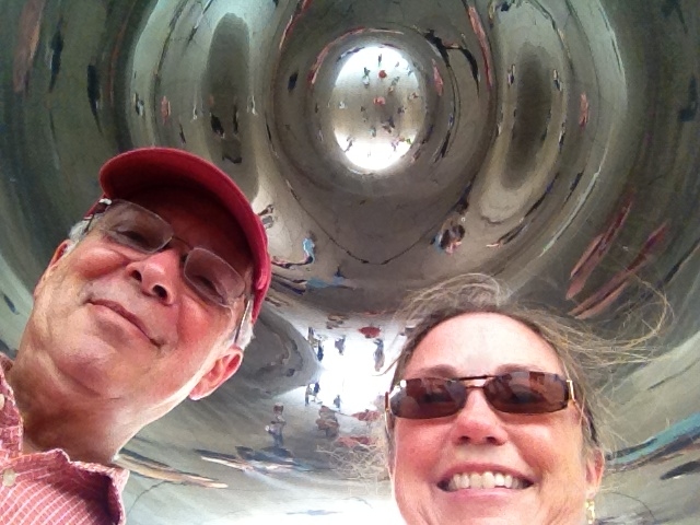 Standing under The Bean. 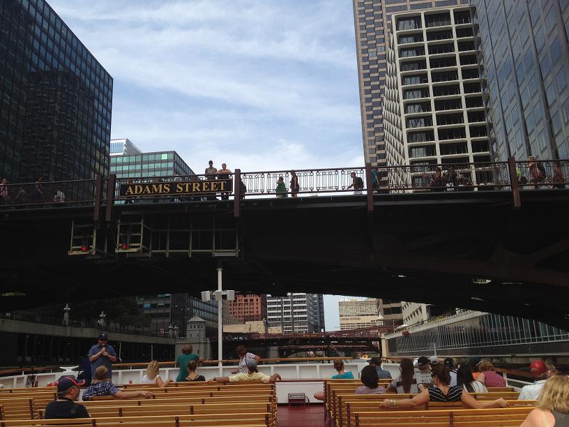 One of the many brigdes that Rickshaw would not be able to clear. | 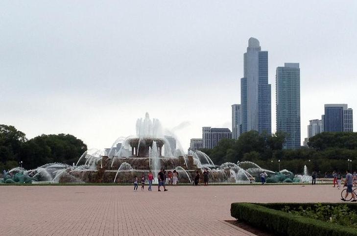 The Buchingham Fountain in Millennium Park where we enjoyed the Jazz Festival on Sunday afternoon.
8/24 & 8/25 - Friday & Saturday - Saugatuck, Michigan - Days 112 & 113
8/26 & 8/27 - Sunday & Monday - St. Joseph, Michigan - Days 114 & 115
8/28 - Tuesday - Michigan City, Indiana - Day 116
We were enjoying the artsy town of Saugatuck so much we decided to stay for 2 more nights. After Skip & Barb left on Friday, we continued our browsing in the many art boutiques in the town, now with Dave & Joy on Maia who had arrived in Saugatuck, hoping to find new decor items for Rickshaw. We settled on 3 wallhangings - one for the galley and another for the salon. One particular art gallery had some very interesting furniture (which we don't need) custom made to look kind of like Cat in the Hat furniture. On Friday evening, back on Rickshaw, we were able to sit out on our aft deck and enjoy the sounds of the local band playing
in the waterside bar, just 50 yards from our anchorage.
The next day, Saturday, Jim wanted to finally go to a beach. The one near Saugatuck is rated as one of the top fresh-water beaches in the country. The weather was perfect, but the hitch was that the beach was a few miles away, across a channel and on the other side of a very steep hill. So our journey to the beach started with loading the 2 bikes onto the dinghy, taking the dinghy over to the small boat dock, offloading the bikes and pedaling to the chain ferry, loading the bikes onto the ferry, taking them off the ferry on the other side, then riding/walking the bikes up to the top of the very steep hill, then riding down to the beach. The rest of Saturday was spent laying on inflatable rafts just off of the shore, and relaxing in the cabana we rented, catching up on reading, and just chilling out. At the end of the day, we reversed the order of the journey to the beach, and landed back on Rickshaw, thoroughly exhausted.
The next 3 days were spent moving further down the Michigan coastline to get us into a better position for a 50 mile weather crossing to Chicago on Wednesday. Since we had not been in a marina since Leland, we needed to stay at least one night in a marina to give our battery bank a full charge. On Sunday, we motored down to the marina in Benton Harbor/St. Joseph, MI where we spent a couple of days, before pushing on to Michigan City, Indiana on Tuesday. The weather and waves were very accommodating for travel, which we were obviously very glad to get. The weather forecast for the crossing day, Wednesday, was 1-2 foot seas out of the northeast. The next day, Thursday, the forecast changed significantly, showing 5-9 foot seas in the middle of Lake Michigan, so we definitely couldn't delay our crossing, although we had enjoyed the eastern side of LM so much we really hated to leave. 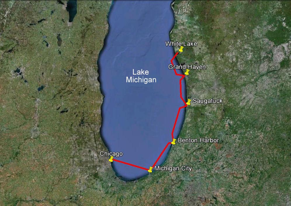 We anchored one night in White Lake, spent two days in Grand Haven at the city dock, three nights anchored in Saugatuck, two days in Benton Harbor and one in Michigan City. We traveled a total of 144 miles. 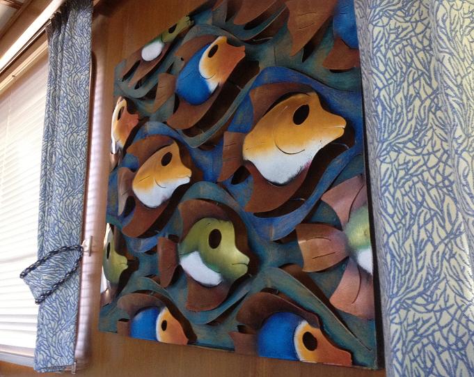 We bought this 3D metal wall sculpture for Rickshaw. 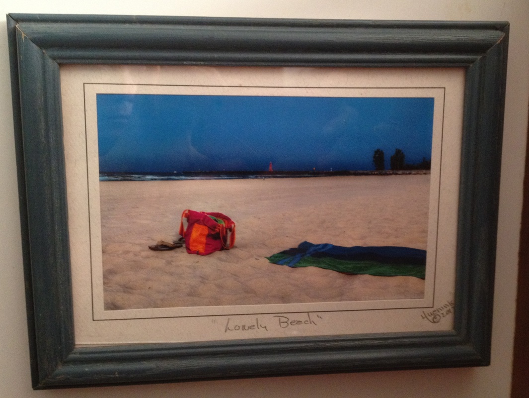 A print for the guest bath.  We enjoyed an afternoon at Opal Beach while in Saugatuck.  Rickshaw tied to the city dock in Benton Harbor. | 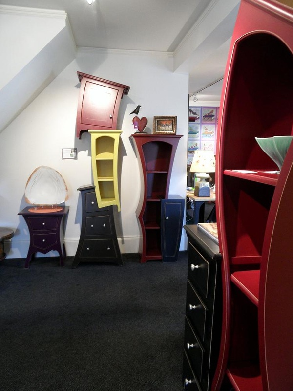 The furniture in this really unique store looked like something from a Dr. Seuss book. The piece in the middle thal looks like three stacked peices was $6,000. But what a conversation piece! 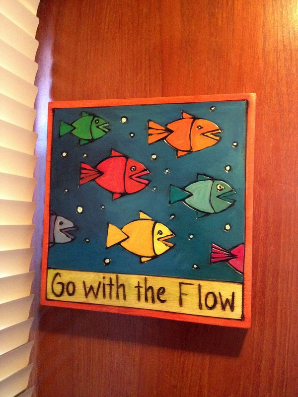 We bought this carved wood plaque for over the sink. 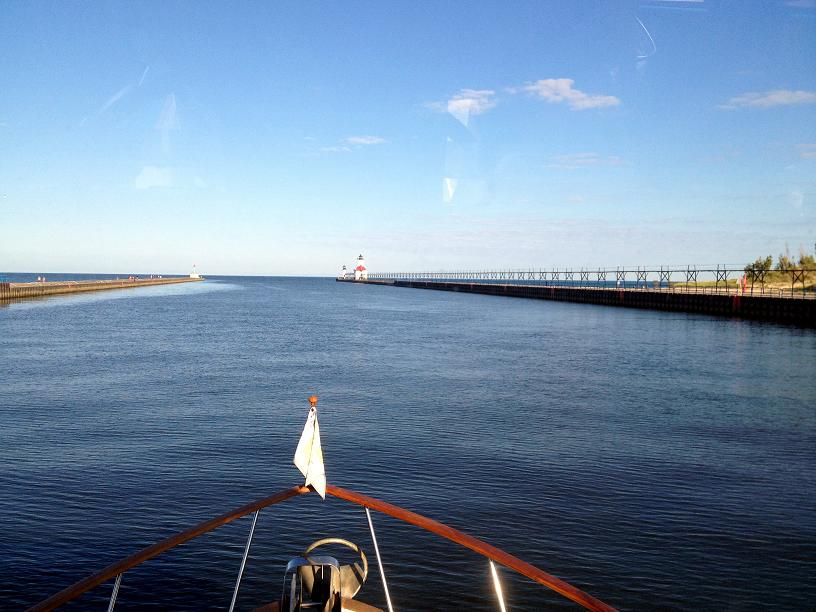 Leaving Benton Harbor and heading out into Lake Michigan. |
Monday - White Lake: Day 108
Tuesday, Wednesday - Grand Haven: Days 109-110
Thursday - Saugatuck: Day 111
After leaving Manistee, we took every opportunity to move south along the Michigan coast line while the weather remained somewhat favorable. We left our anchorage in Manistee on Monday morning heading out the channel and towards White Lake, 60 miles away. At our normal cruising speed of 7.5 knots, today was going to be a very long day. The forecast of 10-15 knot winds out of the northeast with 1-2 foot seas was exactly correct, making the long ride reasonably comfortable for us. Rickshaw has a pair of extra fins on the bottom which are the hydraulic stabilizers which dampen the roll from waves coming at us from our beam, or just ahead or behind of our beam. They are not effective for seas coming directly on our bow or on our stern, so the most comfortable wave direction for us on our trip down the coast is anything but northerly or southerly.
We arrived in White Lake after 8 1/2 hours, dropping the anchor in a pretty little cove surrounded by summer cottages peering down into the bay from high up on the hillside. After the darkness set in, we took blankets and pillows out on the dinghy deck (where Ricky-Dink is stored), and gazed up at the millions of stars in the moonless sky.
On Tuesday, the weather forecast remained good, so we pushed ahead down the coast again a short 24 miles to another popular tourist town, Grand Haven. Grand Haven was a great stopover, especially since it offered one of our most favorite features, a free town wall, which gives us the security of being tied to a wall (instead of at anchor), good access to the town, and best of all, at no cost! GH goes out of its way to make itself a great place to visit, with a nice downtown shopping strip, a great farmers' market on the waterside, and a nightly musical fountain show, which happened to be right in front of where we parked on the wall. We decided to stay in GH for 2 nights, giving us a chance to stop and relax a bit. There is a promenade along the town wall so throughout the day and early evening was a constrant stream of people strolling along the canal, many stopping by to ask where we came from and where we were going. On the 2nd day, we were surprised to see Maia (whom we hadn't seen since Atlantic Highland, NJ 3 months ago) pull in, so we enjoyed catching up with Dave & Joy on Maia.
Although Grand Haven was very nice, we needed to continue pushing south in order to make our goal of being either in Holland (20 miles south) or Saugatuck (27 miles south) by Friday morning, in order to meet Jim's sister, Louise, who was planning to drive over Friday from Detroit. The weather forecast for Thursday wasn't great, predicting 10-15 knot winds out of the south, with 2-3 foot seas, also out of the south, i.e. on the nose. Friday's forecast was slightly worse than Thursday's so we decided to make the jump down the coast, hoping to make it as far as Saugatuck, with the backup plan of stopping at Holland. The ride was probably the worst we had had the entire loop trip, with the waves usually in the 2 foot range but with a few 4 & 5 foot waves hitting us right on the bow. Rickshaw tends to "hobby horse" when pushing into waves on our bow, which made the 3 1/2 hour trip somewhat uncomfortable for us. We had no concerns that it was too much for Rickshaw. Our biggest concern was damage to either us or to the furnishings on the boat during the constant pounding of the bow down into the trough of waves. Shortly before pulling into the Kalmazoo River, which was our entrance into the Saugatuck harbor, we received a call from Louise that she wasn't feeling well and would have to cancel her visit, which obviously was a big disappointment.
When we arrived in the harbor, we considered our choices for parking Rickshaw. The main marina was very expensive (over $100 / night for a slip). We attempted to get a slip at another marina, which, we discovered after running aground twice, did not have enough water in the available slips for our 4 1/2 foot draft. Our final choice was to drop our anchor in the middle of the harbor in 8 ft of water just off of the main town marina. We figured that we were probably the only boat in the group of boats we had been buddy-boating with that would have chosen to travel today, so we were pleasantly surprised to hear Skip & Barb on Moor $tuff call out to us on channel 16 on the VHF, after pulling into the harbor at about the same time, having slogged down from Holland. We enjoyed the rest of the day (Thursday) exploring the upscale, artsy town of Saugatuck with Skip & Barb, followed up by a delicious dinner in town, before getting back on Ricky-Dink to return to Rickshaw, who remained the only boat in the anchorage. 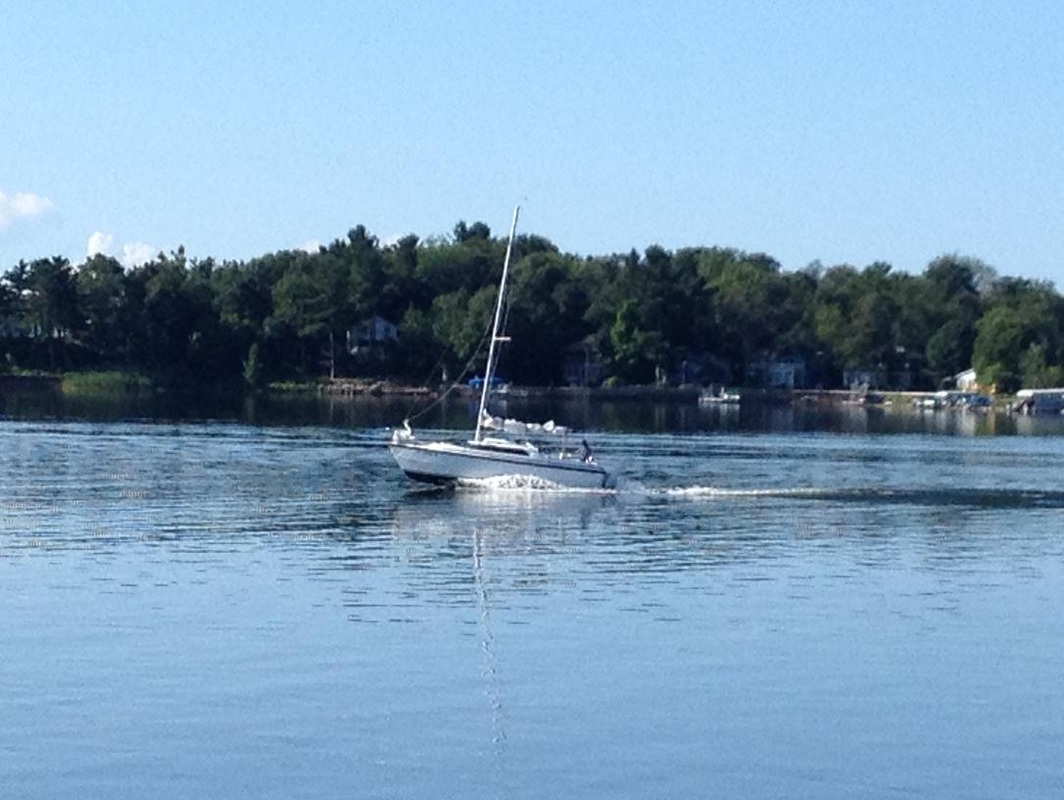 Something just doesn't seem right when you see a sailboat planing under power ..........  A catamaran coming in the Grand Haven channel.  The Grand Haven beach and RV park!  A morning's catch from one of the local charter boats. 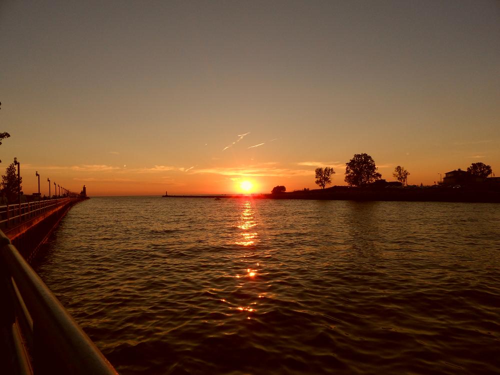 After watching the ballroom daning we walked out on the jettie to see the sun set on Lake Michigan.  We watched the musical fountain two nights while in Grand Haven. Apparently they have several shows so we didn't see the same performance both nights. 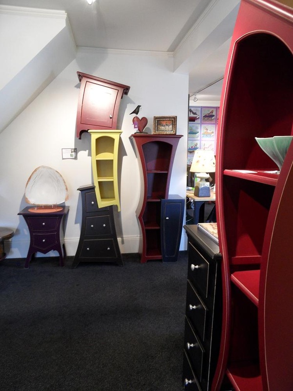 One of the more unique shops in Saugatuck has some VERY unusual furniture. This designer must have been a big fan of Dr. Seuss. |  Either a condo or apartment complex with a beach on the shore of White Lake. 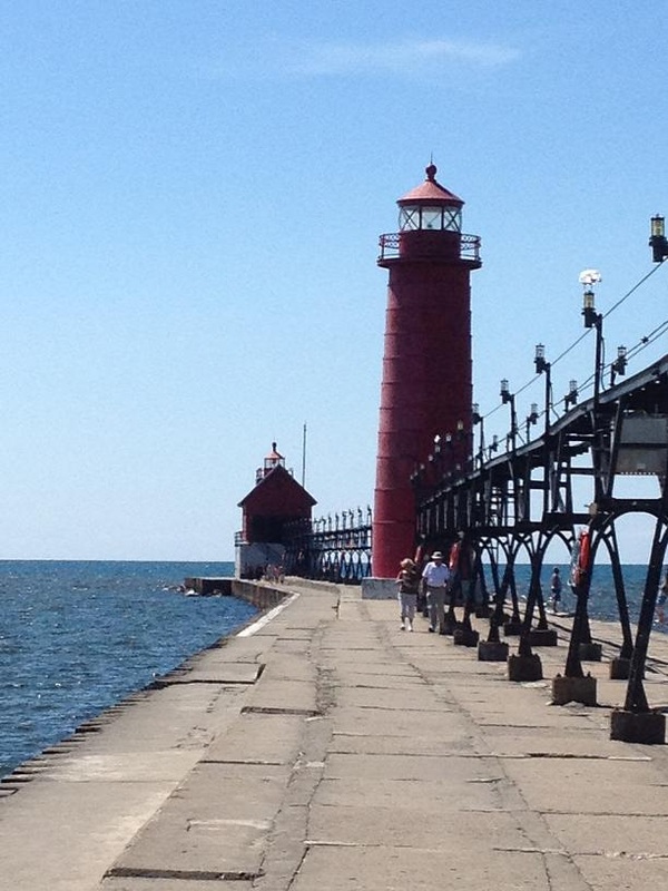 The lighthouse they call Big Red at the end of the sea wall in Grand Haven.  The boardwalk along the canal. Grand Haven is a clean and colorful city which is very welcoming to the tourist!  One evening Grand Haven had an orchestra playing big band music for ball room dancing on the waterfront. 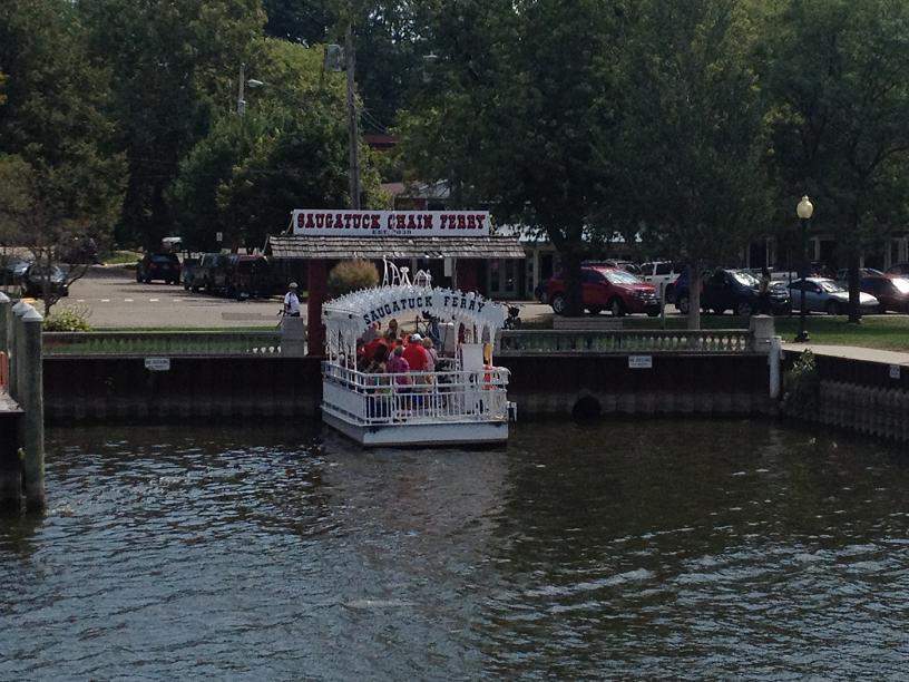 Saugatuck has a chain ferry to take people across the canal. The ferry is guided by chains that are submerged until the ferry pulls them to the surface as it goes across. So you don't want to pass too close or might snag the chains in your props - OUCH! 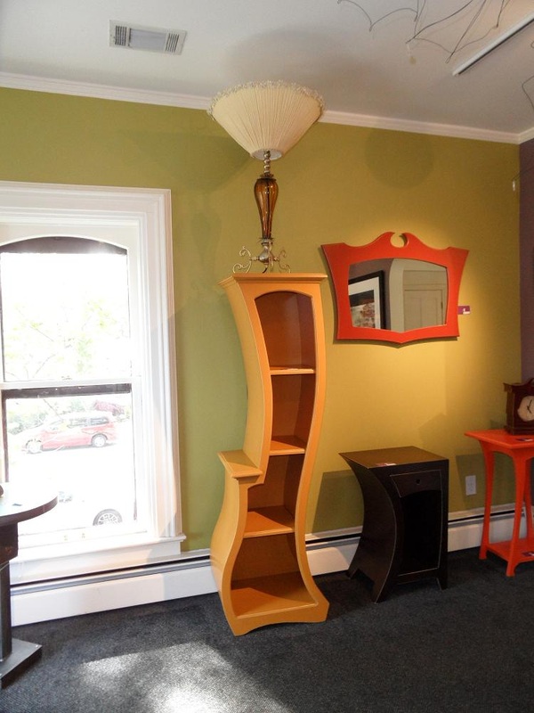 More 'Dr. Suess' furniture and lamp! |
On Tuesday, Joey & Holly needed to return to Northport, so we pulled out of the Mackinac Island marina by 9am, and shuttled them across the Mackinac Straits to Mackinaw City (pronounced the same with different spelling – go figure) where Joey had parked his car the day before. After dropping them off, we continued our journey, passing under the Mackinac Bridge, which, at almost 5 miles in length, is the longest suspension bridge in the western hemisphere. We entered the almost flat waters of Lake Michigan and headed southwest toward a very popular tourist town, Charlevoix, on the western coast of Michigan, 58 miles away. We’ve noticed a change in the weather patterns in the past several weeks, with the warm and long sunny days we had in June & July being replaced by cooler mornings & evenings and the days getting shorter, and windy weather fronts moving through every 5 days or so. Since Lake Michigan can be very rough (so much in fact that the government has ensured that there are harbors of refuge at least every 20 miles down the eastern side of Lake Michigan), our intent is to put as many miles under Rickshaw’s keel as we can whenever the weather is favorable. With the winds typically coming out of the west, the waves fetching across Lake Michigan can easily build to over 6 feet by the time they reach the Michigan shoreline.
We arrived in Charlevoix around 5pm, and motored under the drawbridge between the entrance channel and the main harbor to our anchorage in Oyster Bay. Shortly after dropping our anchor, we got a call from Quest, who was in the Charlevoix marina, inviting us for dinner. So we dropped Ricky-Dink over the side, and sped across the bay 3 miles, meeting up with Carl & Ricki on Quest, Mike & Kathy on Queen Kathleen and Joe & Edie on Seaquel, who we had never met before. Shortly after 8:00pm, we decided we should return to Rickshaw before total darkness set in, so we made our way back to Rickshaw, returning Ricky-Dink to her cradle on the dinghy deck around 9pm.
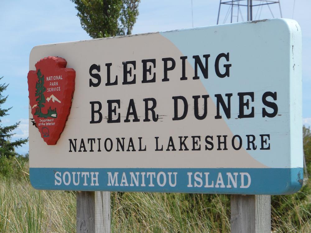
After pulling the anchor up Wednesday morning, we motored back through the Charlevoix channel returning to Lake Michigan, and turned the wheel southbound, heading toward Leland, where we would wait out the front predicted to arrive Thursday, promising heavy rains and high winds. We passed through the Leland harbor entrance around noon, and proceeded to our slip in the marina, awaiting Joey & Holly to return via his car. We had originally hoped to give Joey & Holly the experience of anchoring out Wednesday night, but decided that experiencing heavy rains and 4-5 foot seas when they awoke Thursday morning might be too much for their first time, so we scratched those plans, and instead spent the day exploring the Sleeping Bear Dunes just south of Leland in Joey’s car, along with Joey & Holly. The dunes are 500 foot high sand dunes which steeply drop down to Lake Michigan and are part of the National Park system.
The weather forecast for Thursday morning proved to be 100% accurate, so we awoke in the marina to a downpouring thunderstorm and were rocked throughout the day and night by heavy winds, reaching 40 mph at one point. The bad weather gave us a chance to catch up on a few chores and boat projects, including the repair of the washer & dryer, thanks to the receipt of a new water pump to Holly’s grandmother’s house, and the resolution of a problem with the fuel polisher. Belinda spent the day verifying a successful fix of the washer by catching up on laundry (yea! No more water on the floor!), and exploring the quaint shops in the town between rainshowers. Another problem that needed Jim’s attention was to diagnose the cause of the radar not communicating with the scanner mounted on top of the arch, 8 feet above the flybridge. During one of the breaks in the rain, Jim unzipped the flybridge cover and started the removal of the radar scanner dome cover to check for any loose wiring that might explain the reason for the malfunctioning radar. The dome is held in place by 4 bolts, of which 3 are easily accessible by standing on a bench seat on the flybridge. The last bolt proved very difficult to reach so Jim attempted to extend his reach by standing on a very wobbly 15” stool, placed on top of the bench seat, which soon proved to be a bad decision. As he stood up on the stool to reach the last bolt, the stool tipped over, sending Jim crashing down and planting the left side of his face solidly into the edge of the bench seat, resulting in an almost perfect circular deep-purple black eye.
He now bears a strong resemblance to Petey, on the Little Rascals (for those old enough to remember).
On Friday, Joey loaned us his car which enabled us the means to get out of the marina and do more exploring and to do some major reprovisioning from Walmart in nearby Traverse City, since our existing inventory of food and supplies had been severely depleted over the last month due to the 3 sets of company. We invited Carl & Ricki along & decided to drive back up to Charlevoix for a quick reunion with Skip & Barb on Moor $tuff, whom we had not seen since mid-June in Waterford, NY, and Joe & Tara on Seabatical. After the brief visit and a lunch stop, we headed back south in the car to Traverse City, loading up a basket with $250 in groceries at Walmart, and a few small purchases at West Marine & Home Depot. We arrived back at the marina about 5pm, and quickly dropped off the groceries, before cleaning up and driving back north to Holly’s grandmother’s (Christie) “cottage”, in the exclusive community of Northport Point, where Christie spends her summers, away from her home in Houston. We feasted on wine & a wonderful dinner prepared by Christie, watching the sun set over Grand Traverse Bay, following a golf-cart tour of the gated community before being returned to Rickshaw by Joey around 10pm.
The weather had finally broken Friday afternoon, so, on Saturday morning, we gladly untied our docklines from the Leland marina and headed out to the last island that we would visit for a while, which was the South Manitou island, 15 miles west of Leland. The island is part of the Sleeping Bear Dunes national park, so is manned by two Park Service personnel, who live on the island full-time during the summer season. Upon arriving in the eastern-facing bay on the east side of the island, we dropped our anchor in 25 feet of crystal clear aqua- green water, ate a quick lunch on the aft deck, before hoisting Ricky-Dink over the side to explore the island. The bay is edged by white sandy beaches, which, together with the aqua waters, gave the appearance of being somewhere in the Caribbean, except for the absence of palm trees. We beached the dinghy near the ranger station and walked up the beach to inquire what there was to do there. We were told that we had just missed the last tour of the 150 year old lighthouse, but that we could be given a personal tour in about 30 minutes. Bob, who worked for the Park Service until his retirement a few years ago, and who now volunteers to work for 3 weeks straight on the island, showed up right on time and gave us the personal tour of the lighthouse, explaining the history and the mechanics of how a lighthouse operates, including how a 120 watt light bulb can be projected through a Fresnel lens and be seen over 10 miles away. Returning to Rickshaw early evening, we spent the rest of the evening being rocked to sleep in our anchorage.
Sunday’s weather continued to be favorable for travel, so we took advantage of the calm seas and winds to make more progress down the Michigan coast. Our hope was that, by the end of the week, we could be near the bottom of Lake Michigan to meet up with Jim’s sister, Louise, and her husband, Bob, who could drive over from Detroit for an overnight visit. The next weather system was predicted to be at mid-week, so we wanted to make as many miles as we could while the weather cooperated, in order to be that far south by the end of the week. The best destination for Saturday was decided to be Manistee, 51 miles down the coast, so we pulled up the anchor at South Manitou island early Sunday morning, and motored down the coast, passed many more sand dune cliffs lining the shores of northern Michigan. We arrived in Manistee by 5pm, passing through 3 drawbridges, and into a marina where we took on 660 gallons of diesel, which had been consumed since we last filled up in Brewerton, NY. After doing major damage to our credit card at the fuel dock, we crossed over the bay, and planted our anchor in 20 feet of water, just off of the small boat ramp.
 A freighter just passed under the Mackinac Bridge. The Mackinac Island lighthouse to the right. 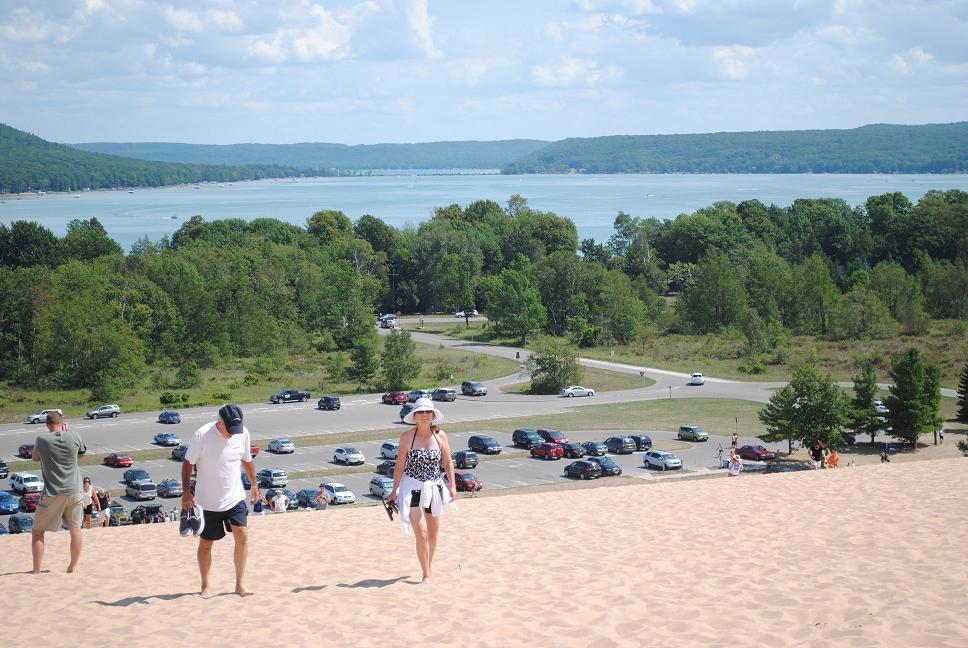 Jim and Belinda made to the top of the first dune - just behind Joey and Holly. 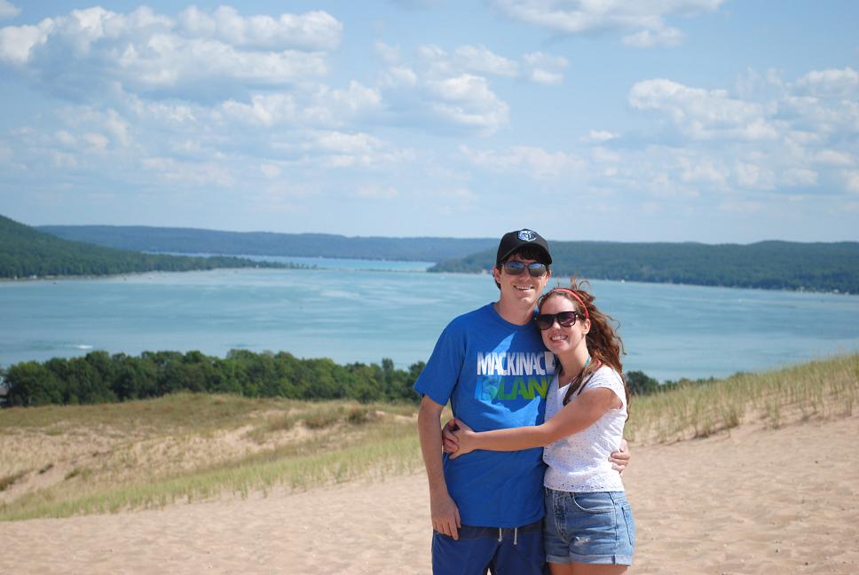 Joey and Holly on the dunes with Glen Lake in the back ground. 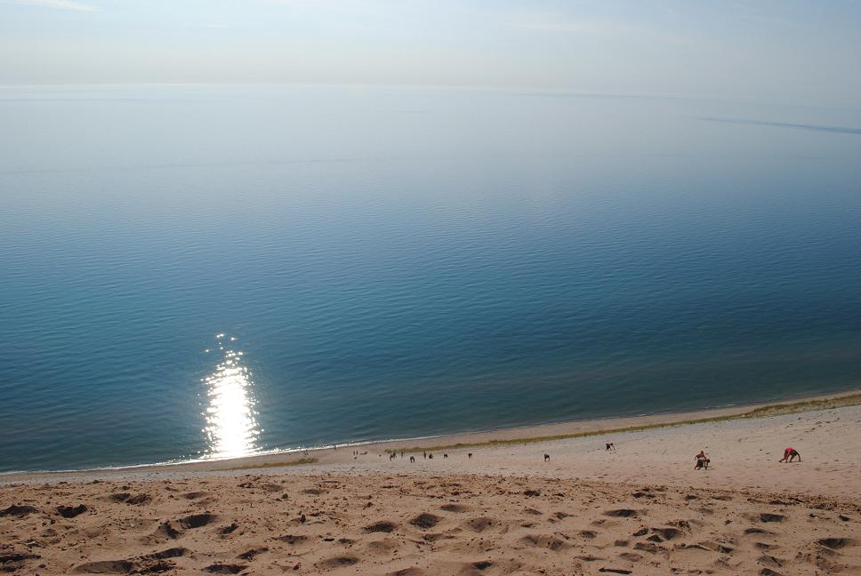 As expected - these are the idiots who can't read. If you look closely you will see the only way these people can climb back up is on all fours. It will take them hours - this dune is VERY STEEP!! 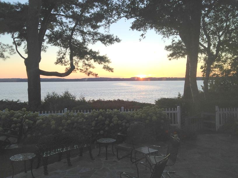 This is the view of Grand Traverse Bay that we enjoyed while dinning at Holly's Grandmother's cottage on Northport Point.  The water in South Manitou Island Bay made us think we were in the Caribbean - we only needed palm trees.  We could see Rickshaw anchored in the bay from the top of the lighthouse.  Sunrise in bay.  As we headed south from South Manitou Island towards Manistee, we got one more look at Sleeping Bear Dunes. | 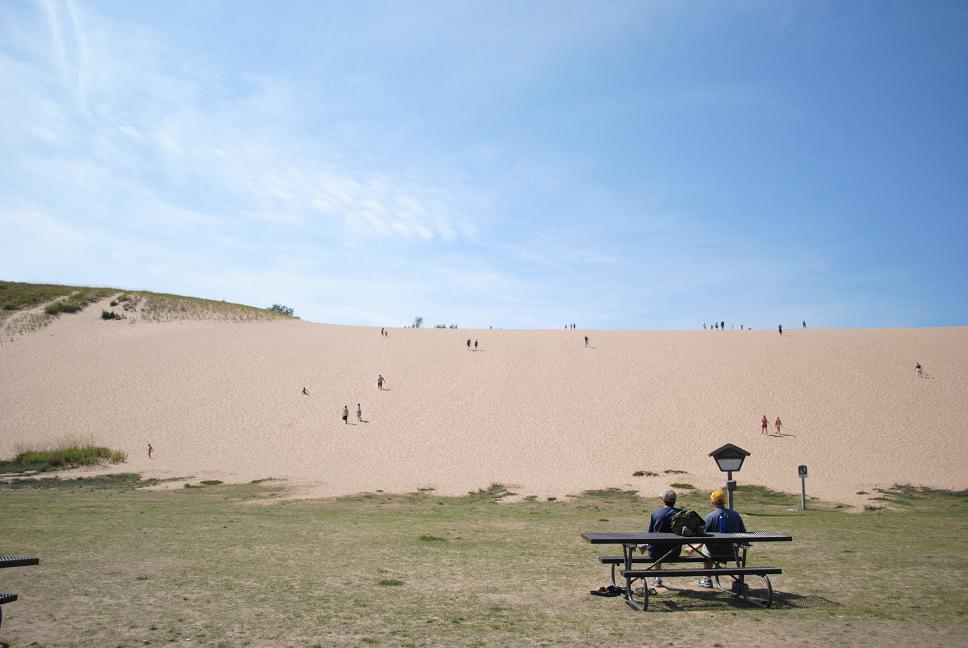 The first dune in Sleeping Bear Dune National Park. 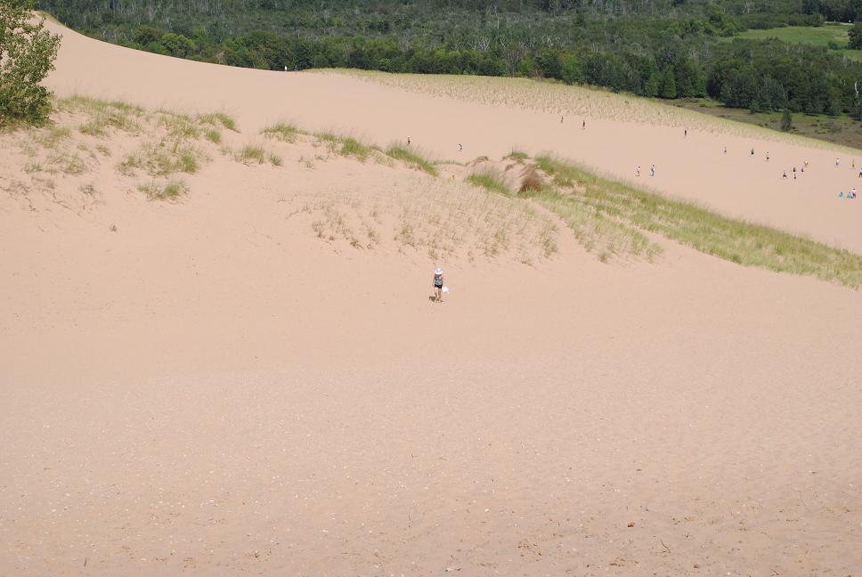 Jim, Holly and Joey made it to the top of the second dune, Belinda is trailing behind.  Joey standing at the top of one of the steepest dunes. A warning sign was posted warning people NOT to go down the eroding sand dune and if rescue was required a fee will be charged. 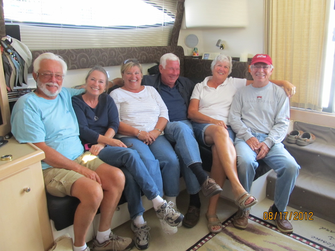 Skip, Belinda, Ricki, Carl, Barbara and Jim. Thanks Tara for snapping this.  It was very windy at the top of the lighthouse! 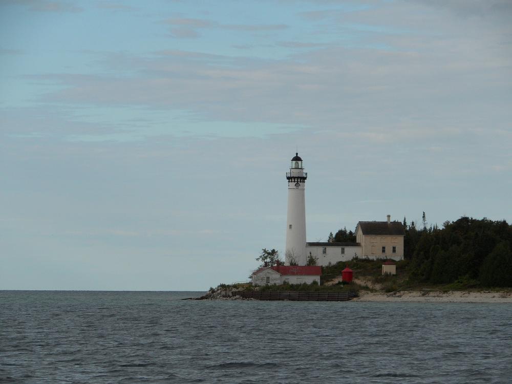 The lighthouse from the bay. 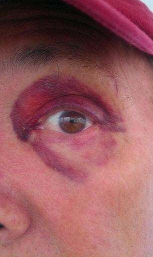 Jim's black eye  The draw bridge opens on request in Manistee - great, no waiting! |
Aug 11th-13th, Sun-Mon, Days 99-101: Mackinac Island
We arrived in the Mackinac Island marina midday on Saturday, and spent the rest of the day catching up with other loopers who had waited out the high winds over the past few days here and waiting for Woody & Carolyn to arrive via ferry from the mainland. Mackinac Island was one of our favorite stopovers in the entire trip. It amazed us to realize that the residents of Mackinac Island have managed to build magnificent homes, and live day to day on this beautiful island without relying on any automobiles, since no motorized vehicles (except for EMS vehicles) are allowed on the island. The only modes of transportation on the island are bicycles and horses, so any inbound supplies are received at the main dock and off-loaded onto horse-drawn wagons for distribution across the island. I guess if you live here long enough, you eventually get used to the smell of horse poop which seemed to be everywhere along the streets. The maintenance department does a great job of trying to keep it cleaned up, but the smell of it permeated the air, making the entire shopping district resemble a town 100 or more years ago.
We spent our last hours with Woody & Carolyn on Sunday exploring the island via bicycles, circling the islands via the 8 mile bike path. We completed our circumnavigation by lunchtime, so we said goodbye to Woody & Carolyn around 2pm, and began getting Rickshaw ready to receive our next set of company due on Monday, Belinda's son Joey and his girlfriend, Holly. Later in the day, we squeezed in a visit to the Grand Hotel, which is the famous upscale $400/night hotel featured in the movie, Somewhere in Time, overlooking the Mackinac Straits.
After Joey & Holly drove up from Northport (near Traverse City) where they were visiting Holly's grandmother, they parked their car at Mackinaw City (on the mainland), and caught the morning ferry Monday morning, and arrived on Mackinac Island around 11am. We spent the rest of the day touring the island by bike (again) and by dinghy, taking Ricky-Dink out of the marina and around part of the island, which afforded us a magnificent view of the island from the water. That night, we treated Joey and Holly to a wonderful dinner at the restaurant "The Woods", which resembled a large hunting lodge, buried deep in the interior of the island. Getting to & from the restaurant is a major part of the experience, since the only way to get there is via horse-drawn carriage. It was a somewhat magical experience to travel through the tree-lined paths, in the woods, in the dark of the night, on a carriage drawn by two draft horses. We filed away in our minds a promise to someday try to bring our grandchildren back here.
 There were many Looper boats already in the Mackinac Island Marina when we arrived - so a docktail party was the best way to share experiences and float plans. 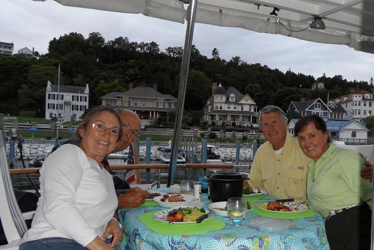 Our last dinner with Woody and Carolyn on the aft deck of Rickshaw. Our view was like a postcard picture of the Mackinac Island homes that lined the harbor. 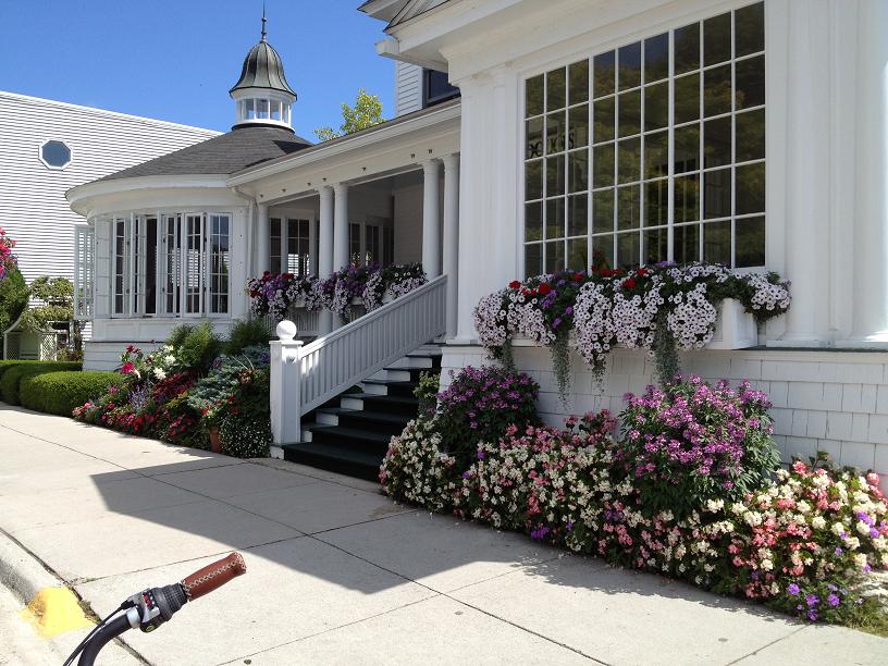 One of the many beautifully landscaped hotels on Mackinac Island.  Since the marina didn't have a laundry we had to bike the guest sheets and towels to the laundry at the other end of town to get ready for our next company. 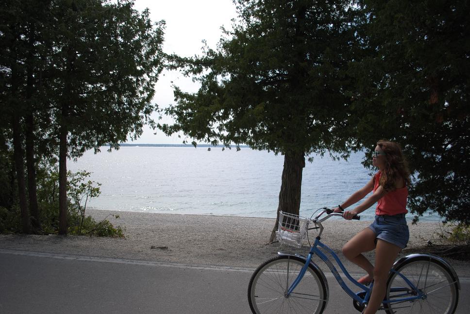 Holly enjoying the cruiser bike along the shore line of Mackinac Island.  The natural arch as seen from the bike path. |  We were delighted to catch up with Tara from Seabatical again. 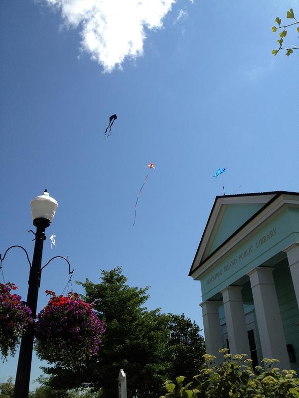 At the end of of bike ride with the Pierces we were treated to these colorful kites floating in the air above the colorful flower baskets that lined the main street.  The Grand Hotel - it has a huge front porch for people watching, it has fantastic views from beautiful grounds but inside it isn't as elegant as the Grand Peabody Hotel in Memphis.  Joey and Holly on their first Ricky-Dink ride.  Joey and Belinda on the bike path along the Mackinac Island shore. 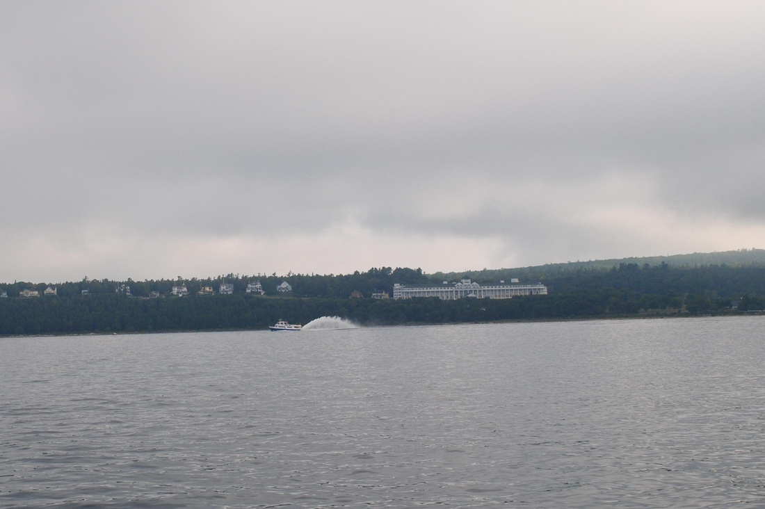 We get one last view of the Grand Hotel and a ferry boat as we sadly leave Mackinac much too soon. |
Aug 6th, Monday, Day 94: Georgian Bay to South Benjamin Islands
Aug 7th, Tuesday, Day 95: South Benjamin Island to Oak Bay
Aug 8th, Wednesday, Day 96: Oak Bay to Whalesback Channel
Aug 9th Thu, Day 97 Whalesback Channel to Drummond Island - USA
Aug 10th & 11th, Fri-Sat, Days 98-99 Drummond to Mackinac Island, MI
After the winds subsided Monday morning, we were finally able to leave the security of the Gore Bay marina and head out with Woody & Carolyn back to one of our previously visited islands in the North Channel. Our destination was somewhere in the Benjamins. Since there was still some moderate winds forecasted for Monday night from the south, we chose a very popular bay on the north side of South Benjamin island which we hoped would give us some shelter from the winds and waves. Throughout the day, several boaters echoed our choice of an anchorage by coming into the bay and dropping their hook. By the end of the day, the bay had over 30 boats spending the night. This bay was surrounded by large granite rocks and several large hills which sloped down to the water’s edge, inviting us to come to shore & walk up to the top of the island, which of course we did, via Ricky-Dink. We also took a dinghy tour of the bay and around the point at the corner of the anchorage. Unfortunately, we seem to have been getting a daily weather pattern of light rain and threatening clouds, so our venture via the dinghy was cut short when ominous clouds started forming on the horizon.
On Tuesday, we left south Benjamin Island and headed northwest to meet up with another buddy boat, Hallelujah, owned by Dave & Barb Reinken, which is also a Defever 44 and very similar to Rickshaw. We motored up to Oak Bay, and by mid-day, were securely anchored a hundred yards from Hallelujah. After eating a quick bite of lunch, we dropped the dinghy into the water and took an extensive cruise around the surrounding waters, past a youth group camp, where there were several First Nation teenagers paddling kayaks in and around the marsh grasses which lined the banks of the bay. After returning to Rickshaw, Woody, Carolyn & Jim toured the immediate area in borrowed kayaks from Hallelujah. Afterwards, we invited Dave & Barb over for dinner on our aft-deck and were entertained by Woody on the guitar, featuring sailing and western songs.
Wednesday’s destination was the very scenic Bear Drop Bay in Whalesback Channel, further west along the northern shore of the North Channel, some 20 miles away. We said goodbye to Hallelujah as our paths diverged, and we motored into the narrow and shallow channel into Bear Drop, with Belinda and Woody on bow-watch keeping a keen eye for any shallow rocks in the uncharted entrance. We were pleasantly surprised to find the very popular anchorage virtually empty, so we picked an ideal spot in the middle of the bay, before taking our exploratory dinghy ride around the bay followed by a circumnavigation of the island. Approaching Rickshaw, we stopped for a quick visit with another boat, White Star, which was a mint-condition 1987 Valiant sailboat. Gar & Helen from Toronto on White Star mentioned that they had enjoyed Woody’s concert which carried over the bay the night before in Oak Bay, where they were also anchored, so we invited them over for a repeat performance by Woody that night, which they eagerly accepted.
We had been keeping close attention to a forecast for gale-force winds that were
supposed to be moving into the area by Thursday night, so when we woke Thursday morning we considered our options for where to stay that night, and decided to push for Drummond Island, 56 miles away, which is the port of entry for boats re-entering the US, so we could be in a marina and wait for the storm to move through. Coincidentally, at exactly the same time as our chartplotter moved from the Canadian charts to the US charts, the ipod selected the next song in the shuffle list & John Denver started singing "It's good to be back home again" over the boat speakers. After a long day on the water, we arrived in Drummond at 4pm, cleared customs, and headed to our assigned slip, which unfortunately was very exposed to the incoming north winds that were beginning to build. We swapped our 5/8” docklines for the larger 1” docklines and tied Rickshaw to the windward dock in 7 places trying to hold her close enough to the dock to enable us to step off and on Rickshaw without much difficulty. In spite of our extra security, when we awoke on Friday morning, after hearing the wind howling throughout the night, Rickshaw had moved 2 feet from the dock due to the constant pulling and slacking of the docklines.
Since we were pretty much certain to be staying in the marina for a couple of days,
Woody & Carolyn took the opportunity to retrieve their car in Sault Ste. Marie, where they had dropped it off almost a week before, and bring it back to Drummond. At this point, the weather forecast did not look promising. We had hoped to be in Mackinac Island Saturday night, but the weather forecast indicated that the weather system that was producing the high winds was supposed to last until late Saturday night, making the hope that we would be in Mackinac before Sunday not very promising. While Woody & Carolyn fetched their car, Belinda took advantage of the downtime to catch up on laundry, while Jim wrestled the washing machine out of its closet to diagnose the source of a water leak that had appeared during the last washing cycle on-board. The washing machine has been a huge advantage on-board, allowing Belinda to wash clothes every couple of days, and not spend time at marinas waiting for machines on-shore.
When Saturday morning arrived, we received an updated weather forecast, which predicted light rain, winds around 15-20 knots, with 2-3 foot seas, between Drummond and Mackinac, 40 miles away. Even though the forecast was not ideal, we decided that we would push to Mackinac, which would keep us on schedule and allow us to be in Mackinac on Sunday, which was predicted to be a sunny & warm day. So after a quick run to the grocery store in Drummond (thanks to Woody’s car), we pulled away from the Drummond marina at 11am, with Woody & Carolyn to catch up with us in Mackinac 5 hours later.
 Carolyn and Belinda out on the fore deck.  Belinda on bow watch. Not all rocks are as obvious as the one off the port bow. Some rocks are that big but just inches under the water. Ouch, we don't want to hit one of those!  The South Benjamin anchorage we had to share with too many other boats. But it was beautiful surrounded with granite rocks. We hiked up the rocks to take this picture. 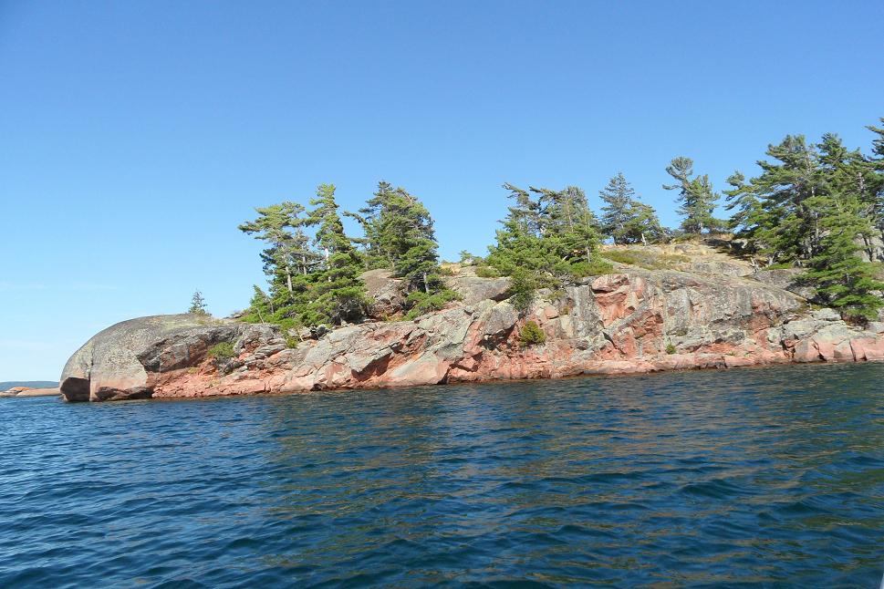 More of the rocks that created the bay for our anchorage.  It's not fun all the time. Belinda's swabbing the deck after raising the anchor. We sure do miss Al sometimes.  This is the pink granite we hiked on - 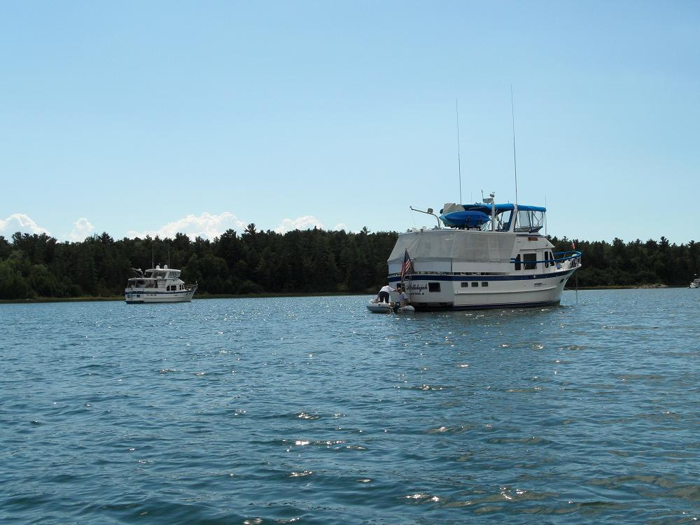 Hallelujah in the foreground and Rickshaw in the back. They are sisters - both 44' DeFevers. 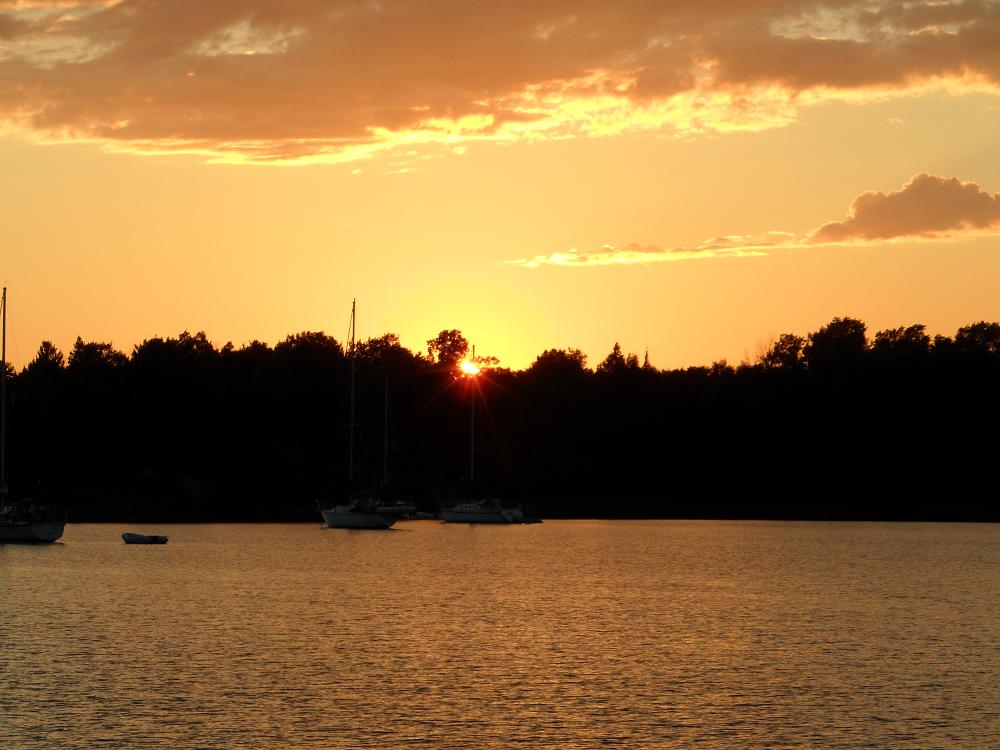 Sunset in Oak Bay.  Woody going in for a swim. |  Jim helping Carolyn at the helm as we head towards our next anchorage.  Jim, Belinda and Carolyn - waiting on Woody to board Ricky-Dink for a gunk-holing trip.  Barb and Dave Reinken from Hallelujah going on a dinghy ride with us. 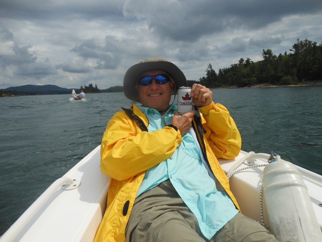 Woody and a Canadian beer!  Woody playing Buffett and cowboy songs for us and Barb and Dave from Hallelujah.  Belinda at the helm navigating a tight rocky channel. 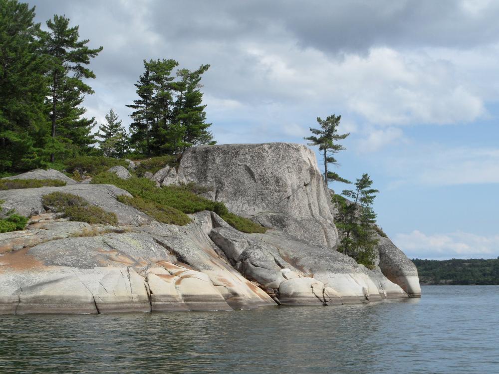 We named this rock Gilbraltar. 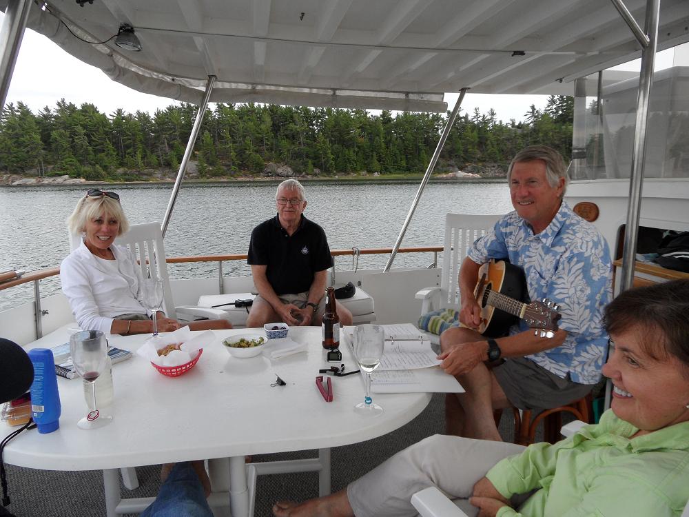 Another evening concert by Woody with Gar and Helen from White Star. |
Wed Aug 1st, Day 89 - Clapperton Island
Thu Aug 2nd, Day 90 - S. Benjamin Island
Fri Aug 3rd, Day 91 - Croker Island
Sat & Sun Aug 4th & 5th, Days 92 & 93 - Gore Bay
Since it had been a few days since our last marina, we needed to stop in the first town on Manitoulin Island, Little Current, for a few groceries and a pumpout before proceeding to another anchorage. Manitoulin Island is the island that defines the southern border of the North Channel, separating Canada from Lake Huron. It is noteworthy being the largest freshwater island in the world, with many of the inhabitants being members of the First Nation tribes. After the 3 hour stop in Little Current, we headed for our anchorage for the night, Clapperton Island, where we arrived just in time to have a quick dinner before the sunset.
On Thursday, we headed toward the Benjamin Island group, keeping our attention on the less than favorable weather forecast, which was indicating 20-25 knot winds out of the north, making an anchorage with some protection to the north very preferable. We tucked into the bay on the south side of South Benjamin Island, barely able to anchor in the lee of the island, just outside of the effects of the winds and the waves coming in around the point. Even though the waves were still felt at our anchor spot, we decided to drop Ricky-Dink off the side and explore the bay and the nearby shallow rock strewn channels. Picking our way through massive granite and quartz boulders, through channels not wider than 15 feet, we idled slowly by a couple of sailboats pressed against the rock walls, kept in place by ropes tied to rock-climbing pitons, secured into the cracks in the granite. We came out on the opposite side of S. Benjamin and discovered a beautiful beach with crystal clear water where we beached the dinghy, and gave Jim a chance to take a quick swim in the very chilly water.
Our plan on Friday was to reconnect with Joe & Tara on Seabatical, which would allow Al & Dawn a last opportunity to say goodbye to Joe & Tara before disembarking from Rickshaw on Saturday. We settled on the bay at Croker Island which was a horseshoe-shaped lagoon surrounded by tall outcroppings of pink granite ringing the anchorage. Our decision to stop at Croker Island was coincidentally shared by several other boats, including Marc's Ark & Blue Heron. We climbed to the top of the 50 foot tall dome that overlooked Croker Bay, and gave us a 360 degree view of the bay and the surrounding waters. After our hike, we had an impromptu happy hour get-together on the beach with several of the boaters, which would most likely be the last time we would see most of them until at least Mackinac or further down the Michigan coast.
Saturday was a sad day for us, because this was the day that we would have to say good-bye to our wonderful friends and guests for the past 2 weeks, Al & Dawn. We motored from Croker Island 15 miles to Gore Bay, where they had dropped their car off 2 weeks earlier, and, after availing ourselves of Al & Dawn's car to go to the grocery store, gave our goodbye hugs and kisses to our good friends, promising to stay in touch and re-unite with them sometime before the end of the year. We spent the rest of Saturday and Sunday morning cleaning and getting Rickshaw ready for our friends from Memphis, Woody & Carolyn, who were scheduled to arrive around noon on Sunday. Although our original plan was to depart for an anchorage Sunday afternoon, high winds kept us in the Gore Bay marina on Sunday night. 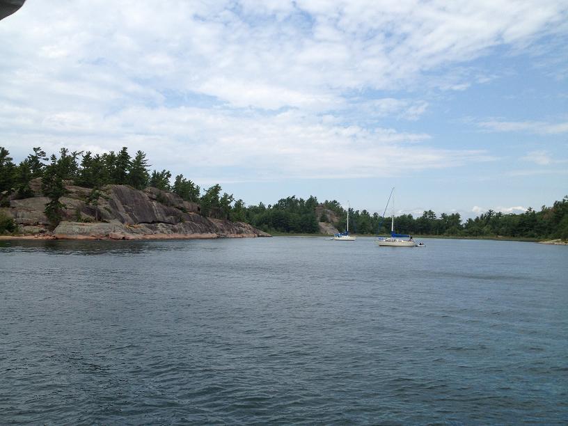 A couple of sailboats, sheltered by the rocks, at anchor off South Benjamin Island.  The water is so clear in this little cove.  Jim going out for a swim. |  Rickshaw at anchor off South Benjamin Island. Note the mast behind the rocks where the sailboat was secured to the granite rocks. 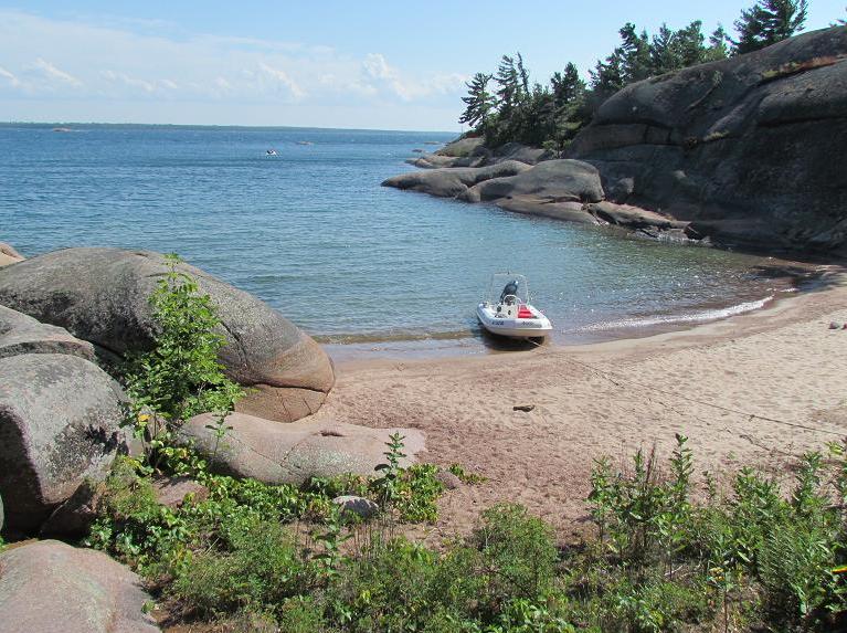 We found this little cove with a beach tucked in between some rock outcropings.  The view from the top of the rock on Croker Island. | 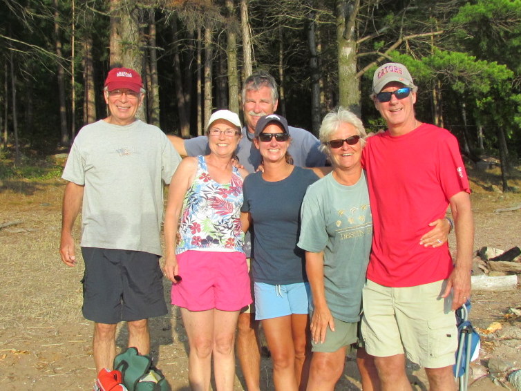 Who would have thought, back in May of 2011 when we first met in Norfolk VA, that we would reunite on Georgian Bay in August 2012. L to R: Jim, Belinda, Al, Tara, Dawn and Joe.
|
 RSS Feed