We started at the end of the Trent Severn Waterway in Port Severn on July 20th and entered North Bay on July 31st in Frayser Bay.
| We started at the end of the Trent Severn Waterway in Port Severn on July 20th and entered North Bay on July 31st in Frayser Bay.
0 Comments
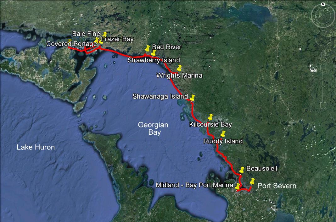
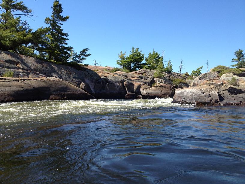
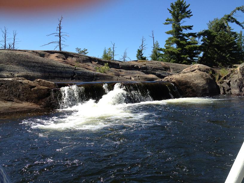
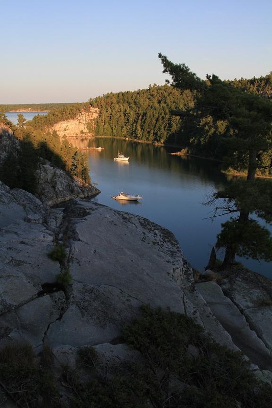
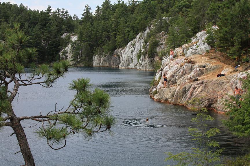
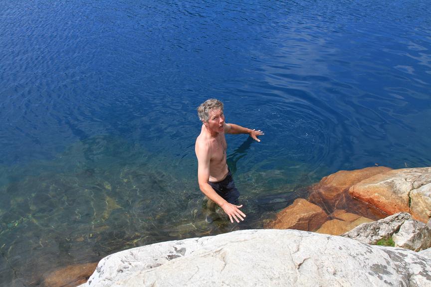
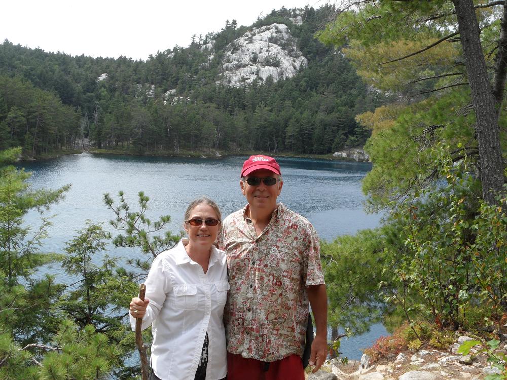
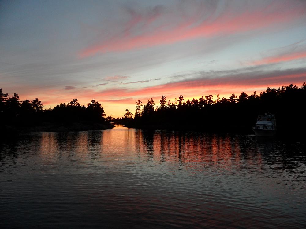
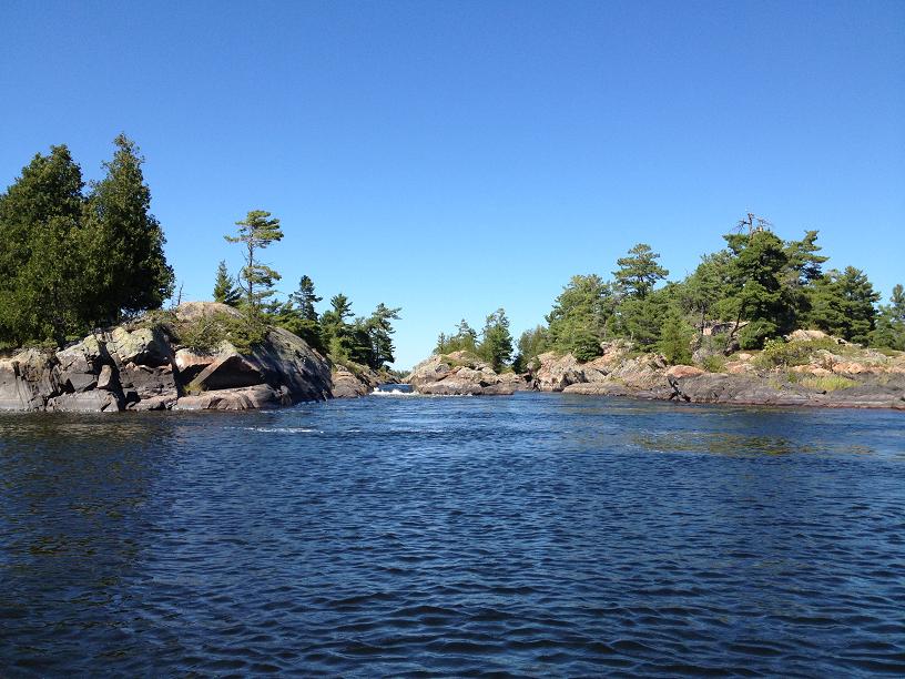
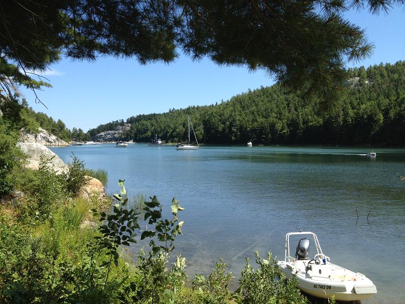
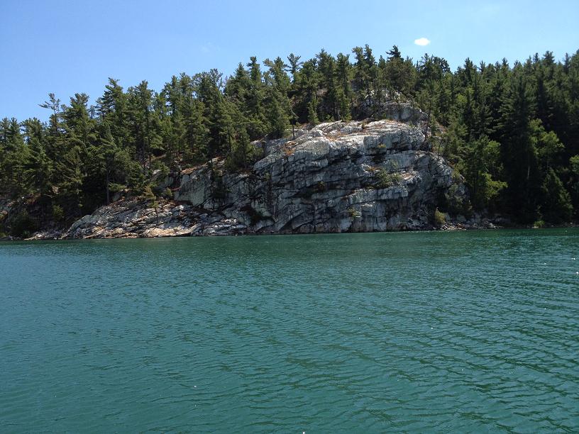
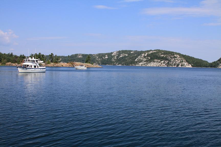
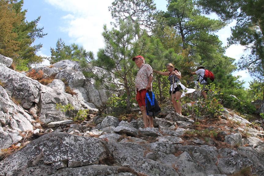
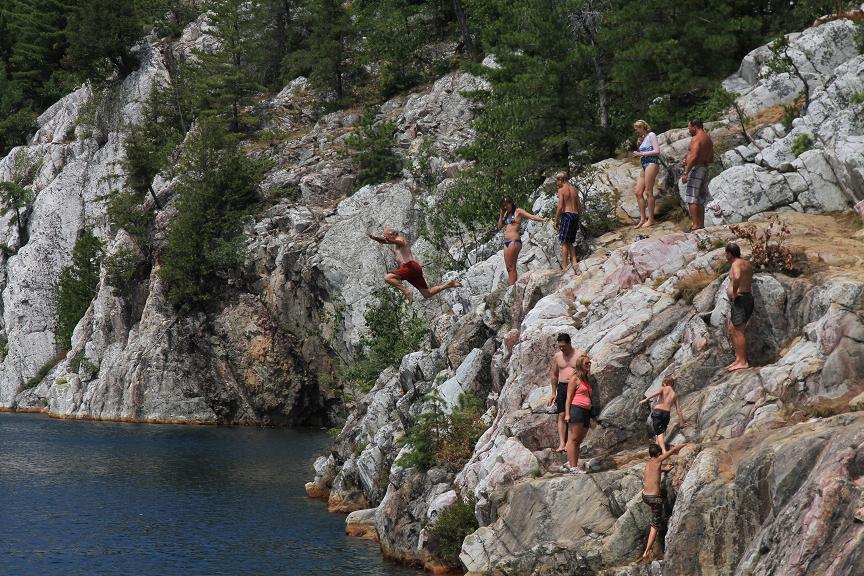
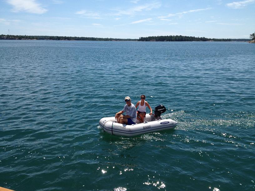
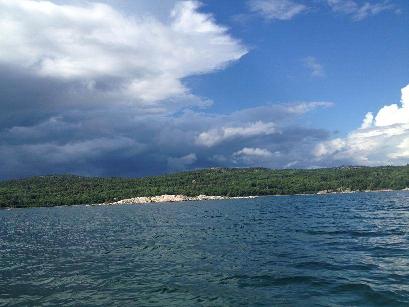
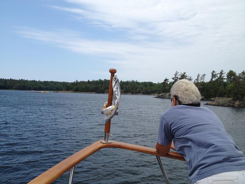
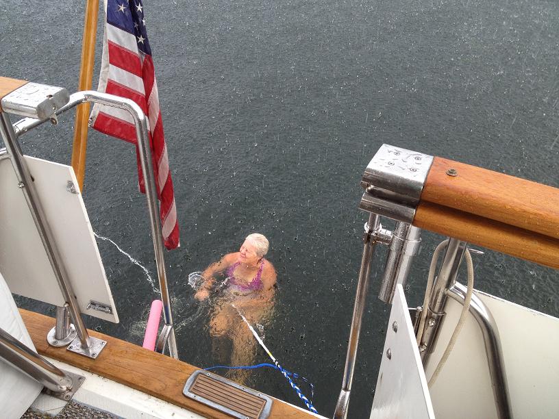
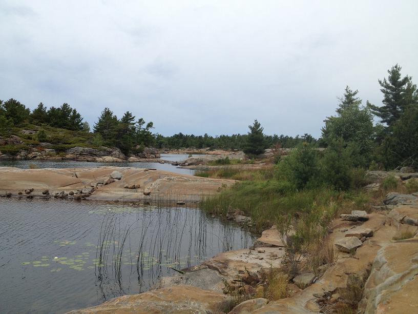
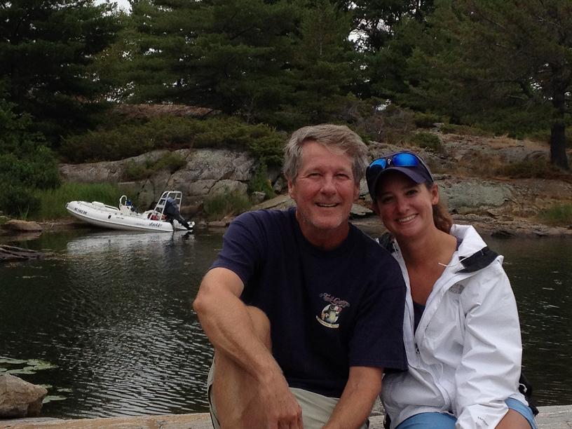
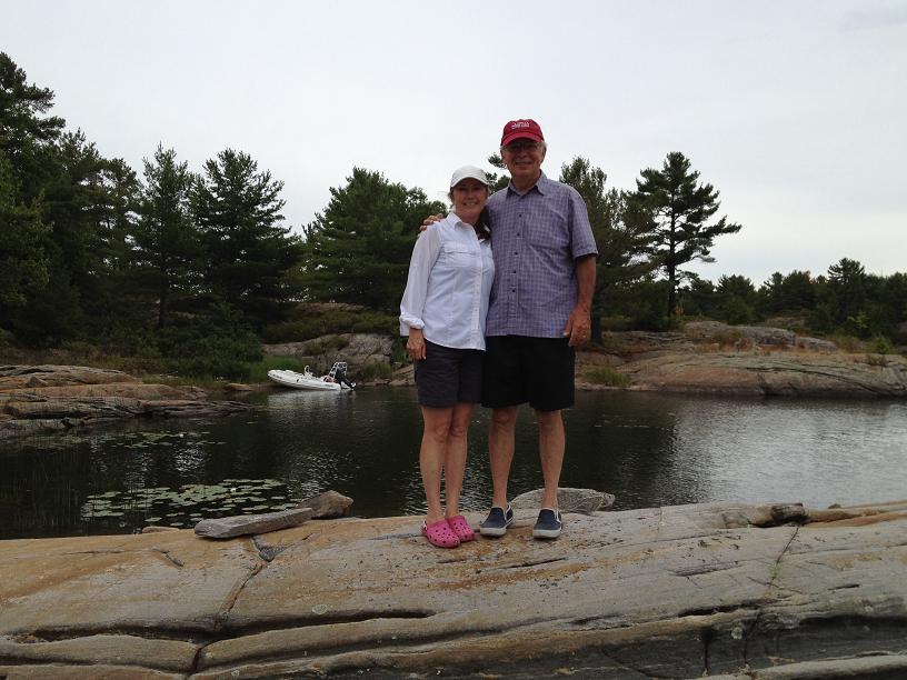
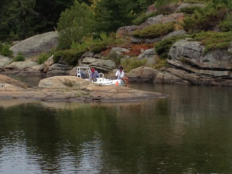
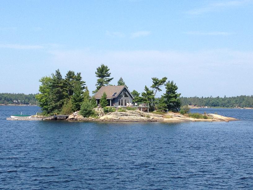
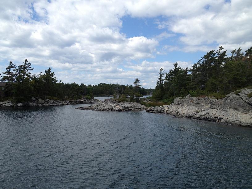
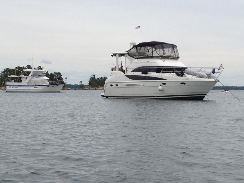
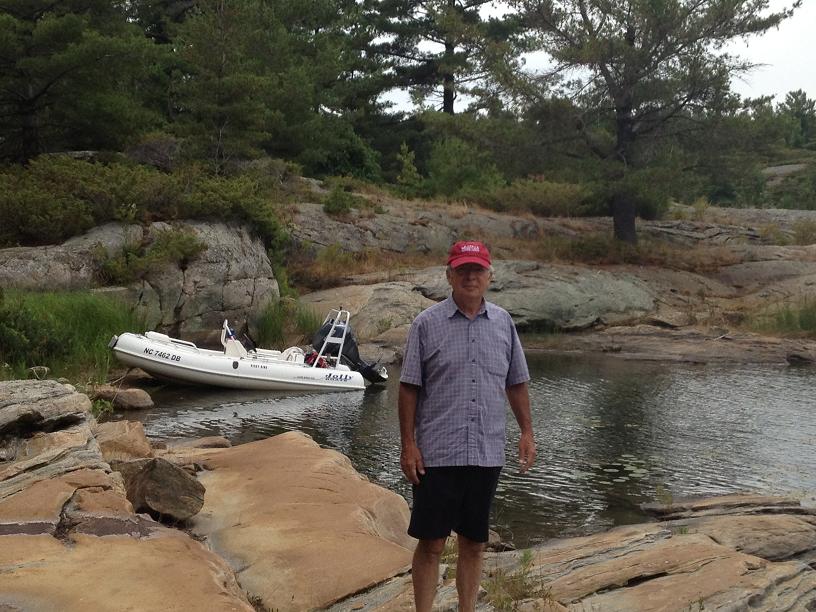
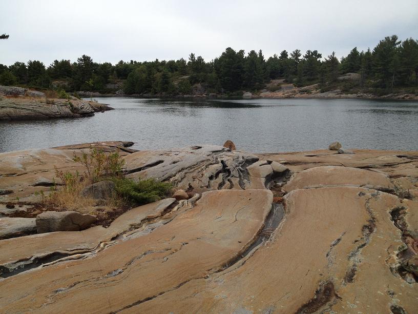
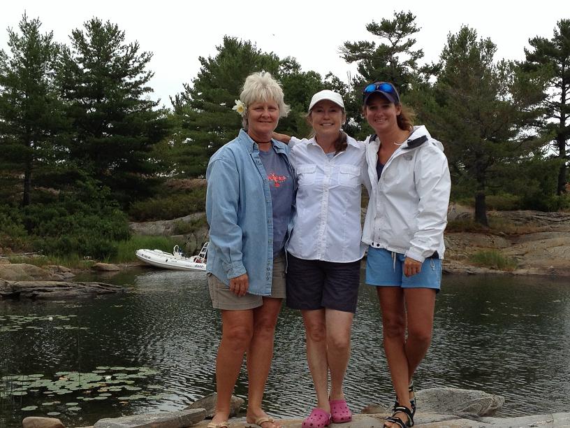
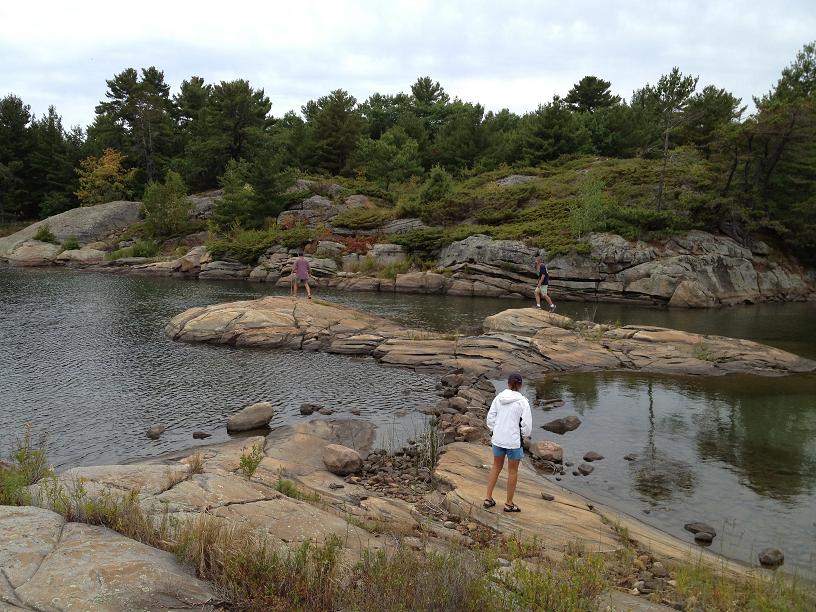
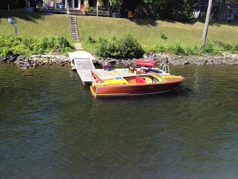
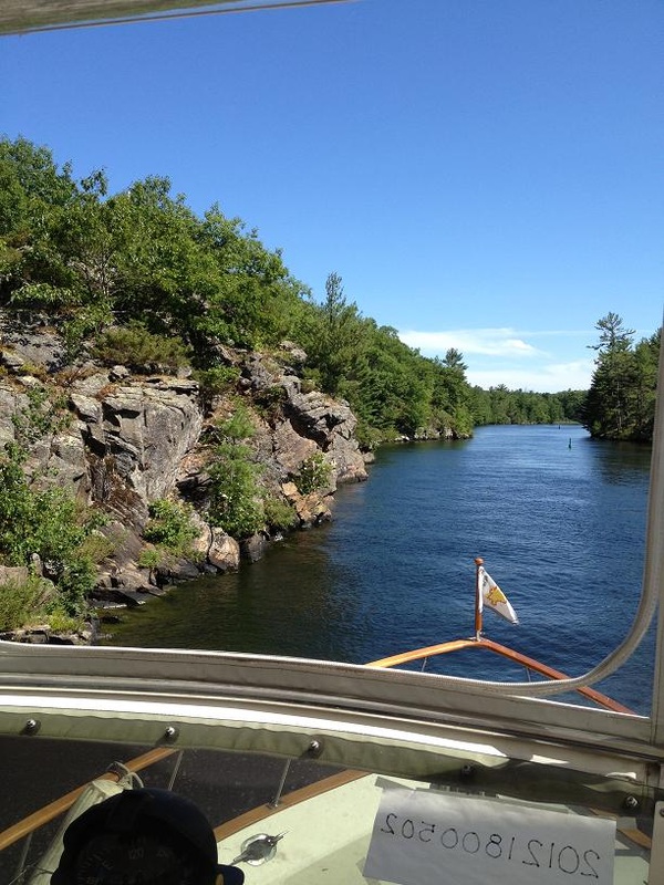
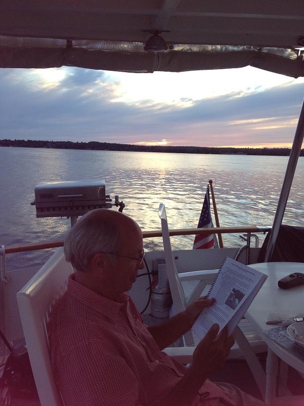
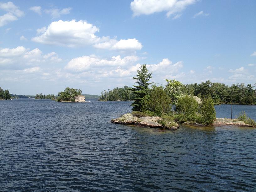
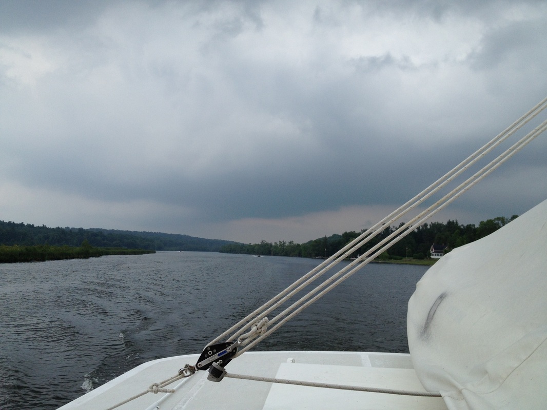
Fri July 27, Day 84: Bustards Islands Sat July 28, Day 85: Bad River Sun July 29, Day 86: Covered Portage Mon July 30, Day 87: Baie Fine Tues July 31, Day 88: Frazer Bay After leaving Wright’s Marina in Britt, we motored further northwest along the Georgian Bay coast towards a remote group of islands called the Bustards, where we anchored along with Marc’s Ark, Quest and Blue Heron in a tight little anchorage between Strawberry Island and Tie Island. Once we’re satisfied that our anchor is secure, we deployed Ricky-Dink over the side, and took an exploratory tour of the several islands separated by narrow channels with steep rocky walls. On Saturday (7/28), we pulled up the anchor and headed further north toward Bad River, which is a lagoon down a narrow and shallow channel, which required Belinda & Dawn to maintain a watch on the bow to alert us of any granite boulders hiding just below the surface. Channel markings are only occasionally present, so the absence of navigational buoys and daymarks does not necessarily mean safe waters. One of the highlights of Bad River is a chute of water that feeds into the anchorage basin and squeezes between 20 foot walls and into the lagoon. So, the “thing to do” here is to run the dinghy almost full speed through the 15 foot wide mini-canyon pushing the dinghy against the 5 knot current, which we did (of course), which was a nail-biter, especially since the water level is reported to be 14” down from last year. Then, to turn around, this time with the current, and shoot out of the canyon back into the lagoon, at an accelerated speed above which Ricky-Dink has probably never experienced. On Sunday morning, we awoke early and headed out in order to hook up with Joe & Tara on Seabatical, further up into the North Channel in a beautiful anchorage, called Covered Portage, on the far side of Killarney, Ontario. Entering Covered Portage (or as the French call it “Portage Couvert”), we were surrounded by 100 ft. cliffs of sheer granite rimming the emerald green waters, where we shared the bay with an estimated 40-50 boats. After lunch, we embarked in Ricky-Dink for a tour of the bay, and beached the dinghy on the innermost shore and went on a very steep hike/climb up to the top of the rock cliffs overlooking the bay. Since we only have a few days left with Al & Dawn, we want to make the most of the time remaining and see as many bays and anchorages as we can. We’ve noticed that as we go north, the water is getting clearer and the shores are mostly pink and gray granite, accentuated with pine & other evergreen trees. The next day, Monday, we depart for Baie Fine, which is a narrow fiord north of Covered Portage, approximately 10 miles long by ½ mile wide. At the end of the fiord is a very small anchorage called “The Pool” which is advertised to be large enough for a half-dozen boats. When we arrived at The Pool (via Ricky-Dink, since we anchored in the main body of water in Baie Fine), we were surprised to find about 2 dozen boats squeezed into the anchorage. On shore, there were several trails to take advantage of, so the 6 of us (which included Joe & Tara) took a 2 mile hike up to the top of the ridge where we enjoyed our lunch at our destination, Topaz Lake, which is a crystal blue/green lake reported to be over a hundred feet deep, surrounded by steep striated granite. Some of the walls are not so steep to provide steps to enable a smooth entry into the very brisk water. In other places, it is possible to maneuver around the boulders and stand 20-30 feet over the water, looking almost straight down into the breath-taking pool below where some (including Jim, Al & Tara) leap out and over the rocks below and plunge into the icy pool. After our hike back to Ricky-Dink, we returned to the mother ship, Rickshaw, after dropping Joe & Tara off at their boat. After a short period of changing into dry clothes on Rickshaw, we invited ourselves back onto Seabatical for happy hour cocktails and snacks before returning to Rickshaw for another wonderful dinner on the aft-deck. The next day, Tuesday, we motored a short 11 miles, to a small horseshoe-shaped cove at the end of Frazer Bay. So far on our Great Loop adventure, we’ve seen rain or even rain clouds only a couple of days. But, in the past few days, we’ve had more overcast days with brief periods of downpours. So we have to time our passages and our dinghy excursions carefully and some days, elect to only go short distances Even though the water has been getting clearer the further north and west we go, in this particular anchorage, the water is so clear we can see the bottom 15 feet down perfectly. So clear, in fact, that during a dice game, Farkle, on the aft deck with Al, Dawn, Tara & Joe, when one of the dice bounced off the table and over the toerail of the boat, we could easily see the die sitting on the bottom 10 feet down, landing with the number 2 face up. After our brief dinghy exploration, which was cut short by ominous rain clouds building on the horizon, we taught Joe & Tara how to play Farkle on our aftdeck, and then ended the day with a chilly swim/wash down off the swim platform, before feasting on Belinda’s famous crabcakes while watching the full moon come up over the eastern shoreline.
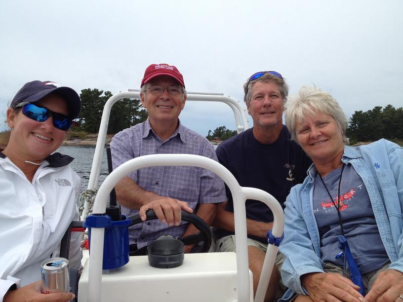
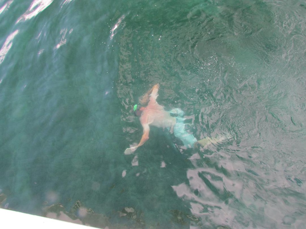 Poor Joe! We made him believe that his dropping the die overboard would put a permanent end to all Farkle games. So we made him jump in to retrieve it from 10 feet below. Not until he returned with the die did we let him know we actually had 12 more on board. Sun Jul 22, Day 79: Anchored Across from Frying Pan Bay Mon 7/23, Day 80: Anchored east of Ruddy Island Tues 7/24, Day 81: Anchored in Kilcoursie Bay Wed 7/25, Day 82: Anchored in Shawanaga Island Thu 7/26, Day 83: Bing Inlet For the next several days, we’re travelling through the region known as the 30,000 islands, even though there are reportedly a lot more islands than 30,000 in this part of Georgian Bay. Navigating through this massive archipelago is a definite challenge, because it is very difficult to really know which islands we’re near without keeping close tracks all along the way of where we are, especially since our electronic charts don’t cover most of this area. So, we navigate by using paper charts and plotting our latitude & longitude along the way. We’ve spent every night at remote anchorages with names like Frying Pan Bay, Kilcoursie & Shawanaga with crystal clear aquamarine waters surrounded by beaches or granite boulder-lined shores. On Tuesday, 7/24, we met up with our friends, Joe & Tara from Atlanta on Seabatical, whom we met last year in Norfolk, at the AGLCA rendezvous, and have kept in contact with ever since, waiting for this year when we, including Al & Dawn, could meet up with them on the Great Loop. While anchored off of Shawanaga, the 6 of us took an exploratory cruise among the boulder islands and outcroppings in Ricky-Dink (our dinghy) prior to a delicious dinner prepared by Tara. We’re slowly working our way northwest up the eastern shore of Georgian Bay, heading toward the upper shores of Lake Huron, called the North Channel, which is considered to be the most beautiful part of the entire loop. On Thursday, we headed into Wright’s Marina in Britt to get connected to the internet (so we could, among other tasks, get caught up on posting to our blog).
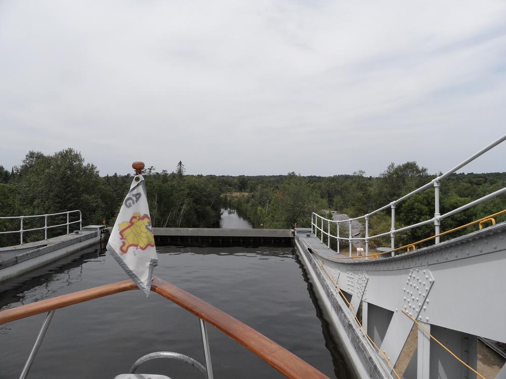
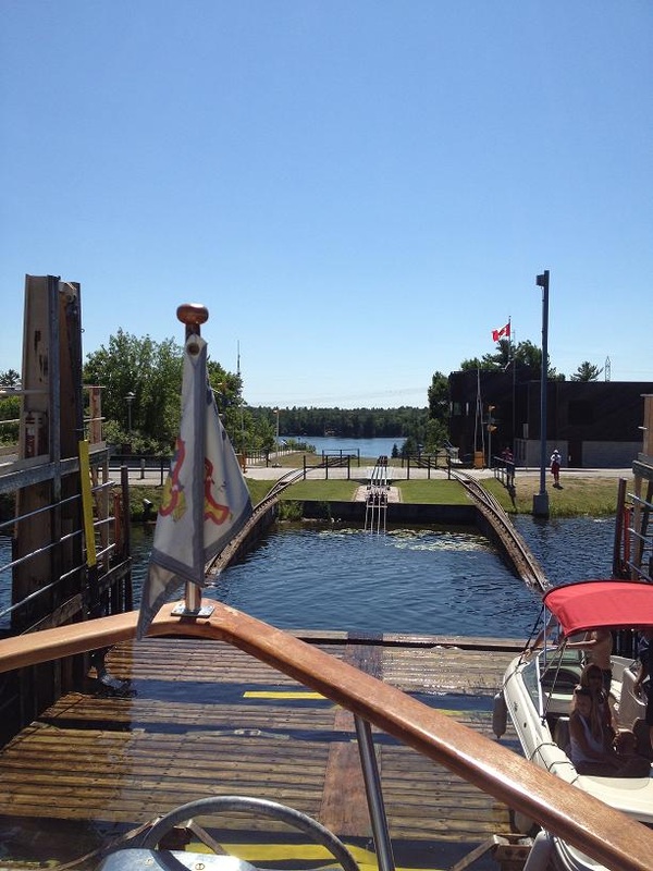
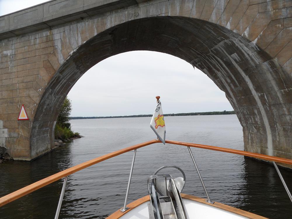
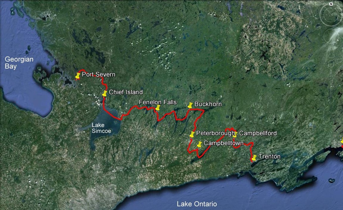 The Trent Severn starts in Trenton, Ontario and ends in Port Severn, Ontario. We covered 259 miles and 42 locks from July 13 - July 20th. Sat Jul 21st, Day 78: Port Severn to Midland on Georgian Bay. Prior to heading out into Georgian Bay, we needed to go through one more lock, #45 of the Trent-Severn and #117 of the overall trip. Unfortunately this lock was relatively small, only allowing one larger boat at a time, which meant that we would have to wait 2 hours before going through. Once through the lock, we headed across to
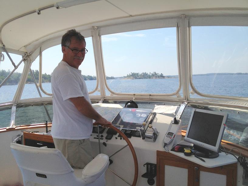
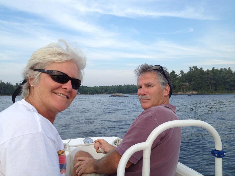
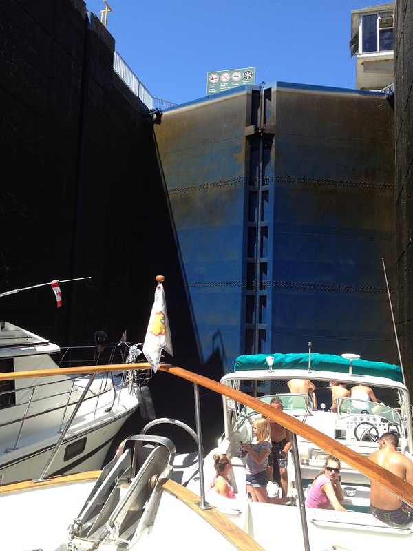
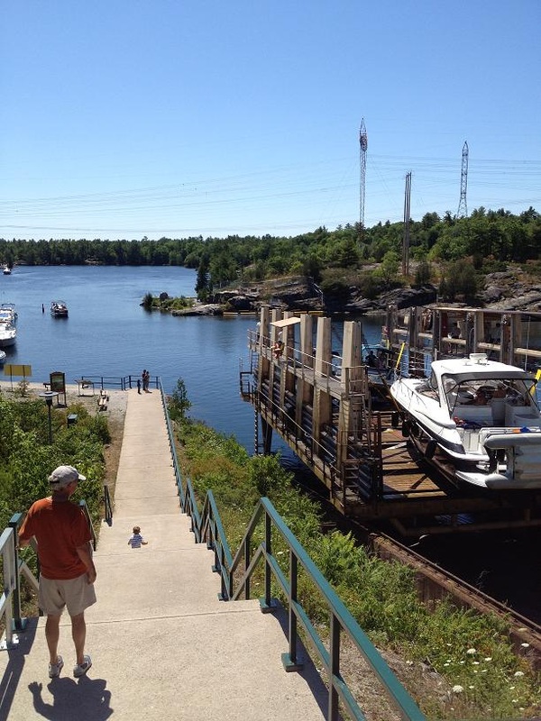
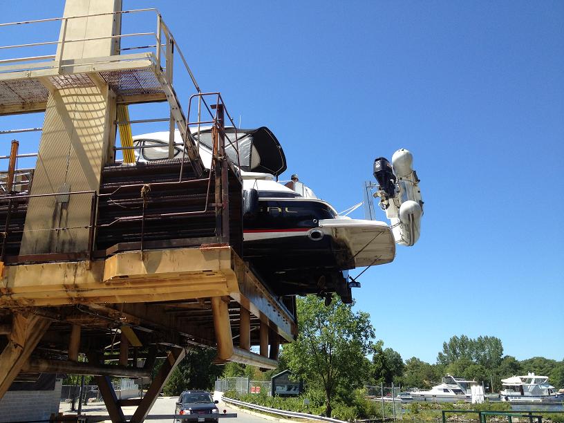
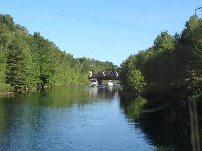
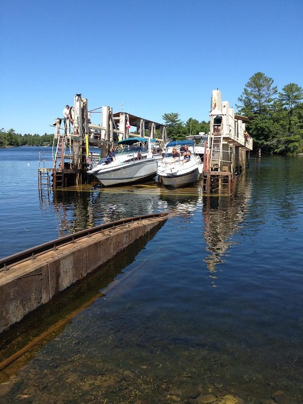
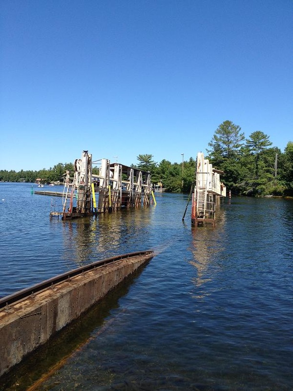
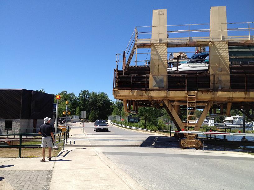
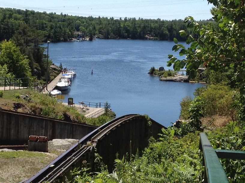
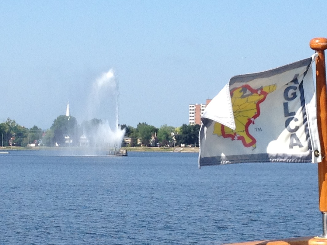
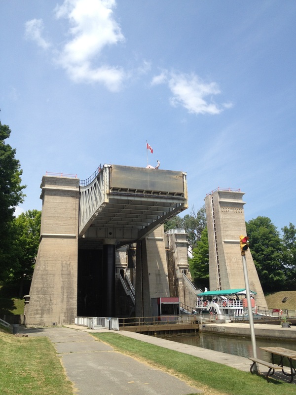
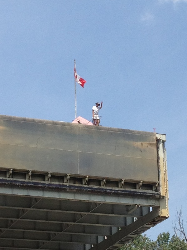
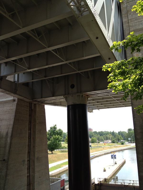
Midland, where we would wait for Al & Dawn to drive their car up to the North Channel (6 hours each way), and return via a rental car. While at the marina in Midland, I decided to take advantage of being near a boat service yard, and have Rickshaw pulled out of the water to check the props. As the Big Chute operator had reported, the port prop was several dings, so we opted to put a spare pair of props that we had on board on the shafts, and have the damaged ones repaired somewhere down the road. After the switch of the props was completed, we were splashed back into the marina, and moved back to our slip. We were pleasantly surprised to find another couple of loopers from York River, Mike & Kathy on Queen Kathleen, in the marina, so we invited them to have appetizers, drinks and dinner with us and Al & Dawn, on our aft deck, where we enjoyed conversation about shared experiences along the loop. Fri July 20th, Day 77: Chief Island to Port Severn – Today was to be our final day on the Trent-Severn, and one of the more interesting ones. After pulling up our anchor, we headed down the canal, and approached a railroad bridge which was, as luck would have it, was down due to the train crossing it. After 10 minutes, that train passed, and then we were told by the railroad worker on the trestle, that it would remain down to allow another train to pass. After about 30 more minutes, the 2nd train had gone by, and we were allowed to proceed. Standing in the same spot in the middle of a narrow river, with several other boats, was somewhat challenging. We had ahead of us another lift-lock, the Kirkfield lift lock, which happens to be the 2nd highest in the world, just after the Peterborough Lift Lock. Since we had now passed over the summit of the canal, all of the locks from this point forward were to move us lower in elevation. So we were going to get to experience a drop, instead of a lift, on one of these locks. Peering over the front of the lock as it dropped us down gave us a different perspective of this type of lock. Further down the canal we also needed to traverse the famous Big Chute, which is actually a combination of boat slings on a submerged railroad car, that picks up boats into the slings, out of the water, and carries them over a road, and then slides down a relatively steep hill dropping them on the other side. Before taking our turn on the Big Chute, we parked Rickshaw off to the side, and walked up to the canal to watch other boats going through. After gaining a better understanding of what to expect, we returned to Rickshaw and moved to the blue line on the dock, which would tell the operators that we were in line to be carried up and over. After several minutes, we heard our boat being called over the PA system to proceed forward into the carriage, where the lock workers expertly positioned the slings fore & aft, picked us up out of the water, then pushed the levers forward to start the train wheels and cables up and over the hill and down the back side. While out of the water, Jim asked one of the workers to check out my props for any signs of dings or dents due to the bumps along the way. He reported that the port prop did have a few dings on it, which I had suspected might be true because I had felt a slight vibration on that side of the boat. After being dropped into the lower basin, we proceeded the final few miles to the end of the Trent-Severn, Port Severn on the eastern shore of Georgian Bay. In Port Severn, we celebrated our completion of this part of our journey by pulling into an upscale resort marina, where we met up with Carl & Rickie on Quest (which we had met originally in York River) and were surprised by the early arrival of Al & Dawn, who were to stay with us throughout our exploration of Georgian Bay & the North Channel for the next 2 weeks. Since Al & Dawn had done the loop from New York to Florida last year on their 39ft sailboat, we welcomed their arrival and their help during the upcoming section of the trip.
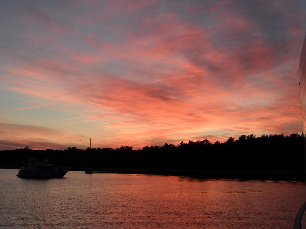
Thu July 19th, Day 76: Fenelon Falls to Chief’s Island – We left Fenelon Falls about 9am and headed toward Lake Simcoe, the largest lake in the region, which has the reputation for being especially nasty, with the potential of large 6ft waves in moderate winds, especially if blowing out of the west. For the last several days, the weather pattern had been calm winds in the morning, with stronger winds in the afternoon, then dying down in the evening hours. So even though stopping short of Lake Simcoe would put us slightly off of our rough planned schedule, we were expecting to end the day just before Lake Simcoe, monitor the weather carefully, and traverse the 15 miles across the lake early Friday. We continued across more lakes and through narrow, rock-lined streams, and passed through the “hole in the wall” bridge, which was a semi-circular opening in a rock bridge between 2 sections of one of the lakes. At 3pm, we were just before Lake Simcoe, with very slight winds coming out of the east, and so we entered Lake Simcoe, along with Wind Song, and proceeded for the next 2 hours across the lake. We entered the Severn River at the north side of Lake Simcoe about 4:15, and pushed ahead towards our destination, an anchorage off of Chief’s Island, where we were treated to a fantastic coral-colored sunset.
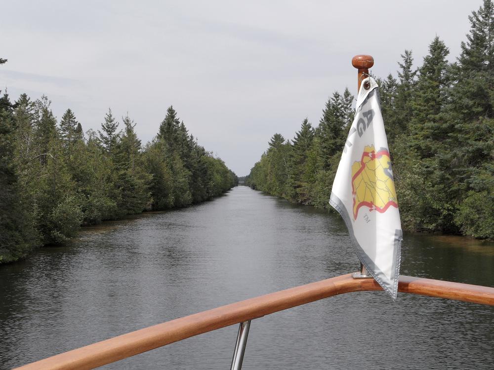
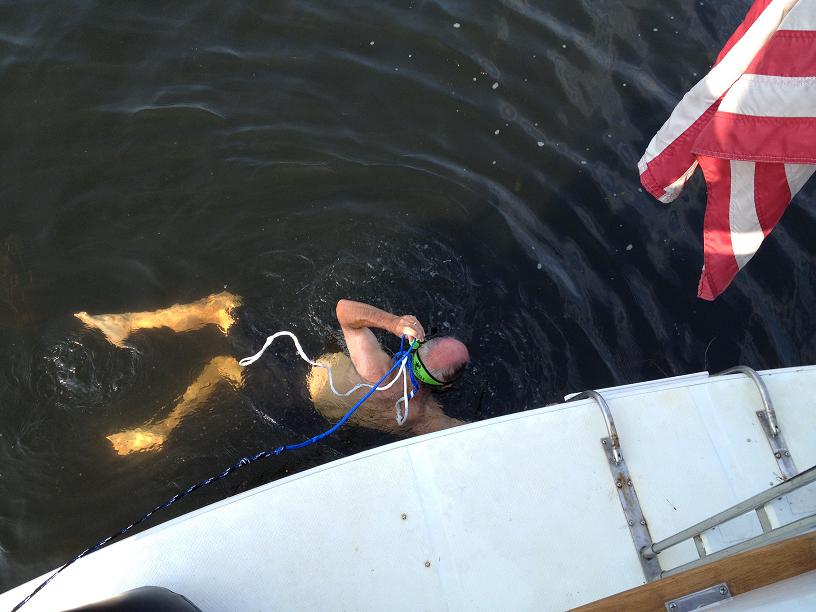
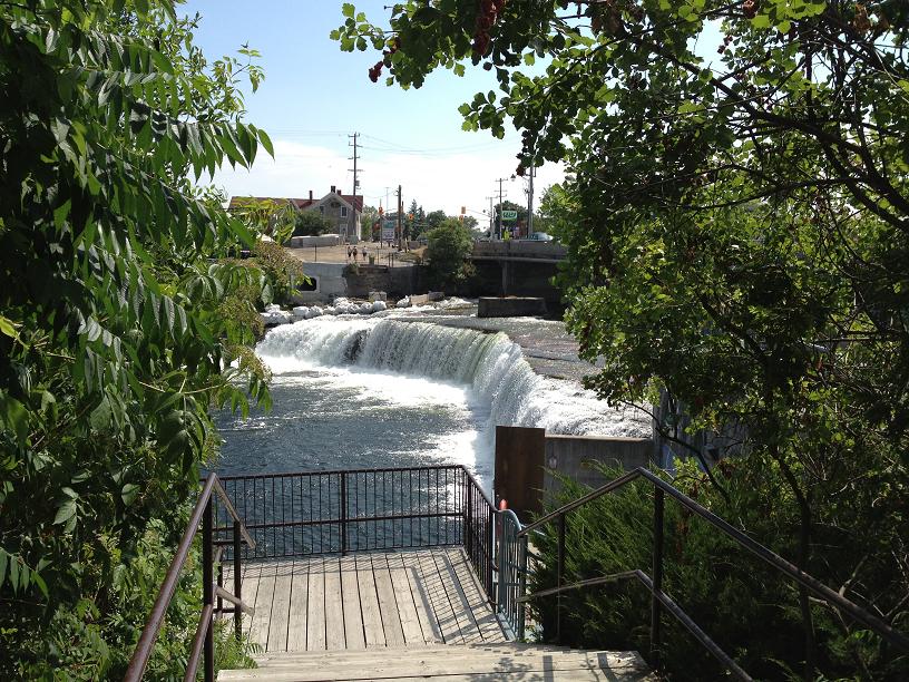
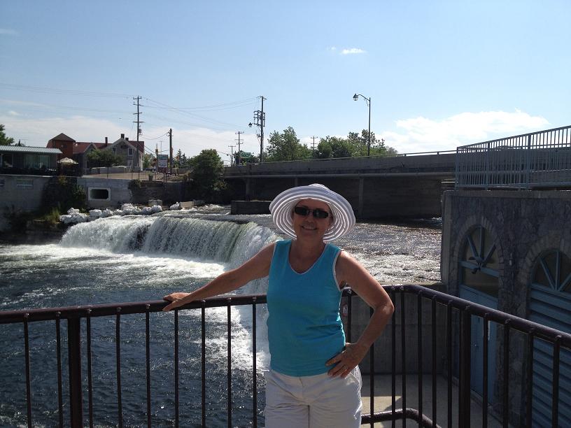
Wed, July 18th– Day 75: Buckhorn to Fenelon Falls – We left Buckhorn early on Wednesday, wanting to make a mid-day stop at the resort town of Bobcaygeon. In almost anybody else’s blogs about the Trent-Severn, or any of the cruising guides for the canal, there is a mention about the fabulous shoe store in Bobcaygeon, so that was, for sure, something that we (or at least, Belinda) needed to see. So we pulled into Bobcaygeon about 11 am, jumped off the boat, and meandered around the town for a couple of hours, visited the obligatory shoe store, ate lunch at Subway, and then, returned to Rickshaw, and departed for our final destination of Fenelon Falls, another quaint village. This part of the Trent-Severn is also renowned for the extreme weediness and shallowness of the lakes, which were made worse by the relatively mild and dry winter. Mid-way across one of the lakes, I (Jim) started having trouble pushing Rickshaw through what felt like pudding, so, instead of trying to continue our journey with props and propshafts wrapped with weeds, dropped our anchor in the middle of the lake, and jumped into the brisk water to inspect the props and clean the vegetation off of the bottom of the props. After about 45 minutes, we were back on our way. At this point, the rivers were no longer skirted by marshlands, and started transitioning into pine and cedar tree lined streams, with tall granite rocks lining very narrow channels between the many lakes. At times, the channels were so narrow that we were advised to broadcast a security message over the VHF radio prior to entering a narrow channel to notify any oncoming boats of our presence in the channel, because there was barely enough, if at all, room for 2 boats to pass each other in the channel. At one point, in the middle of the navigation, we struck something hard on the bottom, which we had done several times before. We ended the day at Fenelon Falls, so named because of the waterfall that is formed with the water coming through the dam next to the Fenelon Falls lock, where we met & visited with other loopers, Jerry & Janet from Kansas on Wind Song, a 42 ft Carver.
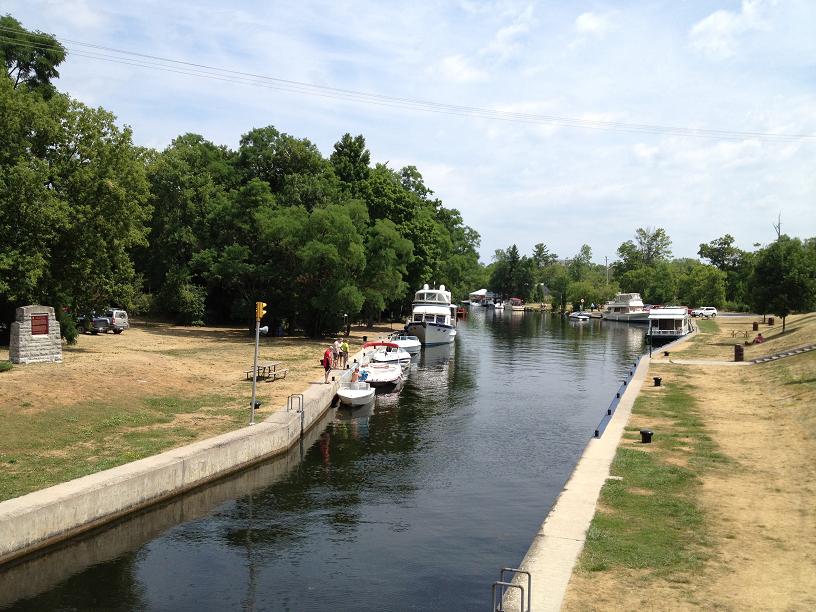
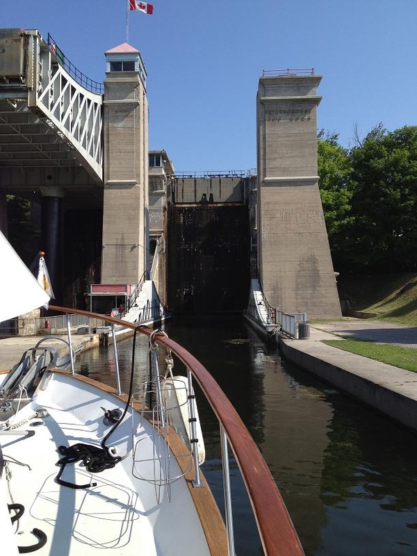
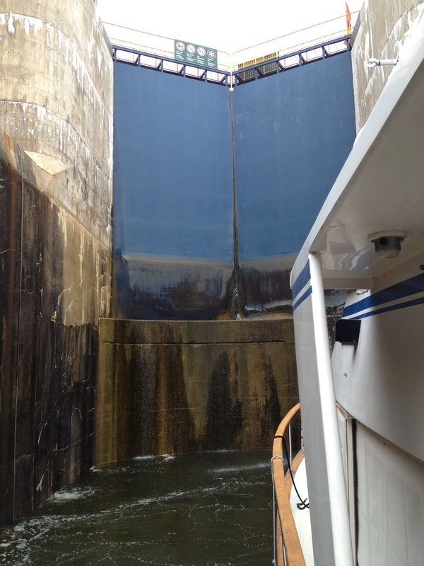
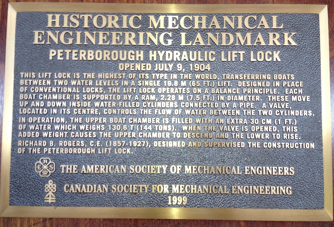
Tue July 17th – Peterborough to Buckhorn: Today was the day for us to have our turn going up the giant Peterborough lift lock. At first glance, the lock appears to be very intimidating due to its massive structure and vertical lift height, but, for us anyway, a closer inspection made it apparent that since we weren’t going to be pushed sideways or back & forth in the lock chamber by massive amounts of rushing water, like other locks, that the ride up from the lower river to the upper river should be very calm, requiring only minimal effort to hold Rickshaw steady once in the chamber. So, after making our way through a “normal” lock just after our marina and preceding the lift lock, we approached the lift lock with much anticipation and confidence that it would be a “piece of cake”, which it was. After being lifted up the nearly 70 feet to the upper river, the gate at the end of the chamber dropped allowing us to proceed further up the canal. We were now in the section of the canal called the Kawartha Region, which is a series of lakes (Clear, Stony, Buckhorn, Pigeon and Cameron Lakes) connected by rivers through marsh and forests. This area is a very popular summer vacation destination, evidenced by a lot of cottages, skiboats, rental houseboats, resort towns and small villages that we passed along the way. Since we had so far been in mostly rural and remote scenery in the Trent-Severn, we were looking forward to visiting a few of these quaint villages. In order to keep up our pace of roughly 30 miles each day, our “hoped-for” destination for the day was the small town of Buckhorn, which was 28 miles up the canal from Peterborough. By 3pm, we had made it as far as Lovesick island and lock, which was 6 miles prior to Buckhorn, and considered stopping there due to the weather forecast for the late afternoon…high winds with gusts up to 35 mph, which we would have to deal with as we crossed one of the larger lakes in the region, the Lower Buckhorn. The lockmaster at the Lovesick lock told us that he had heard that the gusts were up to as much as 60mph, but so far we had experienced gusts that we estimated were more in line with the forecasted wind strength in the mid-30s range. With a slight amount of hubris and confidence in the capabilities of our boat, we decided to push the remaining 6 miles across Lower Buckhorn, which we did, wondering the whole time if we had made the wrong decision, because we were buffeted by the heavy winds all the way across the lake. After an hour,we arrived in the town of Buckhorn, and stopped along the lock wall just above the lock. We treated ourselves to a dinner out that night at a small restaurant, opting to sit outside on the deck overlooking the lake and canal.
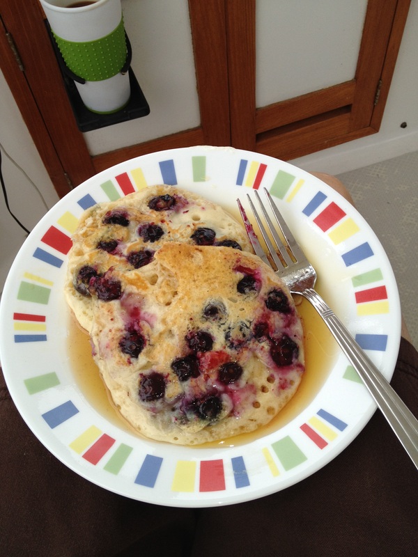
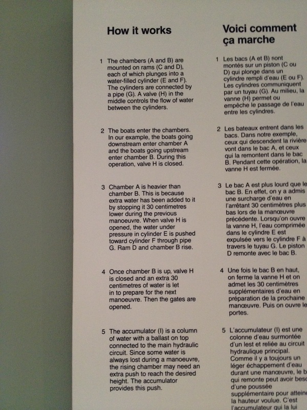
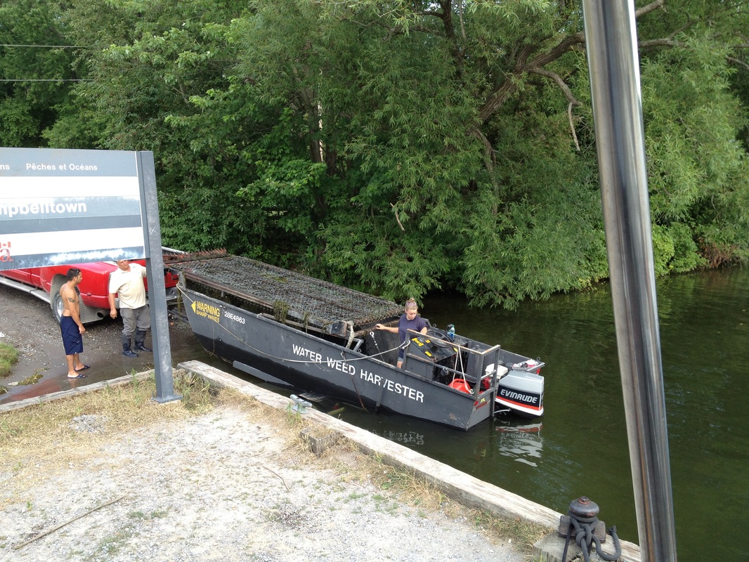
Sat – July 14th, Day 71: We departed from the Trenton Marina and motored north under the bridge across the canal, welcoming us to the Trent-Severn aterway system. Ahead of us, between Trenton and Port Severn, on Georgian Bay, lay 44 locks, of which we expected to have to pass through 13 today. With the smaller, Belinda-sized docklines, locking seemed to go much smoother. Our heavy boat even managed to stress test some of the cables on the lock walls, pulling 2 of them out of the wall with just a moderate amount of effort. The Canadian locks, especially on the Trent-Severn, seem to be past due for preventative maintenance. Our destination for the day was Campbellford, approximately 30 miles up the canal. We had “budgeted” 8 days to do the 240 miles of the waterway, so we hope to average about 30 miles each day. By late afternoon, we entered lock #13, were lifted 23 feet and parked for the night at the top of the lock at the free wall, courtesy of Parks Canada. Sun – July 15th, Day 72: Today’s “stretch goal” destination was Peterborough, one of the larger cities in southern Ontario, approximately 58 miles up the canal. We only had to do 5 locks today, so making time was a bit easier. While underway, Belinda surprised me with a large stack of homemade blueberry pancakes, made with the fresh blueberries bought at the farmer’s market in Trenton. Twenty of the miles were going across a relatively large lake, Rice Lake, which was of some concern to us because the weather forecast called for a 40% chance of severe thunderstorms. Since today was Sunday, the lake was busy with water skiers, wave runners, and fishing boats enjoying the summer warmth. As we approached the river that was to be our exit off of the lake, we received a severe weather report over the VHF, warning of squalls forming over Lake Ontario & Lake Erie (just south of us) that could have heavy rains and strong winds. So, instead of pushing to Petersborough, we opted to end our day at Campbellton (not to be confused with Campbellford). Our berth for the night was a somewhat rundown municipal dock, where we watched an underwater mower, chopping weeds and vegetation off of the bottom in front of the summer cottages that lined the bank, and then depositing the cuttings in more remote parts of the river. The undergrowth is so thick in some places, the “water weed harvester” must have a brisk business. Mon – July 16th, Day 73: We had a short day today, just going 18 miles, and through 1 lock, in order to spend almost a full day in Peterborough. We left Campbellton about 7:45 and were pulling into Peterborough about 10. Instead of staying at a free dock (where we don’t have shore power), we treated ourselves to a stay in the local marina, which was very close to the main city center, making a trip to the marine supply store and grocery store very convenient. After lunch, we unfolded our bikes on the aft deck, lowered them to the docks, and pedaled 5 miles to preview the infamous Peterborough Lift Lock, which we would have to go through tomorrow. The lock is famous, since it is the highest lift lock in the world, lifting (or lowering) boats 65 feet via a pair of giant, water-filled chambers, like a giant see-saw counter-balanced by adjusting the weight to make the upper chamber heavier than the lower. The see-saw effect is activated by adding an additional foot of water into the upper chamber, which adds 144 tons of weight to the top chamber, and pushes it down and forcing the lower chamber up.
| Cruising Areas
All ArchivesSeptember 2013 |

 RSS Feed