Sun Jul 22, Day 79: Anchored Across from Frying Pan Bay
Mon 7/23, Day 80: Anchored east of Ruddy Island
Tues 7/24, Day 81: Anchored in Kilcoursie Bay
Wed 7/25, Day 82: Anchored in Shawanaga Island
Thu 7/26, Day 83: Bing Inlet
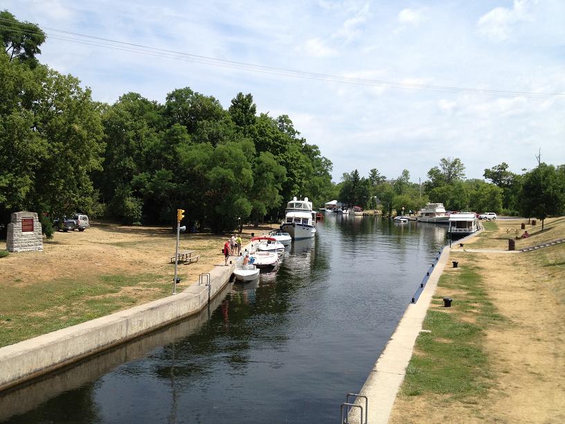
For the next several days, we’re travelling through the region known as the 30,000 islands, even though there are reportedly a lot more islands than 30,000 in this part of Georgian Bay. Navigating through this massive archipelago is a definite challenge, because it is very difficult to really know which islands we’re near without keeping close tracks all along the way of where we are, especially since our electronic charts don’t cover most of this area. So, we navigate by using paper charts and plotting our latitude & longitude along the way. We’ve spent every night at remote anchorages with names like Frying Pan Bay, Kilcoursie
& Shawanaga with crystal clear aquamarine waters surrounded by beaches or granite boulder-lined shores. On Tuesday, 7/24, we met up with our friends, Joe & Tara from Atlanta on Seabatical, whom we met last year in Norfolk, at the AGLCA rendezvous, and have kept in contact with ever since, waiting for this year when we, including Al & Dawn, could meet up with them on the Great Loop. While anchored off of Shawanaga, the 6 of us took an exploratory cruise among the boulder islands and outcroppings in Ricky-Dink (our dinghy) prior to a delicious dinner prepared by Tara. We’re slowly working our way northwest up the eastern shore of Georgian Bay, heading toward the upper shores of Lake Huron, called the North Channel, which is considered to be the most beautiful part of the entire loop. On Thursday, we headed into Wright’s Marina in Britt to get connected to the internet (so we could, among other tasks, get caught up on posting to our blog).
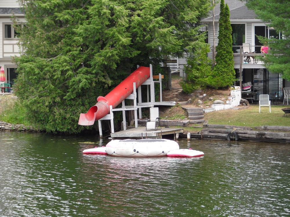 Great slide! 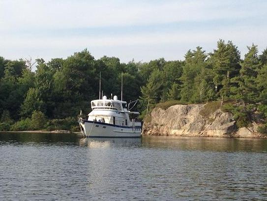 Rickshaw in the first anchorage in Georgian Bay - across from Frying Pan Bay. 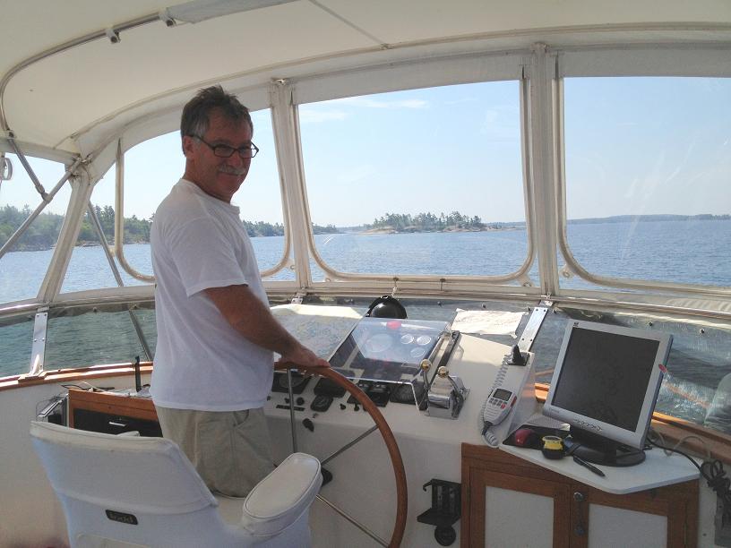 Al at the helm. They own a sail boat so driving a twin engine cruiser is a new experience for him. 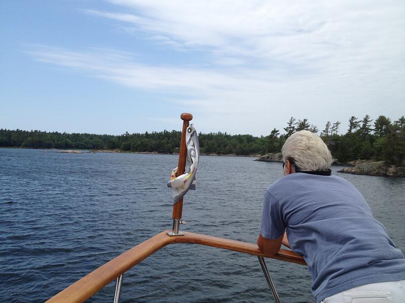 Dawn on rock watch! 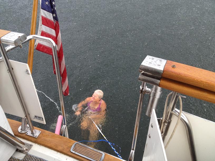 We went out for a swim one afternoon but shortly after we jumped in it started to rain really hard. Everyone but Dawn climbed out. The sun was out again within minutes so after rushing to close all the doors and hatches we jumped back in. 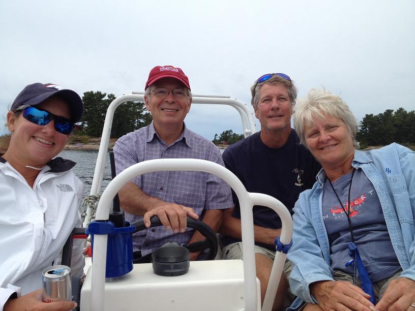 Tara, Jim, Joe and Dawn on Ricky-Dink. 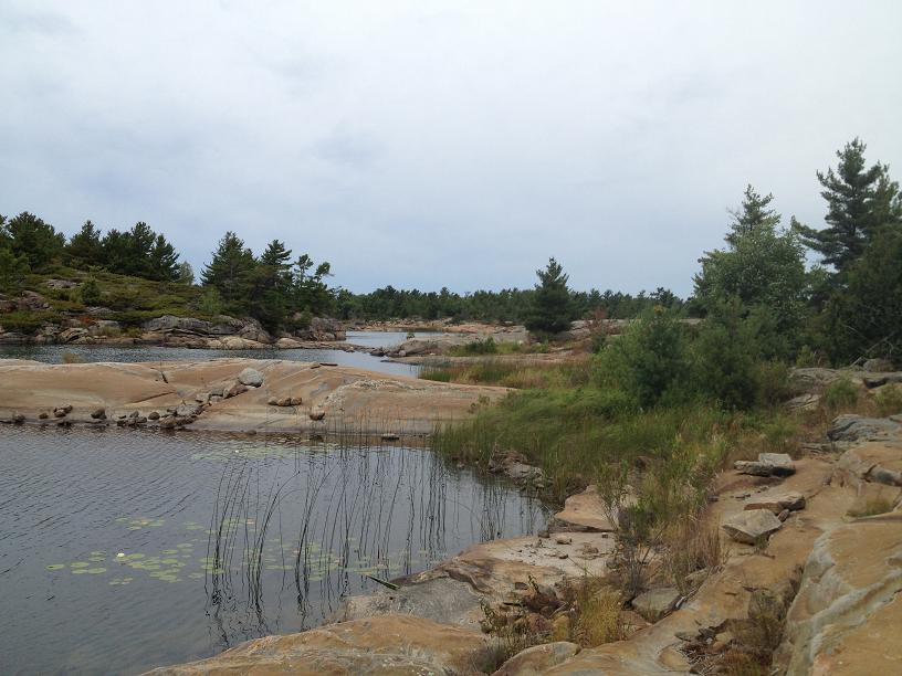 Joe claimed this island so it now Parker Island! 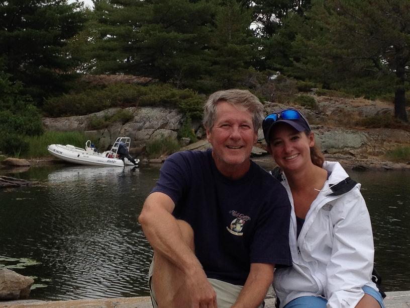 Joe and Tara 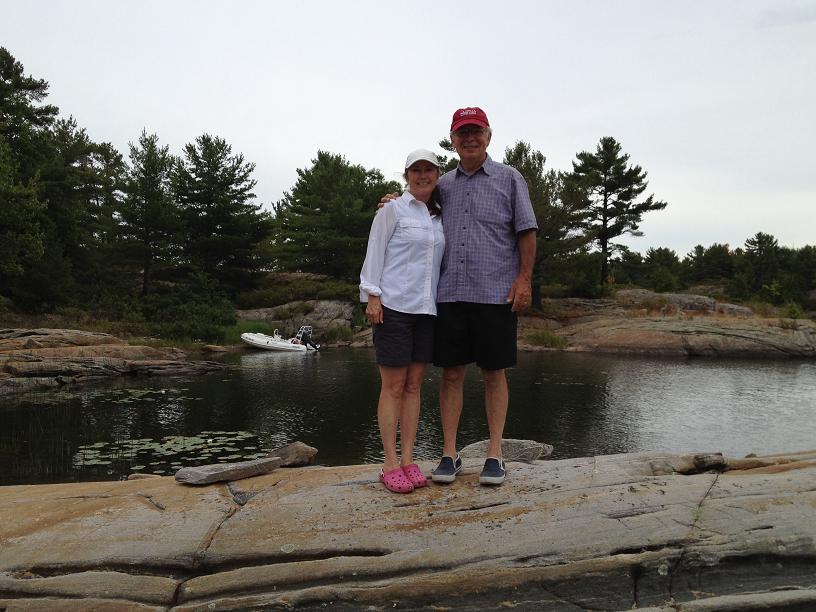 Jim and Belinda enjoying 'Parker Island' with our friends. 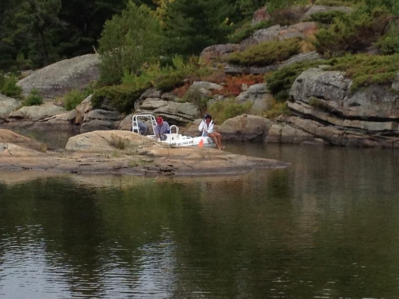 To keep Ricky-Dink light and shallow only Jim and Tara brought her though the cut. At one point Jim had to raise the motor and Tara paddled past the shallow area. 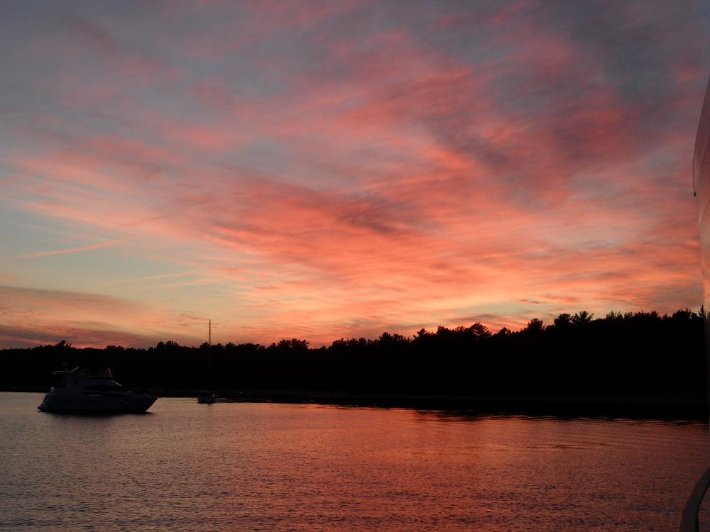 Seabatical at sunset. | 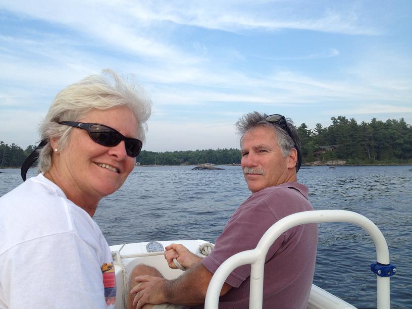 Dawn and Al with us on a Ricky Dink ride. 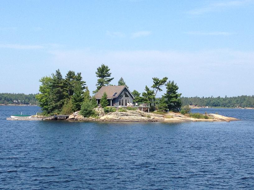 Another beautiful house on another beautiful island!  Here is one of those 'rocks awash' that can ruin your day if you hit it with your props or keel. 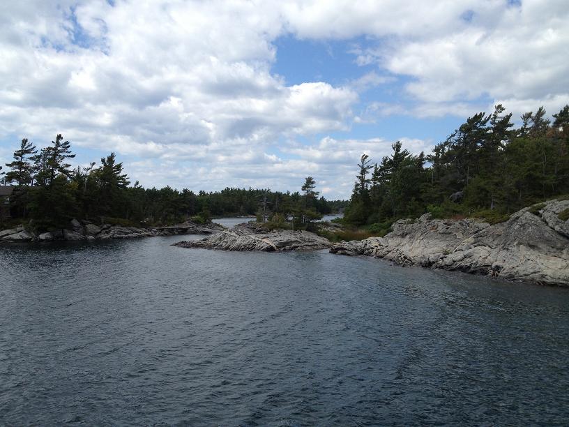 Some of the 30,000 islands in the area.  Rickshaw (left) and Seabatical. 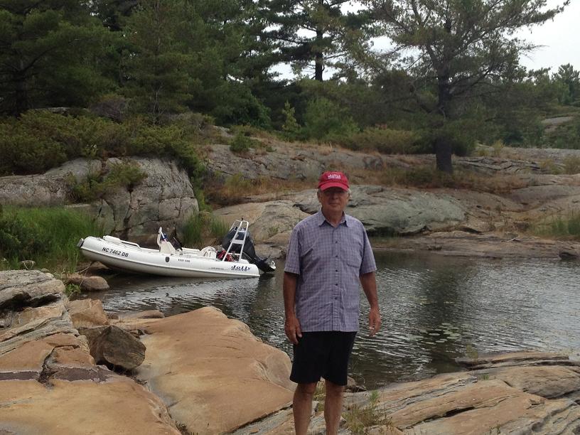 We beached Ricky-Dink to explore an island - one down 29,999 more to go. 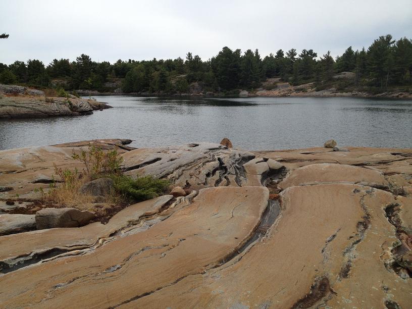 The rock formations are very interesting. 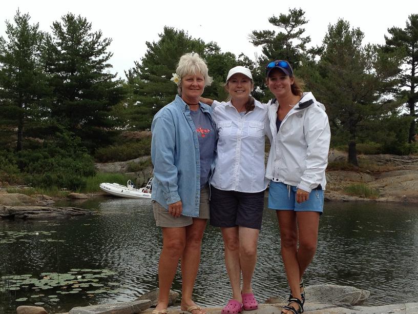 My cruising girlfriends - Dawn (left) and Tara (right). 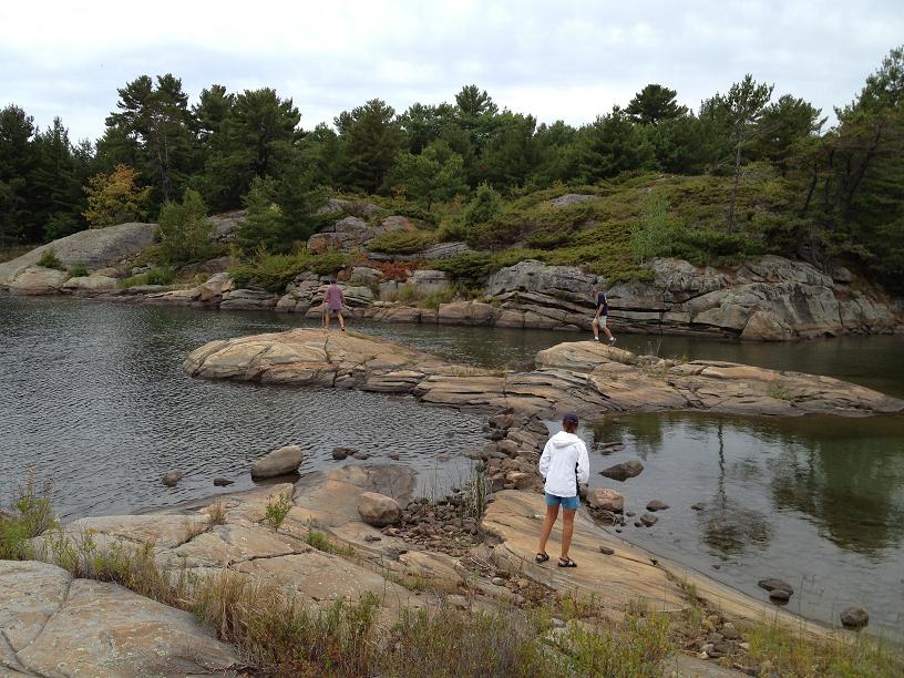 Joe, Al and Tara exploring a cut in the rocks to see if we can bring Ricky-Dink through so we can continue our exploration. 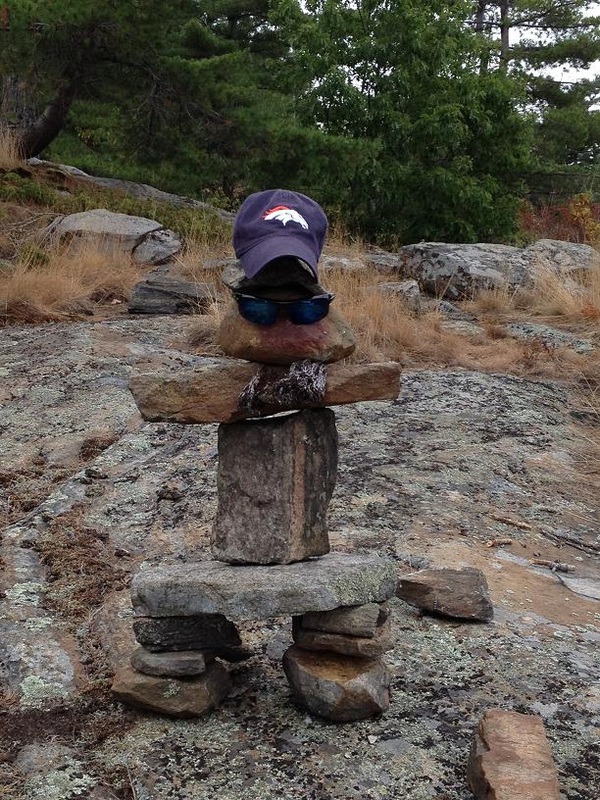 We left our mark for future explorers. |
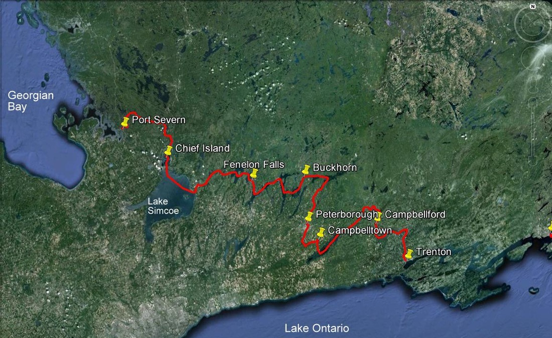 The Trent Severn starts in Trenton, Ontario and ends in Port Severn, Ontario. We covered 259 miles and 42 locks from July 13 - July 20th.
Sat Jul 21st, Day 78: Port Severn to Midland on Georgian Bay. Prior to heading out into Georgian Bay, we needed to go through one more lock, #45 of the Trent-Severn and #117 of the overall trip. Unfortunately this lock was relatively small, only allowing one larger boat at a time, which meant that we would have to wait 2 hours before going through. Once through the lock, we headed across to
Midland, where we would wait for Al & Dawn to drive their car up to the North Channel (6 hours each way), and return via a rental car. While at the marina in Midland, I decided to take advantage of being near a boat service yard, and have Rickshaw pulled out of the water to check the props. As the Big Chute operator
had reported, the port prop was several dings, so we opted to put a spare pair of props that we had on board on the shafts, and have the damaged ones repaired somewhere down the road. After the switch of the props was completed, we were splashed back into the marina, and moved back to our slip. We were pleasantly surprised to find another couple of loopers from York River, Mike & Kathy on Queen Kathleen, in the marina, so we invited them to have appetizers, drinks and dinner with us and Al & Dawn, on our aft deck, where we enjoyed conversation about shared experiences along the loop.
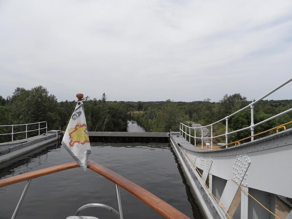
Fri July 20th, Day 77: Chief Island to Port Severn – Today was to be our final day on the Trent-Severn, and one of the more interesting ones. After pulling up our anchor, we headed down the canal, and approached a railroad bridge which was, as luck would have it, was down due to the train crossing it. After 10 minutes, that train passed, and then we were told by the railroad worker on the trestle, that it would remain down to allow another train to pass. After about 30 more minutes, the 2nd train had gone by, and we were allowed to proceed. Standing in the same spot in the middle of a narrow river, with several other boats, was somewhat challenging. We had ahead of us another lift-lock, the Kirkfield lift lock, which happens to be the 2nd highest in the world, just after the Peterborough Lift Lock. Since we had now passed over the summit of the canal, all of the locks from this point forward were to move us lower in elevation. So we were going to get to experience a drop, instead of a lift, on one of these locks. Peering over the front of the lock as it dropped us down gave us a different perspective of this type of lock. Further down the canal we also needed to traverse the famous Big Chute, which is actually a combination of boat slings on a submerged railroad car, that picks up boats into the slings, out of the water, and carries them over a road, and then slides down a relatively steep hill dropping them on the other side. Before taking our turn on the Big Chute, we parked Rickshaw off to the side, and walked up to the canal to watch other boats going through. After gaining a better understanding of what to expect, we returned to Rickshaw and moved to the blue line on the dock, which would tell the operators that we were in line to be carried up and over. After several minutes, we heard our boat being called over the PA system to proceed forward into the carriage, where the lock workers expertly positioned the slings fore & aft, picked us up out of the water, then pushed the levers forward to start the train wheels and cables up and over the hill and down the back side. While out of the water, Jim asked one of the workers to check out my props for any signs of dings or dents due to the bumps along the way. He reported that the port prop did have a few dings on it, which I had suspected might be true because I had felt a slight vibration on that side of the boat. After being dropped into the lower basin, we proceeded the final few miles to the end of the Trent-Severn, Port Severn on the eastern shore of Georgian Bay. In Port Severn, we celebrated our completion of this part of our journey by pulling into an upscale resort marina, where we met up with Carl & Rickie on Quest (which we had met originally in York River) and were surprised by the early arrival of Al & Dawn, who were to stay with us throughout our exploration of Georgian Bay & the North Channel for the next 2 weeks. Since Al & Dawn had done the loop from New York to Florida last year on their 39ft sailboat, we welcomed their arrival and their help during the upcoming section of the trip. 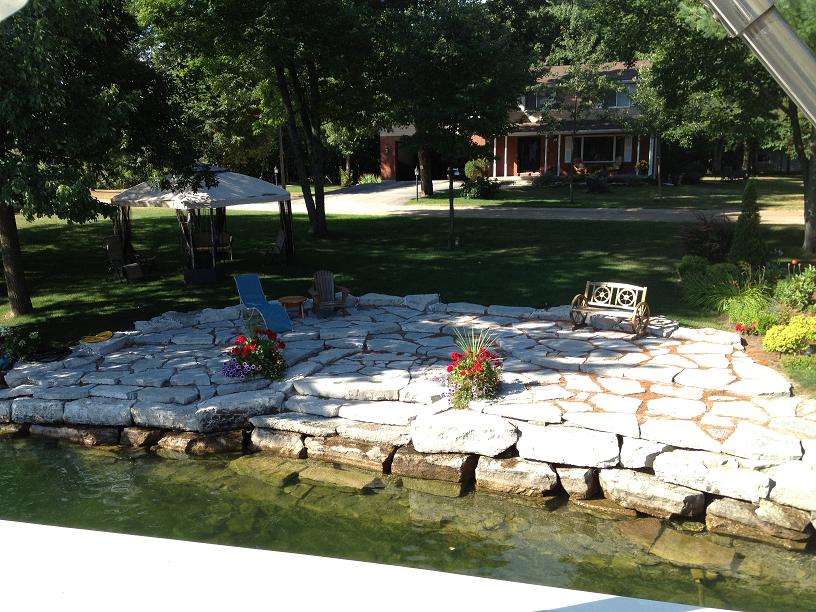 One of the very comfortable patios along the water's edge. 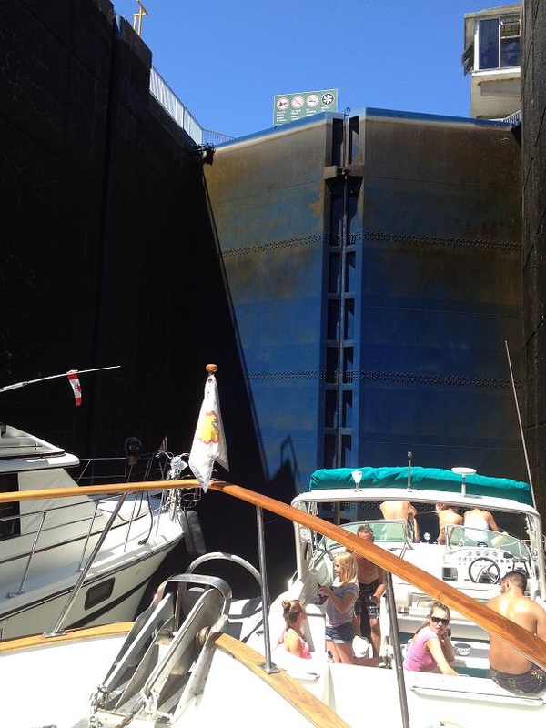 We felt like our anchor was almost in the cockpit of the boat in front of us. This was a tall lock and it was full of boats. 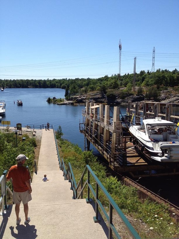 Jim watching this load of boats being lowered down the tracks. 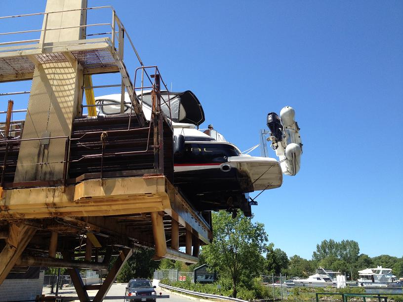 The bigger boats loaded in the rear have to hang off the carridge. | 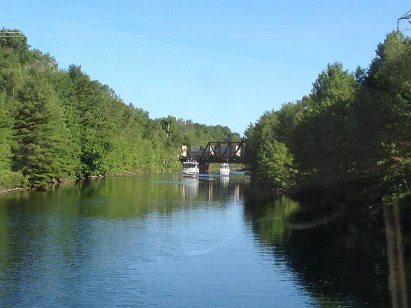 Waiting on the train so the bridge can swing open for us with Wind Song and another boat.  Another very nice patio. This one is covered with hammacks. 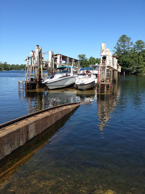 Boats have been loaded on the carridge that is on submerged tracks at this point. 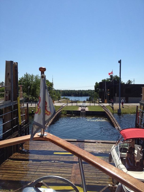 Its Rickshaw's turn to go down the Big Chute. Here we are going up the tracks to cross the street. |  A beautiful wooden boat. 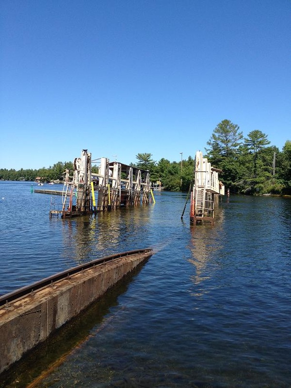 The carrage submerged before any boats are loaded. 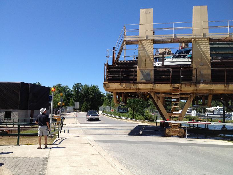 The carridge is crossing the road like a train. The crossing arms are down and traffic has been stopped. 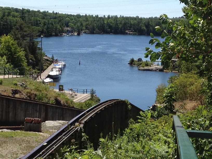 The view from Rickshaw at the top of the Big Chute. It is a little scary since we can't see the bottom. We threw up our arms and yelled Ye-ha!! 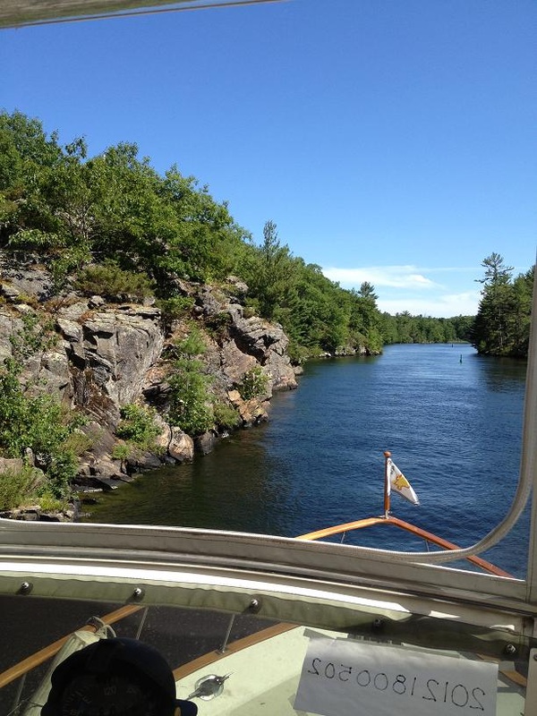 We were told to watch for rocks - we thought they just meant under the water. But here the rocks stick out the side of the canel. |
Thu July 19th, Day 76: Fenelon Falls to Chief’s Island – We left Fenelon Falls about 9am and headed toward Lake Simcoe, the largest lake in the region, which has the reputation for being especially nasty, with the potential of large 6ft waves in moderate winds, especially if blowing out of the west. For the last several days, the weather pattern had been calm winds in the morning, with stronger winds in the afternoon, then dying down in the evening hours. So even though stopping short of Lake Simcoe would put us slightly off of our rough planned schedule, we were expecting to end the day just before Lake Simcoe, monitor the weather carefully, and traverse the 15 miles across the lake early Friday. We continued across more lakes and through narrow, rock-lined streams, and passed through the “hole in the wall” bridge, which was a semi-circular opening in a rock bridge between 2 sections of one of the lakes. At 3pm, we were just before Lake Simcoe, with very slight winds coming out of the east, and so we entered Lake Simcoe, along with Wind Song, and proceeded for the next 2 hours across the lake. We entered the Severn River at the north side of Lake Simcoe about 4:15, and pushed ahead towards our destination, an anchorage off of Chief’s Island, where we were treated to a fantastic coral-colored sunset.  Approaching the Hole in the Wall Bridge. 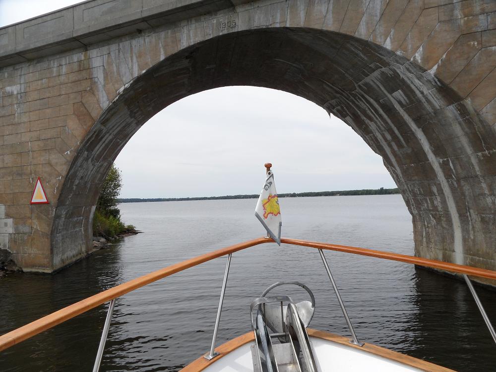 Going through the Hole in the Wall. | 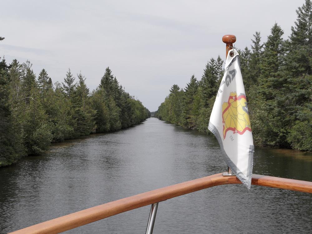 We called this Christmas Tree Lane Canal. I'm sure is is beautiful in the winter with the snow. It is probably freezes over and it is a long ice rink! 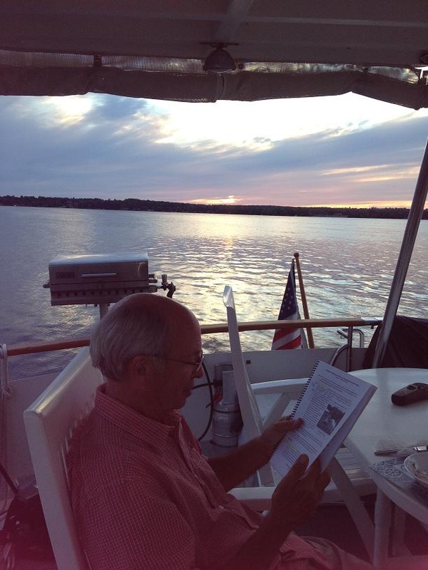 Jim studying the cruising guide for tomorrow. |
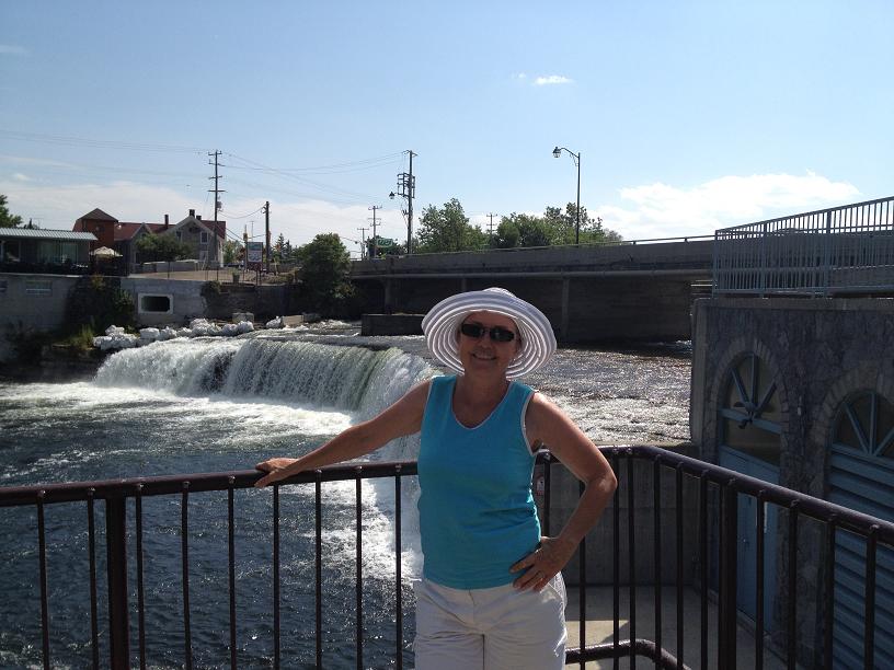
Wed, July 18th– Day 75: Buckhorn to Fenelon Falls – We left Buckhorn early on Wednesday, wanting to make a mid-day stop at the resort town of Bobcaygeon. In almost anybody else’s blogs about the Trent-Severn, or any of the cruising guides for the canal, there is a mention about the fabulous shoe store in Bobcaygeon, so that was, for sure, something that we (or at least, Belinda) needed to see. So we pulled into Bobcaygeon about 11 am, jumped off the boat, and meandered around the town for a couple of hours, visited the obligatory shoe store, ate lunch at Subway, and then, returned to Rickshaw, and departed for our final destination of Fenelon Falls, another quaint village. This part of the Trent-Severn is also renowned for the extreme weediness and shallowness of the lakes, which were made worse by the relatively mild and dry winter. Mid-way across one of the lakes, I (Jim) started having trouble pushing Rickshaw through what felt like pudding, so, instead of trying to continue our journey with props and propshafts wrapped with weeds, dropped our anchor in the middle of the lake, and jumped into the brisk water to inspect the props and clean the vegetation off of the bottom of the props. After about 45 minutes, we were back on our way. At this point, the rivers were no longer skirted by marshlands, and started transitioning into pine and cedar tree lined streams, with tall granite rocks lining very narrow channels between the many lakes. At times, the channels were so narrow that we were advised to broadcast a security message over the VHF radio prior to entering a narrow channel to notify any oncoming boats of our presence in the channel, because there was barely enough, if at all, room for 2 boats to pass each other in the channel. At one point, in the middle of the navigation, we struck something hard on the bottom, which we had done several times before. We ended the day at Fenelon Falls, so named because of the waterfall that is formed with the water coming through the dam next to the Fenelon Falls lock, where we met & visited with other loopers, Jerry & Janet from Kansas on Wind Song, a 42 ft Carver.
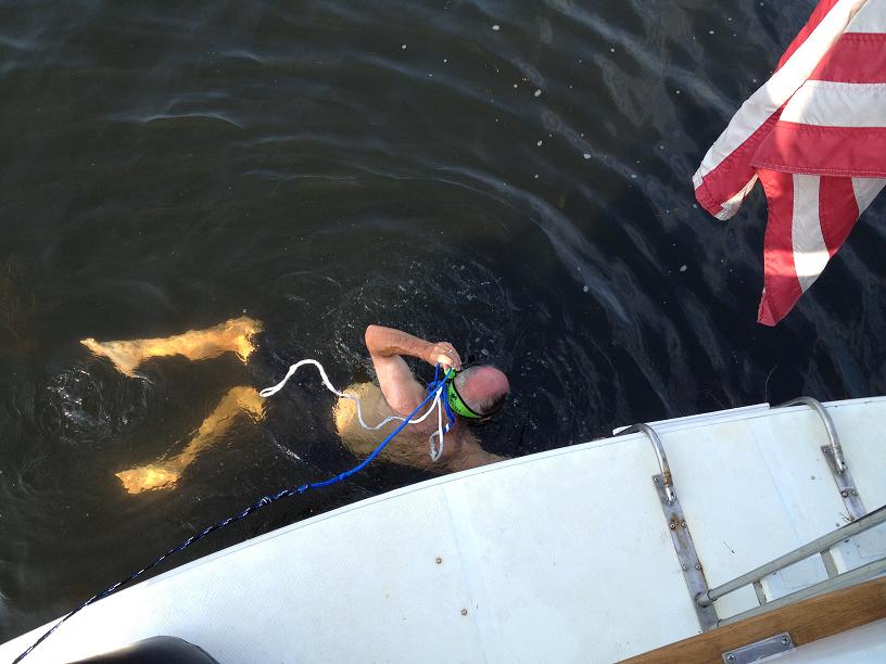
Jim - checking the props for weeds and dings
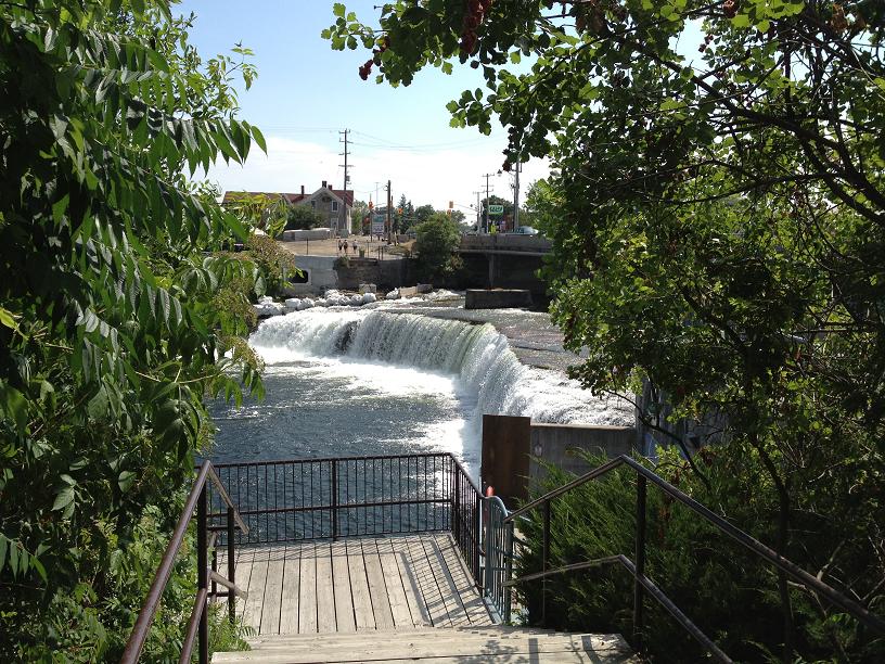
Fenelon Falls
|
Rickshaw - is the big kid on the block. This is at Bobcageon
Belinda - a quick stop at the falls before going to THE shoe store!
|
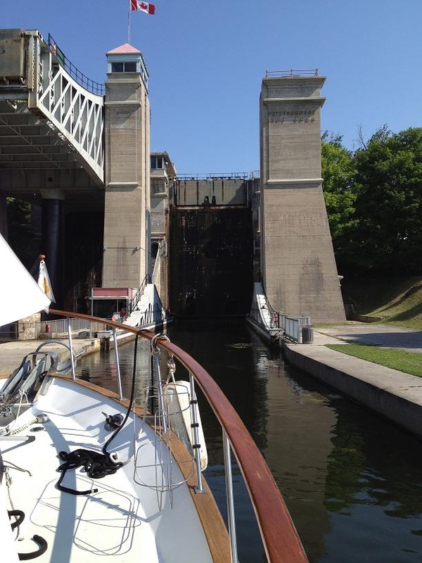
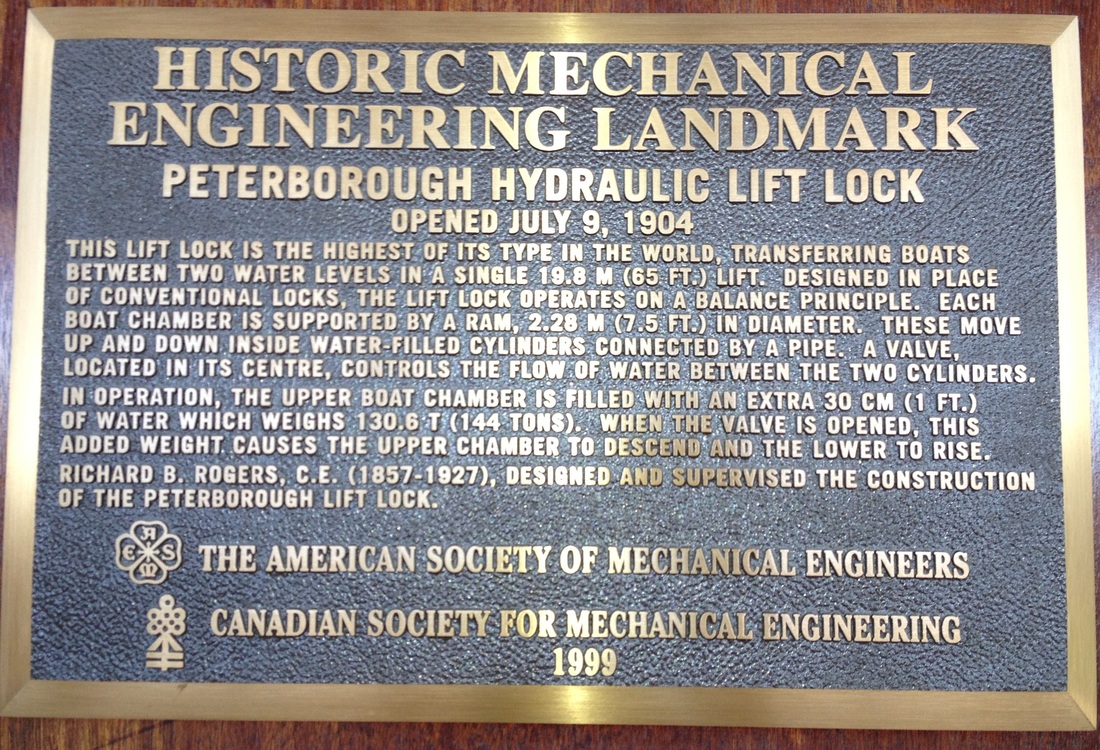
Tue July 17th – Peterborough to Buckhorn: Today was the day for us to have our turn going up the giant Peterborough lift lock. At first glance, the lock appears to be very intimidating due to its massive structure and vertical lift height, but, for us anyway, a closer inspection made it apparent that since we weren’t going to be pushed sideways or back & forth in the lock chamber by massive amounts of rushing water, like other locks, that the ride up from the lower river to the upper river should be very calm, requiring only minimal effort to hold Rickshaw steady once in the chamber. So, after making our way through a “normal” lock just after our marina and preceding the lift lock, we approached the lift lock with much anticipation and confidence that it would be a “piece of cake”, which it was. After being lifted up the nearly 70 feet to the upper river, the gate at the end of the chamber dropped allowing us to proceed further up the canal. We were now in the section of the canal called the Kawartha Region, which is a series of lakes (Clear, Stony, Buckhorn, Pigeon and Cameron Lakes) connected by rivers through marsh and forests. This area is a very popular summer vacation destination, evidenced by a lot of cottages, skiboats, rental houseboats, resort towns and small villages that we passed along the way. Since we had so far been in mostly rural and remote scenery in the Trent-Severn, we were looking forward to visiting a few of these quaint villages. In order to keep up our pace of roughly 30 miles each day, our “hoped-for” destination for the day was the small town of Buckhorn, which was 28 miles up the canal from Peterborough. By 3pm, we had
made it as far as Lovesick island and lock, which was 6 miles prior to Buckhorn, and considered stopping there due to the weather forecast for the late afternoon…high winds with gusts up to 35 mph, which we would have to deal with as we crossed one of the larger lakes in the region, the Lower Buckhorn. The lockmaster at the Lovesick lock told us that he had heard that the gusts were up to as much as 60mph, but so far we had experienced gusts that we estimated were more in line with the forecasted wind strength in the mid-30s range. With a slight amount of hubris and confidence in the capabilities of our boat, we decided to push the remaining 6 miles across Lower Buckhorn, which we did, wondering the whole time if we had made the wrong decision, because we were buffeted by the heavy winds all the way across the lake. After an hour,we arrived in the town of Buckhorn, and stopped along the lock wall just above the lock. We treated ourselves to a dinner out that night at a small restaurant, opting to sit
outside on the deck overlooking the lake and canal.
Rickshaw entering the lower chamber on the Peterborough Lock.
|
Some beautiful nature -
|
Sat – July 14th, Day 71: We departed from the Trenton Marina and motored north under the bridge across the canal, welcoming us to the Trent-Severn aterway system. Ahead of us, between Trenton and Port Severn, on Georgian Bay, lay 44 locks, of which we expected to have to pass through 13 today. With the smaller, Belinda-sized docklines, locking seemed to go much smoother. Our heavy boat even managed to stress test some of the cables on the lock walls, pulling 2 of them out of the wall with just a moderate amount of effort. The Canadian locks, especially on the Trent-Severn, seem to be past due for preventative maintenance. Our destination for the day was Campbellford, approximately 30 miles up the canal. We had “budgeted” 8 days to do the 240 miles of the waterway, so we hope to average about 30 miles each day. By late afternoon, we entered lock #13, were lifted 23 feet and parked for the night at the top of the lock at the free wall, courtesy of Parks Canada.
Sun – July 15th, Day 72: Today’s “stretch goal” destination was Peterborough, one of the larger cities in southern Ontario, approximately 58 miles up the canal. We only had to do 5 locks today, so making time was a bit easier. While underway, Belinda surprised me with a large stack of homemade blueberry pancakes, made with the fresh blueberries bought at the farmer’s market in Trenton. Twenty of the miles were going across a relatively large lake, Rice Lake, which was of some concern to us because the weather forecast called for a 40% chance of severe thunderstorms. Since today was Sunday, the lake was busy with water skiers, wave runners, and fishing boats enjoying the summer warmth. As we approached the river that was to be our exit off of the lake, we received a severe weather report over the VHF, warning of squalls forming over Lake Ontario & Lake Erie (just south of us) that could have heavy rains and strong winds. So, instead of pushing to Petersborough, we opted to end our day at Campbellton (not to be confused with Campbellford). Our berth for the night was a somewhat rundown municipal dock, where we watched an underwater mower, chopping weeds and vegetation off of the bottom in front of the summer cottages that lined the bank, and then depositing the cuttings in more remote parts of the river. The undergrowth is so thick in some places, the “water weed harvester” must have a brisk business.
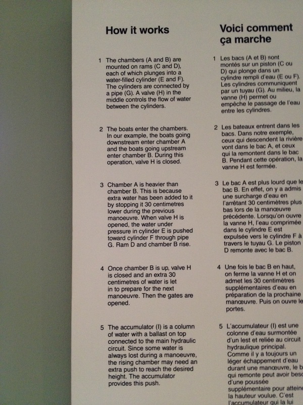
Mon – July 16th, Day 73: We had a short day today, just going 18 miles, and through 1 lock, in order to spend almost a full day in Peterborough. We left Campbellton about 7:45 and were pulling into Peterborough about 10. Instead of staying at a free dock (where we don’t have shore power), we treated ourselves to a stay in the local marina, which was very close to the main city center, making a trip to the marine supply store and grocery store very convenient. After lunch, we unfolded our bikes on the aft deck, lowered them to the docks, and pedaled 5 miles to preview the infamous Peterborough Lift Lock, which we would have to go through tomorrow. The lock is famous, since it is the highest lift lock in the world, lifting (or lowering) boats 65 feet via a pair of giant, water-filled chambers, like a giant see-saw counter-balanced by adjusting the weight to make the upper chamber heavier than the lower. The see-saw effect is activated by adding an additional foot of water into the upper chamber, which adds 144 tons of weight to the top chamber, and pushes it down and forcing the lower chamber up.
 The bridge in Trenton that is the official beginning of the Trent-Severn Waterway! 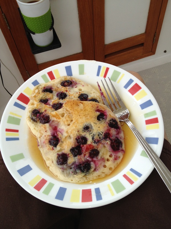 Yum! Pancakes (cooked while underway) with fresh blueberries purchased earlier at the Trenton Saturday morning Farmer's Market. 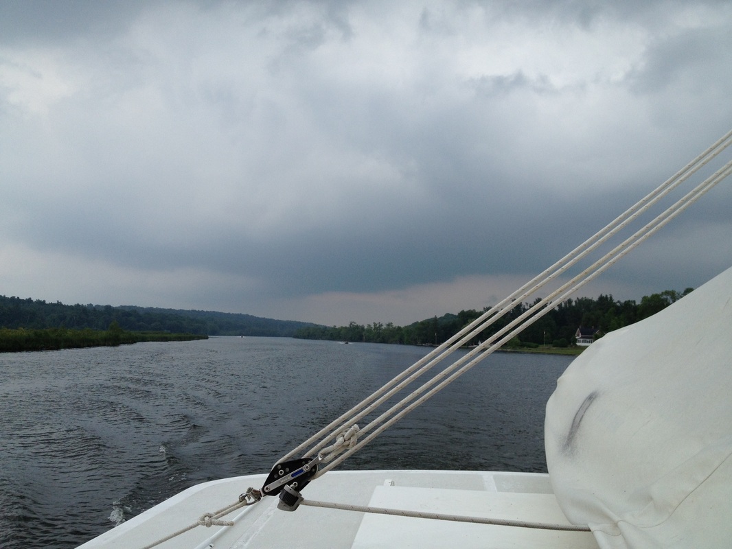 Wind, dark clouds and 4 loud claps of thunder caused us to cut our day short and stop for the night in Campbelltown. 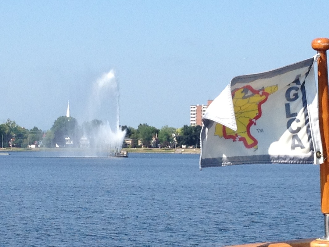 Peterborogh sits on the Little Lake which has a huge fountain in the center. 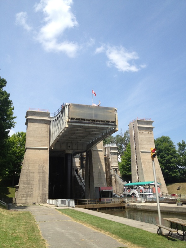 And here he is with the camera not zoomed in! |  I'm not sure I have seen this speed posted before - ? 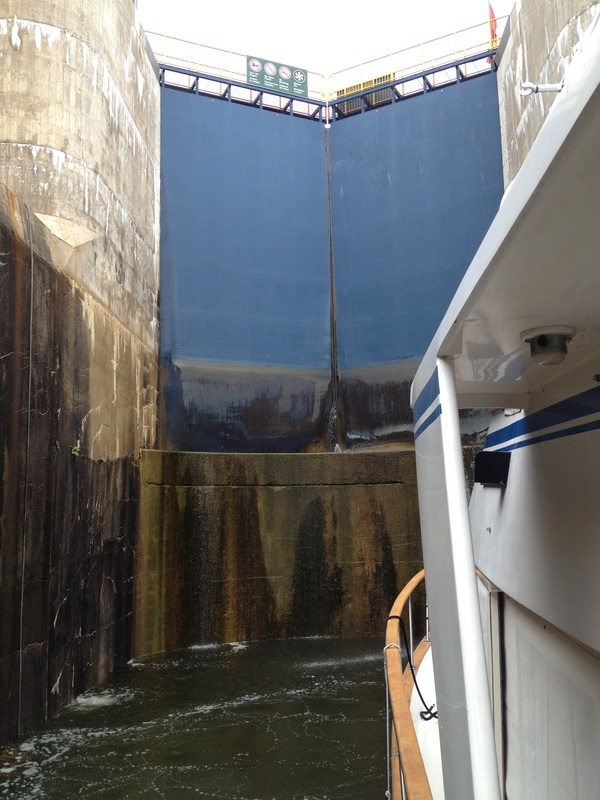 We entered this lock, looked up at the HUGE metal gates and it reminded us of a scene from the original King Kong movie. 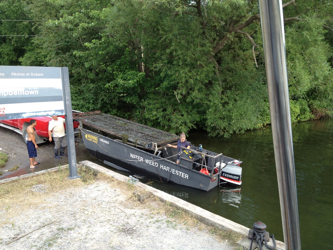 The Water Weed Harvester 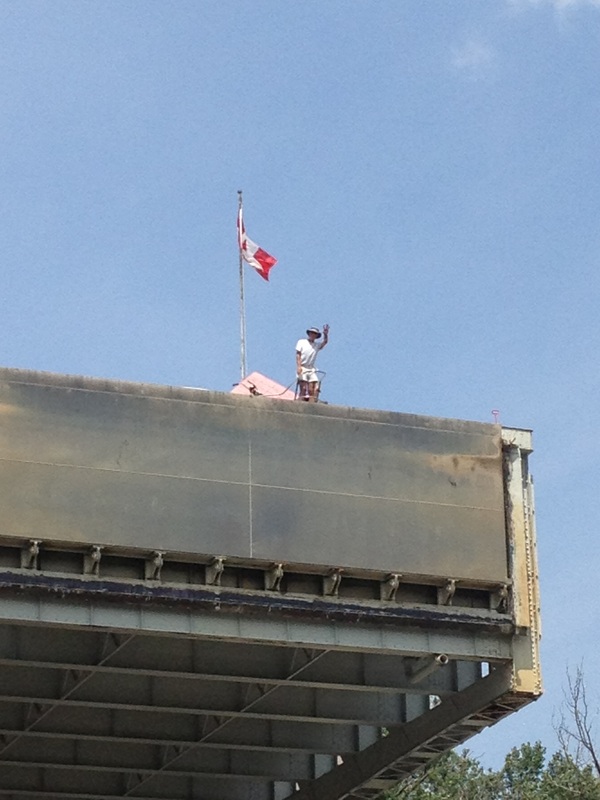 This man is standing on the bow of his 55 foot yacht in the upper chamber of the lift lock. 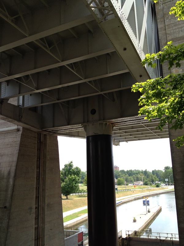 The hydraulic cylinder below the upper chamber. |
Dear Friends and Family - since wifi is expensive for us in Canada we can only upload the blog with all the pictures when we get free wifi at marinas. So we are uploading the blog in bulk when we can. This one covers 8 days. The Our Log and Track page has also been updated. Thanks for all the comments - we really enjoy reading them and knowing that you're following our trip. July 6th, Friday - Day 63: Today was dedicated to getting caught up on reprovisioning our pantry and a few other boat chores before continuing our return trip down the Rideau, so there’s not much to report for this day.
July 7th, Saturday - Day 64: We departed our slip in Smith’s Falls at 8am and headed for the waiting area for the first lock which opened at 8:30. Our hope was to make it back to Kingston in less than 2 days, in order for us to stay on our rough schedule, and give us some time to go beyond Kingston and start our tour of the 1000 islands area in the St. Lawrence River. So, in order to make our objective, we had to push ourselves to put as many miles and locks behind us. Armed with brand-new, Belinda-sized docklines, we starting knocking off the locks with much more ease.
By the late afternoon, we targeted Morton Bay for our overnight stopover location, where we had anchored 7 days earlier. On the trip up the canal, we had anchored there and discovered massive amounts of vegetation on our anchor and chain when we pulled our anchor up. Assuming that this messy experience was just the result of picking the wrong spot in the bay, we chose another spot, dropped our anchor, and settled in for the night under dark, star-filled skies and a wind-less night.
July 8th, Sunday - Day 65: We awoke early, anxious to get underway in order to make it beyond Kingston and into the 1000 islands by the end of the day. When Jim stepped on the windlass (the winch that pulls up the anchor) switch, the chain started being captured by the windlass gypsy, and as it started coming up from the depths of the bay, revealed an absolutely huge ball of vegetation, including a 10 foot long tree branch (about 5 inches in diameter) completely captured and tied up by the anchor chain. After about a full hour of tugging and pulling and cutting, the tree branch was still very much secured to the anchor chain with little hope of being freed without either Jim or someone else working on it from below. Fortunately, we shared the bay with a fishing boat with three women fishing, who saw our dilemma and came over to see what, if anything, they could do to free us from our extra anchor that we had picked up overnight. By lowering the branch back into the water, it became somewhat buoyant and the chain was able to be unwrapped from the tree limb. Once underway, we proceeded at the fastest speed possible, given the narrow and shallow channels ahead, realizing that our destination beyond Kingston was in jeopardy with our late start. The last lock of the day was Kingston Mills, just north of Kingston, which we arrived at by 2pm, but since it is a 4 step lock, if we happened to get to the lock when it was closed, and even worse, if it had just started lowering boats down the
steps, we would be forced to wait an hour or longer, for all of the chambers to be filled (on the upbound side) or emptied (on the way down). We fortunately got there right before the gates closed and were able to squeeze in with several other boats for the ride down the steps. After exiting the Kingston Mills locks, we had less than an hour to make it to Kingston and through the lift bridge that opened at 3pm which we need to do because, following that opening, it didn’t open again until 6pm. We managed to make it to the bridge 10 minutes ahead of the 3pm opening and proceeded out of the Kingston harbor into Lake Ontario toward the 1000 islands without a clue as to where we would spend the night that night. We had several choices, since many of the islands are in the national park system and our annual pass entitled us to free overnight dockage. But the catch was that there had to be space for a boat of Rickshaw’s size and there had to enough depth up to the docks for us, which limited our choices significantly. After passing several islands that were either already full or were too small, we decided to push ahead to the closest town of any size on the Canadian side of the river, which was Ganonoque, and stay at the local marina there. Motoring up Bateau Channel, which hugs the Canadian shore, we were 5 miles from Ganonoque, when Jim noticed another DeFever parked at a dock on Howe Island, which is one of the larger islands in the 1000 islands archipelago. He picked up the binoculars to try to see the name (in case we might happen to know them), and saw that it was a 41 DeFever but didn’t recognize the boat, Cop’er Tub. The dock was kind of interesting because running 40 feet off of the dock parallel to the shore was a series of inflatable pool floats depicting various animals like turtles, dinosaurs, etc., tied together and forming some sort of silly-looking channel or shoal marking. Up on the hillside, in front of a very impressive home, was a sign that said “Keeler’s Landing”. We then noticed that there were 4 people on the dock waving their arms and yelling at us to come closer. By that time we had almost past by the menagerie of pool animals, so we made a u-turn and went back to see what all of the commotion was about. The people on the dock appeared to be waving us in, encouraging us to come and park at their dock. When we arrived at the dock to see what they wanted, we discovered that the owners of the house on the shore, who owned the dock, were former DeFever 44 owners (Frank & Ruth Keeler) who had sold their beloved DeFever that they had owned for almost 20 years, loved to talk to DeFever owners and had a “open dock” policy of letting other DeFever owners park at their dock for free. The owners of the DeFever 41 (Jim & Mary Cole) were dear friends of theirs from Syracuse who were visiting them. We visited until after 11 that night, hearing all of Frank’s and Ruth’s cruising stories of their life on their DeFever around the loop in the 90’s and for many years in the Bahamas. They seemed so excited to meet other DeFever owners and went way out of their way to make us feel welcome, including giving us detailed suggestions about where to go in the 1000 islands, and offering to loan us charts that we were missing. It was incredible.
July 9th, Monday - Day 66: Because of our experience with checking into Canada in Kingston, we definitely wanted to avoid taking Rickshaw back to the US (to see that part of the 1000 islands) and then coming back into Canada. One of the must-see destinations in the 1000 islands is Boldt Castle, on Heart Island, on the US side. Boldt Castle was built in the early 20th century by George Boldt, the roprietor of the Waldorf-Astoria Hotel in New York, as a valentine’s present to his wife. His desire was to create a replica of a Bavarian castle on the St. Lawrence for his wife, but, tragically, she died before it was completed, and he abandoned the project, and left the unfinished castle to the harsh elements. Several years ago, it was purchased by the Thousand Islands Bridge Authority, who has been slowly bringing it back to where it was before work stopped, and beyond to full completion. Typical of the Keeler’s generosity, Frank offered us his pickup truck to use to drive into Ganonoque to catch the tour boat that would take us on a 3 hour boat cruise throughout the 1000 islands, plus a 2 hour stopover at Boldt Castle. That night, back at Keeler’s Landing, Frank and Ruth invited us up to their home for a wonderful dinner and more tales of the cruising life.
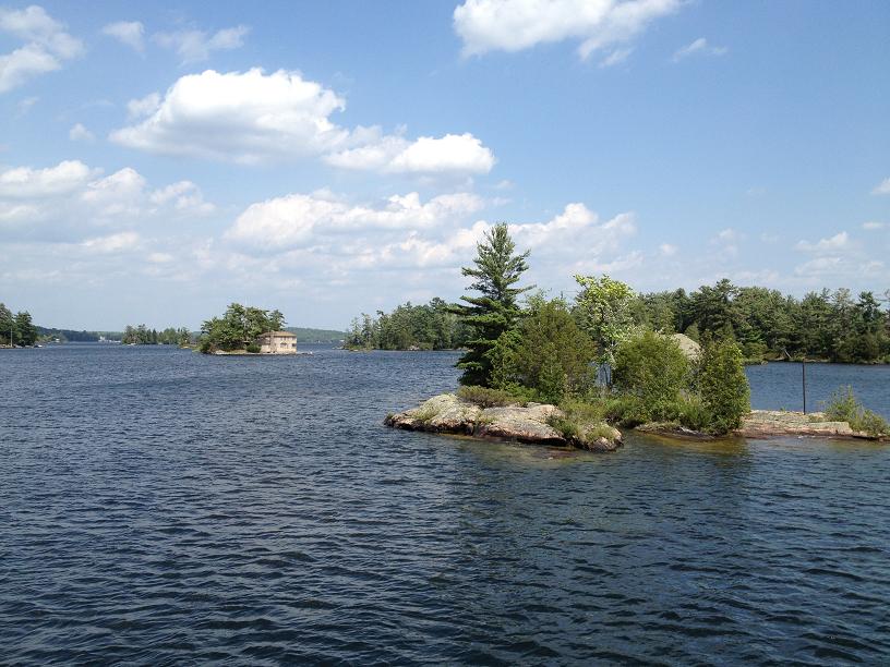
July 10th, Tuesday - Day 67: After absorbing the local knowledge of the 1000 islands from the Keeler’s, we pulled away from their dock and continued down the St. Lawrence, meandering among the many, many islands, past small 800 sf cottages that consumed small postage stamp sized islands, and massive homes with boathouses bigger than most homes and waterfalls, fountains and manicured lawns on larger islands. After cruising by several possible overnight stopover sites, we settled on a small island, Georgina Island, just south of Rockport, Ontario, which was about 18 miles further down the river from the Keelers. Georgina Island is one of the many islands owned by Parks Canada, and is essentially a wild, no frills, natural park with several small inlets and coves available for boaters and campers to stay at overnight – for free, with the annual pass. After docking, we jumped off of Rickshaw, and hiked the perimeter of the island, then returned back to the boat, and dropped Ricky-Dink (our dinghy) into the water and went exploring up and down both sides of the St. Lawrence River for several miles, pulling as close as we dared to the impressive home and sheer rock cliffs that line the river. Upon our return to Rickshaw, we went for a short swim in the crystal clear waters of the Georgina lagoon, and feasted on hamburgers on the aftdeck.
July 11th, Wednesday - Day 68: We awoke early (in Canada, the days are really long with the sun coming up at 5 and staying up until 9pm). One of the tradeoffs of sleeping on our boat with the windows open to feel the cool night air is that our cabin is very bright, very early in the morning. We noticed that another looper boat had arrived in our lagoon that morning, a small, sleek trawler named Irish Wake, with a couple from New Brunswick, Canada on board. We visited with them for a short while then said goodbye and untied our dock lines and headed back to the Keeler’s because Belinda had offered to fix dinner for Frank, Ruth, Jim & Mary as partial repayment of their warm generosity, featuring her specialty dish, Shrimp Creole, with a special dessert treat of Bananas Foster. Upon returning to Keeler’s Landing, Belinda eagerly received three more Belinda-sized dock lines that Jim (from Cop’er Tub) had very generously picked up for us at West Marine earlier that day. The six of us feasted on our aft-deck and swapped more tales, before calling it a night when the mosquitoes discovered us and tried to make us their dinner for the night.
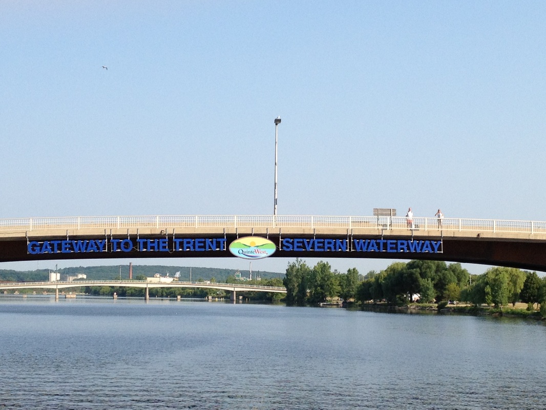
July 12th, Thursday - Day 69: We said our goodbyes to our new-found friends, Frank & Ruth Keeler and Jim & Mary Cole, at Keeler’s Landing, and headed southwest down the St. Lawrence toward the start of the Trent-Severn Waterway, 60 miles away. After passing by Kingston, we meandered through the narrow channel in the Bay of Quinte, which is on the northern shore of Lake Ontario, and pushed toward Trenton, Ontario, which prides itself as being the “Gateway to the Trent-Severn Waterway”. Instead of continuing all of the way to Trenton, where we would have to pay for a marina, we opted to stop about 5pm at a nice bay 12 miles short of Trenton, where we dropped our anchor in a small cove with a couple of other boats, had a short swim, then enjoyed dinner on the aft-deck. About 10pm, we went back outside to look at the stars, and noticed a 20 ft. ski boat 50 yards away from us sitting in total darkness. We had seen this boat earlier in the evening with about 6 people on it, including a small child. We could tell by the voices earlier, and the conversation that carried across the soundless anchorage, that there was a bit of drinking, and every now and then, thought we caught a whiff of pot in the air, so we knew that they had been having a good time. Now we could hear some discussion about the boat having a dead battery, and since the boat was obviously not one that you would normally sleep aboard, especially with a small child, we called out across the water to ask if they needed any help. But were told “no thanks”. About that time, we saw a couple of flashlights bouncing around in the woods heading down the shore line in the direction of the boat. We finally concluded that 2 of the people on the boat had swam to shore a few hours earlier (about 60 yards), gone somewhere, somehow, and got a battery, and were now swimming across the black lagoon towing some sort of float with the battery. We flooded the situation with our spotlight, watching the couple and their floating battery finally reach the ski-boat. Ten minutes later, the ski boat started and the lights came on. The drunk Canucks were certainly resourceful in resolving their situation.
July 13, Friday - Day 70: We awoke at the absolutely still anchorage and saw that the ski boat had gone back home, pulled up our anchor, and headed the remaining 12 miles to Trenton. After tying up at the local marina, we spent the day catching up on boat chores. Since Trenton is at the very beginning of the Trent-Severn, it sees a lot of boats stop here on their way up the Trent-Severn, either as a short summer trip or as part of the Great Loop. We met a couple of other boats, one being a trailerable skiboat from Louisiana that had been towed up to the Chesapeake. They had come up to Ontario on their small boat, and were going to do the Trent-Severn, before putting the boat back on the trailer in Michigan and returning back home to Shreveport. 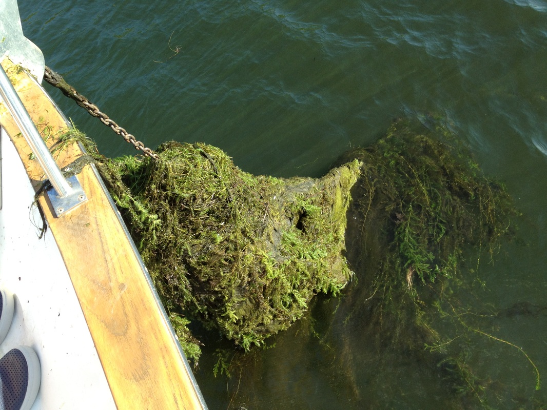 The mass of grass with a 10 foot log underneath it all with the anchor chain wrapped around it. It took over an hour to clear this mess. 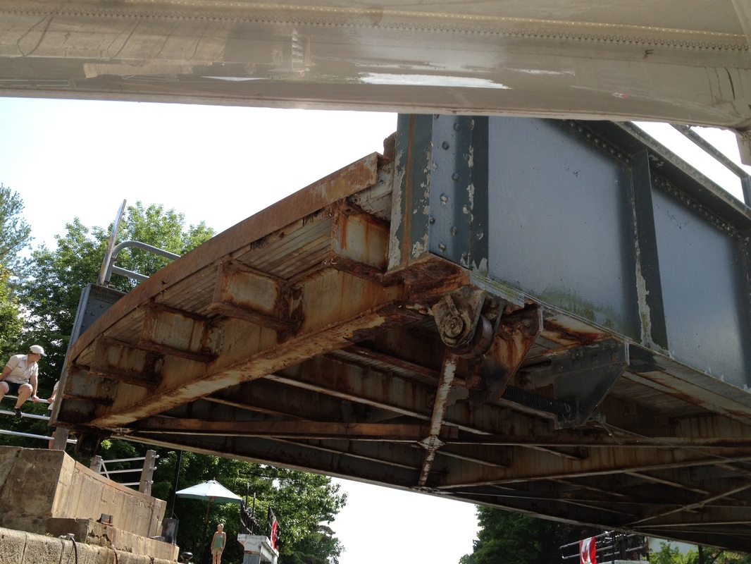 Over this lock was a swing bridge. What we didn't know until after it was time to swing the bridge to let us out, was that the bridge swings in - towards us. It came within 5 feet of our fly bridge. 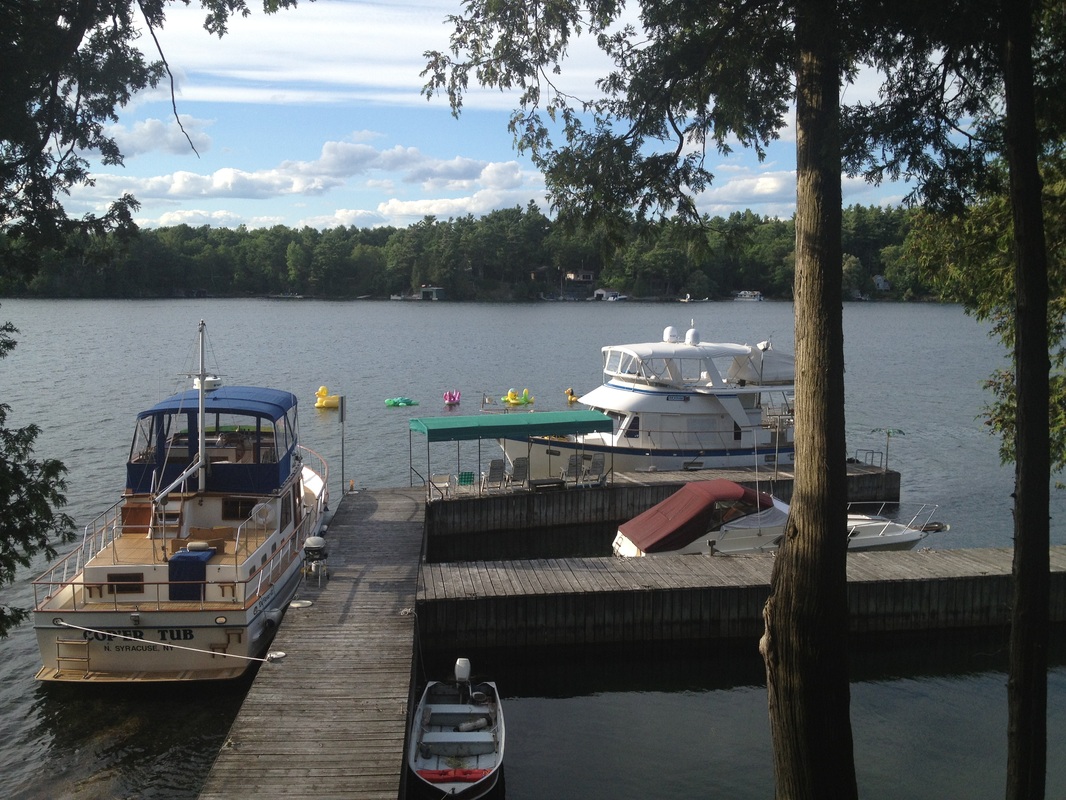 Rickshaw and Cop'er Tub sitting at the Keeler Landing dock. Cop'er Tub is owned by Jim a retired police officer.  We are cruising the Thousand Islands in a 1982 pick up! Actually we are the first vehicle on a three car cable ferry. Thanks, Ruth & Frank for loaning us your truck to get to the tour boat. 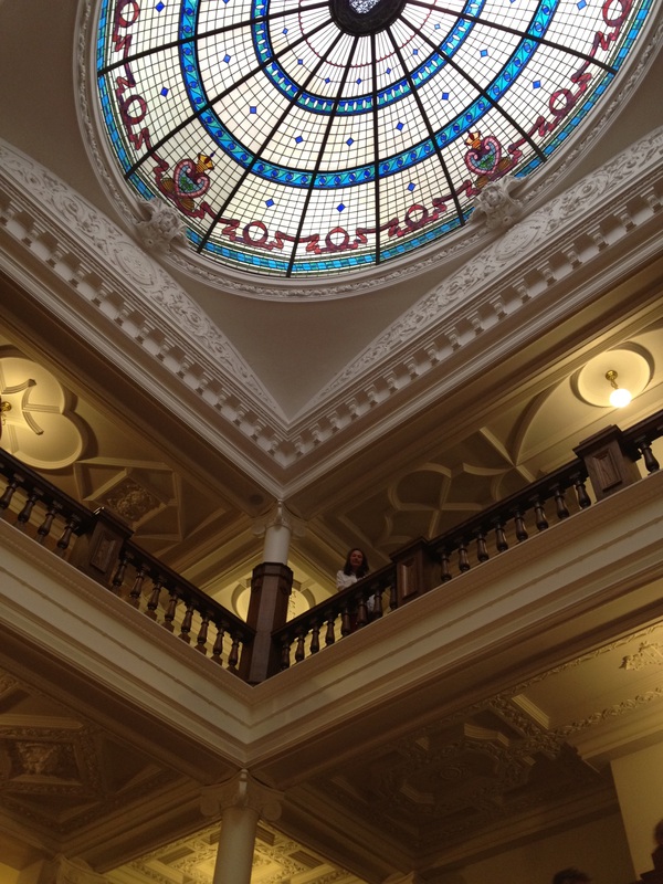 Belinda on the third floor of the entry hall with the stain glass dome ceiling. Beautiful! 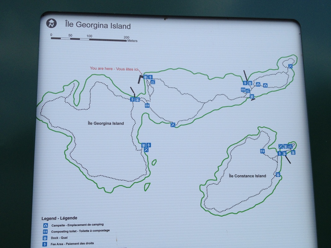 The trail map on Georgina Island. It took 50 minutes to do the complete loop. Lots of hills but the view from the island was beautiful. 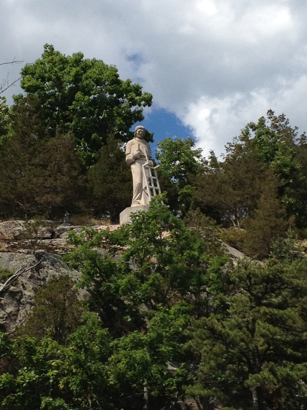 A statue of St. Lawrence on top of a cliff along the river. St. Lawrence is the patron saint of chefs since St. Lawrence was executed on a gridiron. 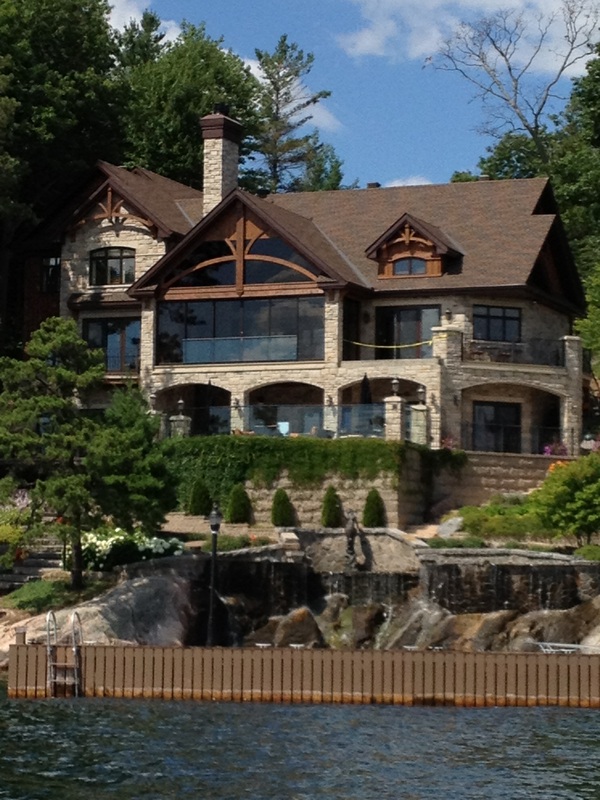 One of the larger homes in the Thousand Islands with a water fall. There is one section that is known as Millionare Alley. Many are owned by old money from New York. | 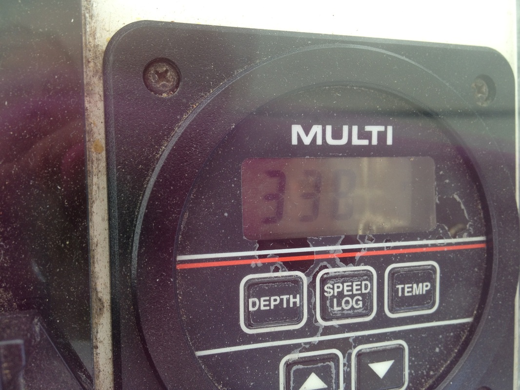 On the Big Rideau River, which is part of the Rideau Canal, our depth meter read 338 feet! 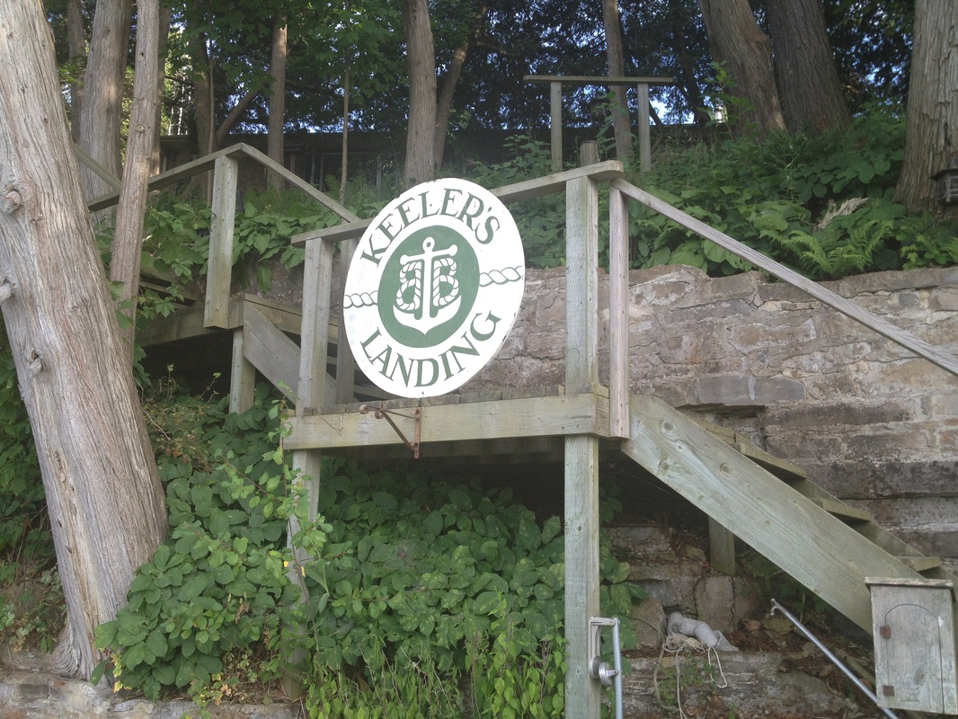 Keeler's Landing! The sign is on the stairs from dock to the beautiful house that overlooks Bateau Channel on the north side of Howe Island 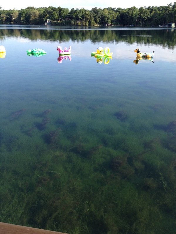 The pool toys that mark the shoal off Keeler Landing. Since the river was still we could see the thick vegetation growing on the bottom that gave us so much trouble in Morton Bay. 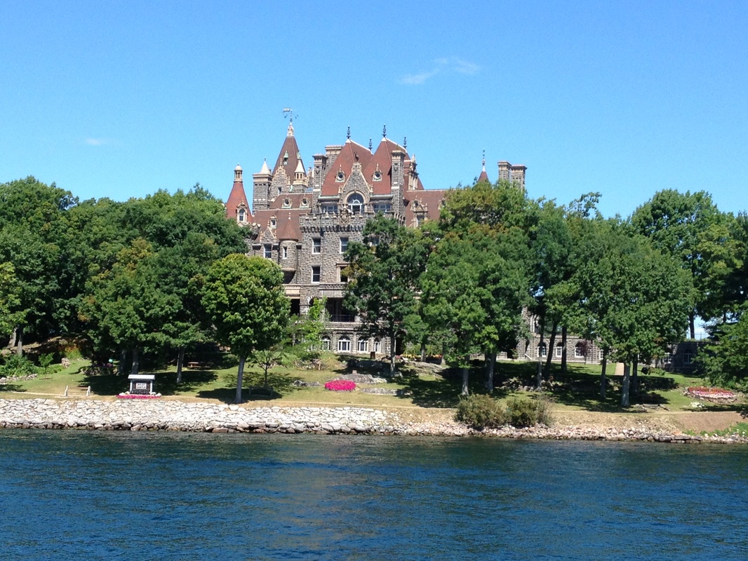 Boldt Castle from the water. The grounds are beautiful. 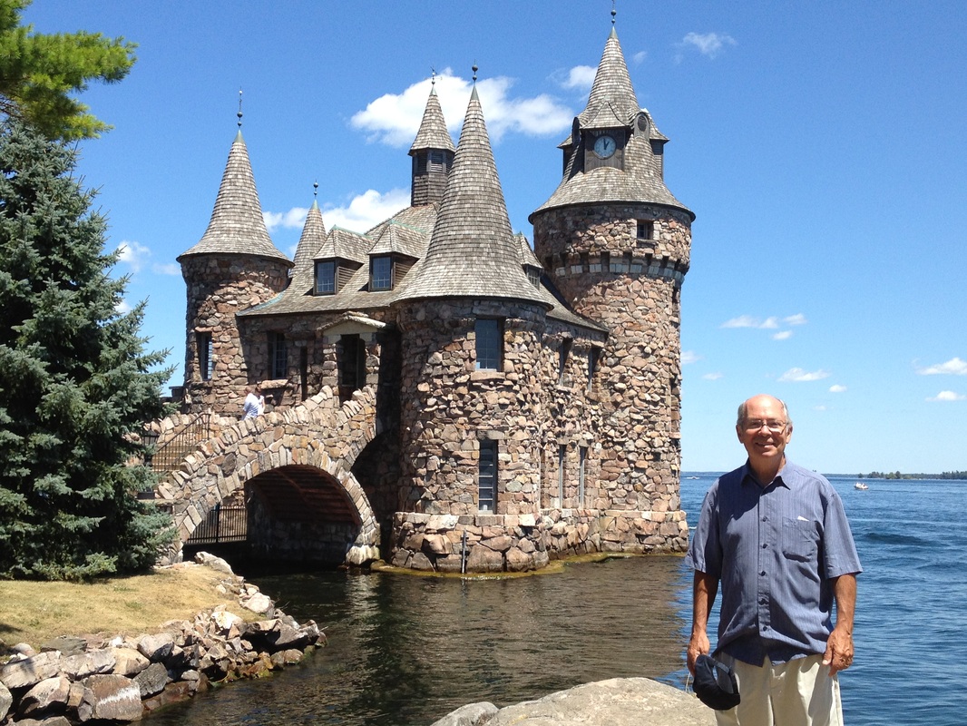 Jim outside the power house. This mini castle houses the engines that generate power for the castle. 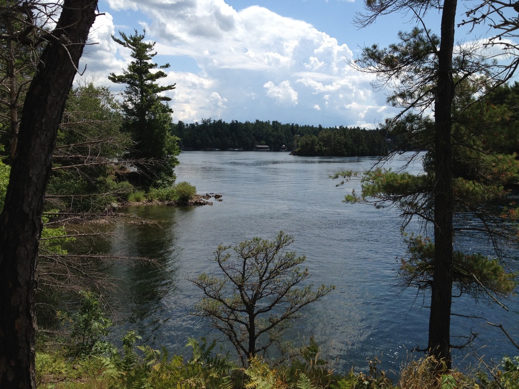 The view from the trail on Georgina Island overlooking other islands in the Thousand Islands. There are actually over 1800 islands in the archipelago. 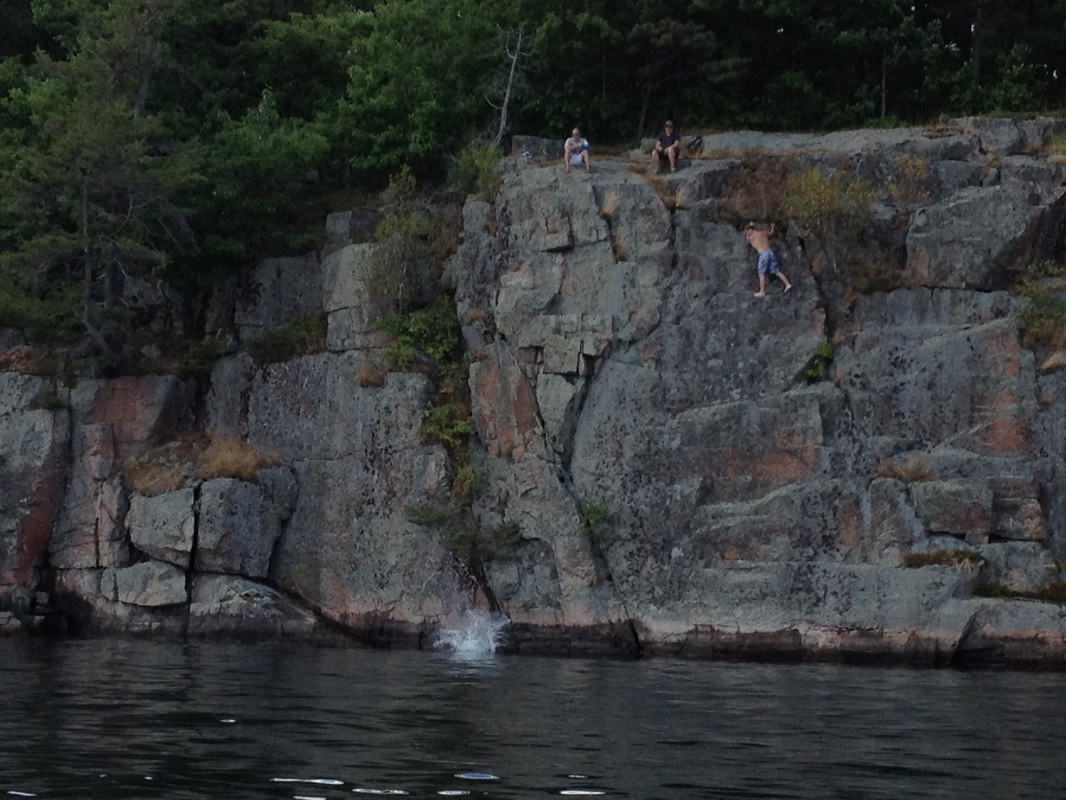 These boys are jumping from the one of the many cliff walls along the St. Lawrence River. 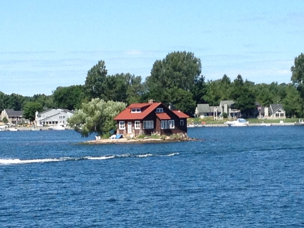 One of the one cottage islands in the Thousand Islands. Most had lots of trees so you could barely see the cottage, but this one was the smallest island we saw with a cottage. 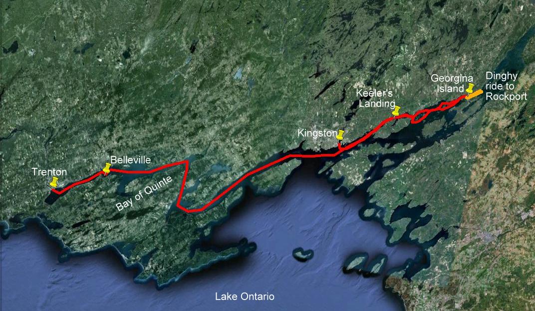 This map covers our track east from Kingston through the western end of the Thousand Islands then arcoss the Bay of Quinte to Trenton. A toltal of 178 miles. |
July 2nd - Day 59: After leaving the lock wall at Poonamolie, we travelled north to our destination, Merrickville, just 15 miles up the canal. Merrickville had the reputation for being quaint with several antique and nick-nack shops lining the main streets. One of the curious things we’ve noticed about Canada is their “appreciation” for country music, e.g. at a café we stopped at to eat lunch, there was a trio that started off the set with “Your Cheating Heart”. The further up the canal we went, the more we ran into French-Canadians who came down from Quebec to enjoy the canal on their 25 ft sport cruisers. In Merrickville, we were the only non-French boat at the dock, and managed to get the last spot at the dock. Because we had bought an annual Parks Canada mooring pass, we are able to stay at lock walls for no charge, allowing us to save a few dollars for higher cost marinas in other spots along our trip.
July 3rd - Day 60: We reversed our track today, heading back down the Rideau to one of the “larger” towns in this part of Ontario, Smith’s Falls, so we could let Rickshaw rest for a couple of days, while we hopped on the train to visit Ottawa, which was 40 miles north of Smith’s Falls. Since we were going back through all of the same locks we had gone through on the way up the canal, we knew what to expect and the lock experience seemed to go much better.
July 4th - Day 61: At 9am on our Independence Day in Smith’s Falls, Belinda put on her stars and stripes shirt, and we unloaded our folding bikes off of the aft deck and pedaled the 3 miles to the train station for our 10am train to Ottawa. Upon arriving in Ottawa, we inquired about local bus service to downtown Ottawa and managed to find the correct bus which took us to the heart of the capital city. We had read that a couple of looper friends, Bill & Joyce on Carried Away (from Williamsburg) who we met on the Hudson, were in Ottawa on their boat, so we went down to the canal in the city center, and found them relaxing on their aft deck, having just gone up the 8 step locks in Ottawa. Since Ottawa is the capital of Canada, and considers Queen Elizabeth to be their monarch, the British influence can be seen everywhere including the governmental buildings which resemble those in London, and the queen’s guards in red suits and bearskin hats, like those in London. Since we had a relatively short day on the first day (since we didn’t arrive until almost noon), we used the rest of the day to visit the large farmers market area next to downtown, where Belinda found the local delicacy that she had been told had to be tried while in Canada – fried beaver tail, which is really a variation on a funnel cake in the US. Toward the end of the day, we went to the centerpiece of the Canadian governmental complex, Parliament Hill, which houses the legislative branch of the Canadian government, including the House of Commons and the Senate, and were able to jump on the final tour of the day. Our return train to take us back to Smith’s Falls left shortly after 6pm, so, following the parliament tour, we hopped on another city bus and caught our train back.
July 5th - Day 62: One of the “must do’s” in Ottawa is to watch the changing of the guard in front of Parliament Hill, which happens each morning at 10am. Since the morning train did not arrive in Ottawa until noon, we opted for the 7am Greyhound bus from Smith’s Falls into Ottawa, which took 90 minutes to cover the 40 miles into Ottawa. So, we hopped on the bikes at 6:15 am, and made our way to the bus station. The daily ceremony was very elaborate complete with marching bands, bagpipes, and a couple of hundred red-coated guards marching from down the street, through the front gates, and onto the front lawn of the parliament building in strict formation. Following the changing of the guard, our next destination was the local marine supply store to buy a few new docklines that were needed to make Belinda’s job as the linehandler in the locks a bit easier. Unfortunately, the one we needed to go to was outside of town, so our challenge was to figure out the local bus service, and where and when to catch the correct bus to get us at least close enough to walk to the marine store from the bus stop. Two hours later, we had found the lines we needed, found the correct bus to get us back to the city center, and returned to town for our next to-do of the day, a hop-on/hop-off tour of the city on a double-decker bus. The bus gave us the opportunity to see parts of the city not accessible by our normal means of transportation, walking or the city bus, including a lot of the museums and foreign consulates. We were very impressed with Ottawa and, to some degree, regretted that we had not come up via Rickshaw to see the city. But, the entire Great Loop is a multitude of tradeoffs of what to see and what to skip along the way, so, in the interest of time and not wanting to shortcut other parts of the trip, we had decided to visit Ottawa via a quicker form of transportation than a trawler provides. At 6pm, we took the train back to Smith’s Falls, picked up our bikes from the bus station down the street from the train station, and returned to Rickshaw, exhausted after a very long day.
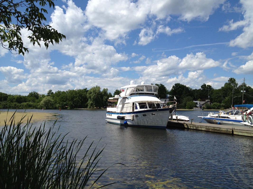
Rickshaw in Merrickville - this is the farthest we will go on the Rideau Canal.
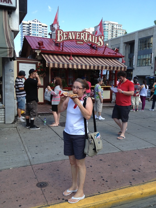
Belinda eating a fried beaver tail - a Canadian delicacy!
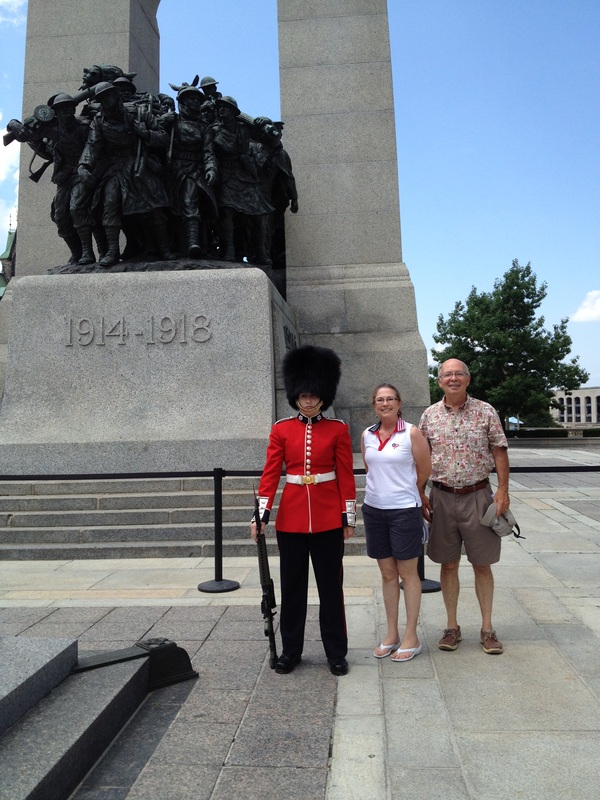
Belinda and Jim standing with one of the Royal Guards at the War Memorial in Ottawa.
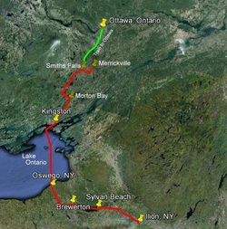
Since the last track map we have traveled from Illion NY to Merrickville, Ontario then back tracked to Smiths Falls - a total of 218 nautical miles.
|
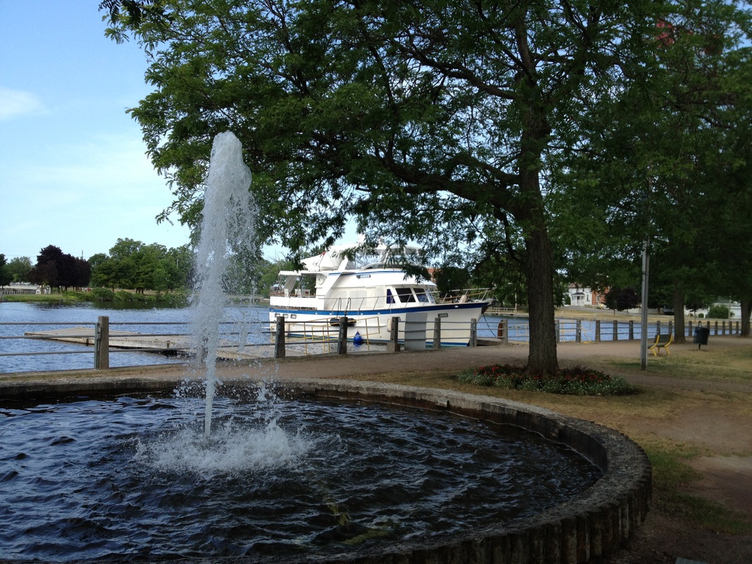
Rickshaw docked at a pretty town park in Smiths Falls. She got to rest while we visited Ottowa by train.
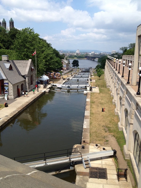
The eight step locks in downtown Ottawa.
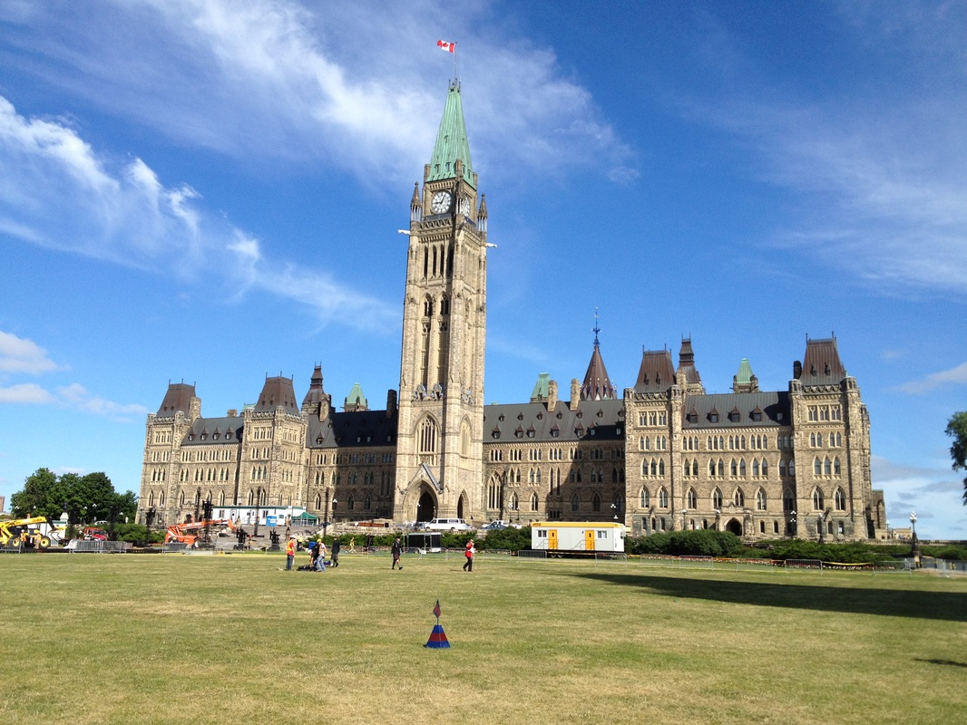
The Canadian Parliment building in Ottawa.
|
|

 RSS Feed